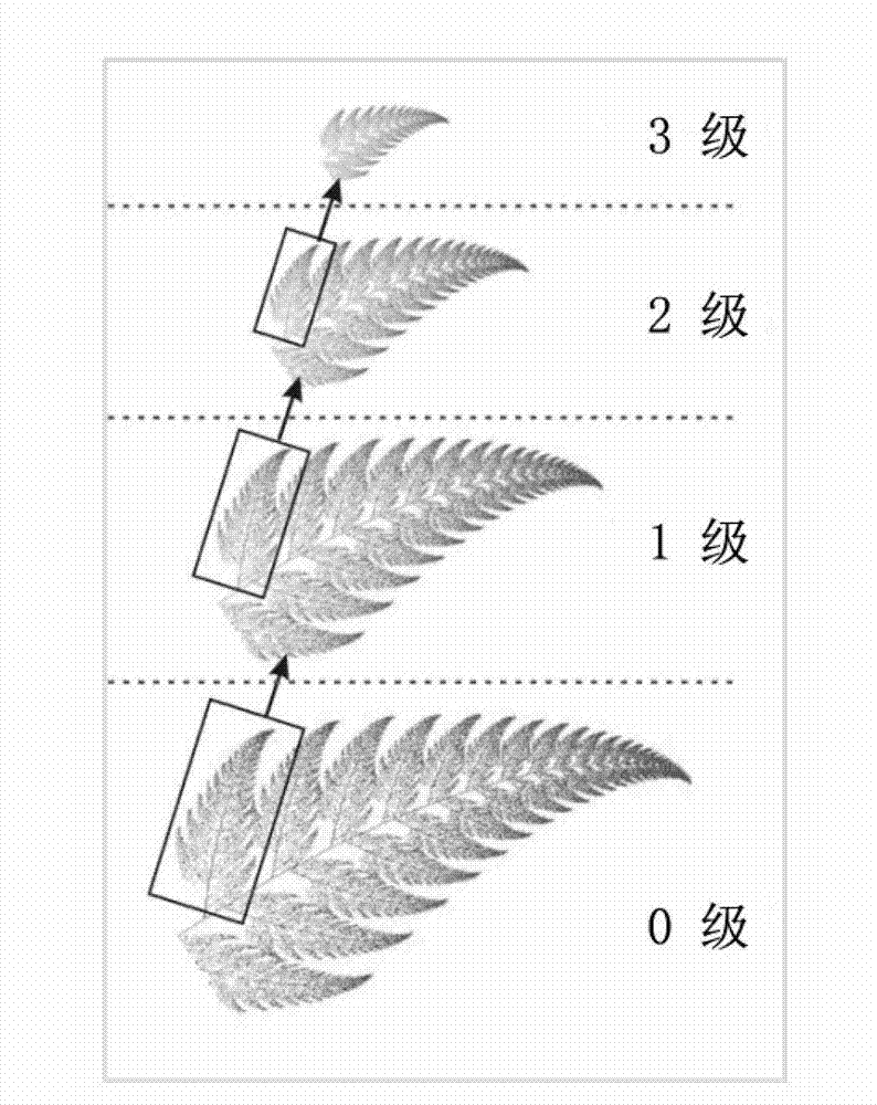
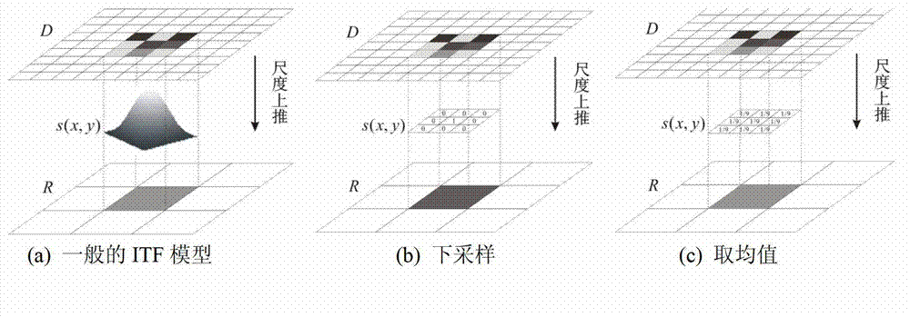
Rebuilding algorithm for super-resolution remote sensing image based on fractal theory
A super-resolution, remote sensing image technology, applied in the field of geographic information science, can solve problems such as difficulty in obtaining
- Summary
- Abstract
- Description
- Claims
- Application Information
AI Technical Summary
Problems solved by technology
Method used
Image
Examples
Embodiment approach
[0077] In conjunction with real data, the implementation of the algorithm of the present invention is briefly described as follows:
[0078] The first step is data collection and preprocessing
[0079] SRTM (Shuttle Radar Topography Mission) is a joint survey completed by NASA (National Space Administration), NGA (National Geospatial-Intelligence Agency) and the German and Italian space agencies. Interferometric radar sensors on the space shuttle Endeavor to obtain elevation data from the Earth's surface. The final released DEM data set has two spatial resolutions, that is, the grid size is 1 arc second and 3 arc seconds, which are approximately equivalent to the spatial resolution accuracy (on the equator) of 30m and 90m respectively, and the latter is based on the former processed. The area we selected is the SRTM image within the range of latitude 35.48N to 35.63N and longitude 99.68W to 99.53W (attached Figure 5 ). The size of SRTM3 (LR) is 180×180, and the size of co...
PUM
 Abstract
Description
Claims
Application Information
 - R&D
- Intellectual Property
- Life Sciences
- Materials
- Tech Scout
- Unparalleled Data Quality
- Higher Quality Content
- 60% Fewer Hallucinations
Browse by: Latest US Patents, China's latest patents, Technical Efficacy Thesaurus, Application Domain, Technology Topic, Popular Technical Reports.
© 2025 PatSnap. All rights reserved.Legal|Privacy policy|Modern Slavery Act Transparency Statement|Sitemap|About US| Contact US: help@patsnap.com


