Live-action navigation method and navigation terminal

A navigation terminal and real-scene technology, applied in the field of positioning and navigation, can solve problems such as inconvenience, insufficient user experience, and poor user experience, and achieve the effect of ensuring driving safety, easy understanding, and intuitive and accurate navigation images

Inactive Publication Date: 2013-01-23
DONGGUAN YULONG COMM TECH +1
View PDF10 Cites 66 Cited by
  • Summary
  • Abstract
  • Description
  • Claims
  • Application Information

AI Technical Summary

Problems solved by technology

[0003] Chinese patent application CN200910170836.5 discloses a street view dynamic navigation system and its method. The scheme needs to establish a street view image database in the whole area, and the street view image is called out from the database during use, but the street view image is not consistent with the actual scene seen by the user. There are still differences, resulting in a poor user experience
[0004] Chinese patent application CN20101026944

Method used


Image

  • Live-action navigation method and navigation terminal
  • Live-action navigation method and navigation terminal
  • Live-action navigation method and navigation terminal

Examples


Embodiment Construction

[0071] In order to make the object, technical solution and advantages of the present invention clearer, the present invention will be further described in detail below in conjunction with the accompanying drawings and embodiments. It should be understood that the specific embodiments described here are only used to explain the present invention, not to limit the present invention.

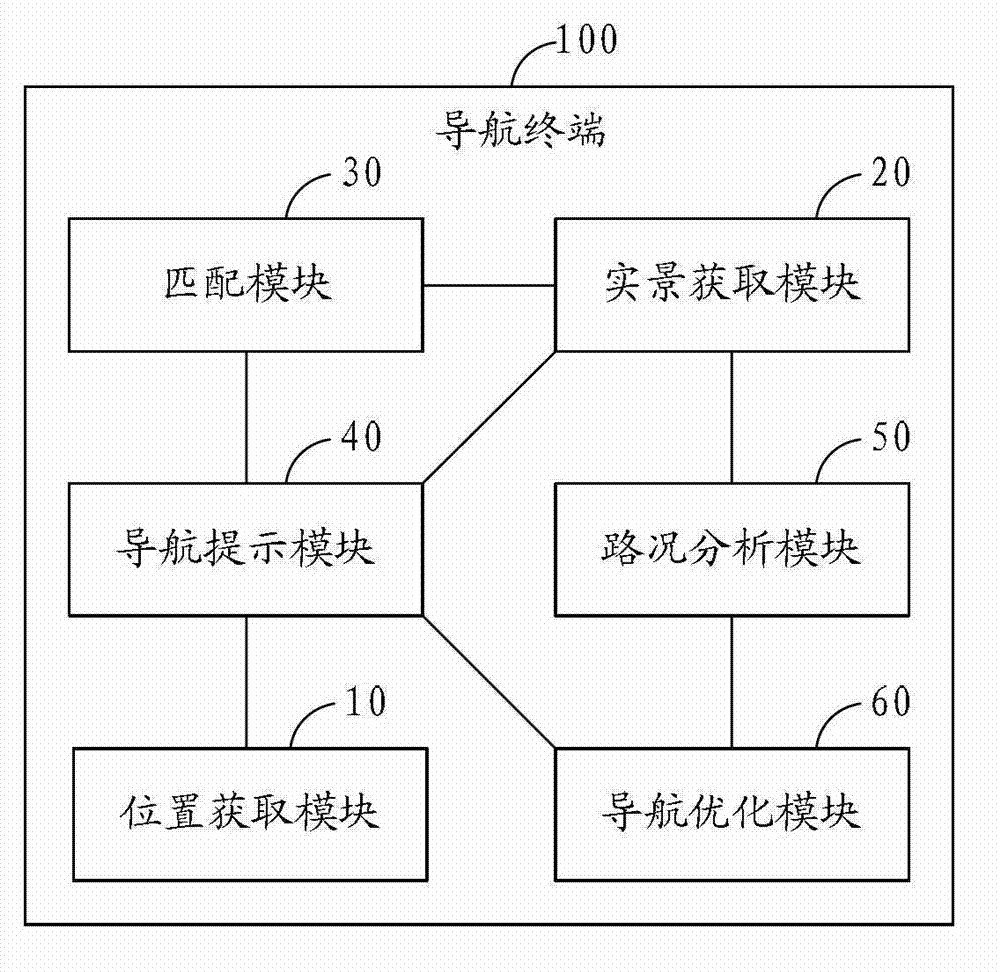
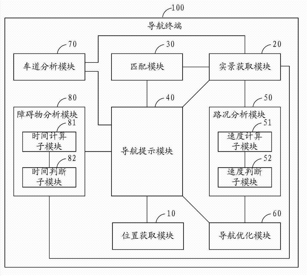
[0072] figure 1 It is a structural schematic diagram of the navigation terminal of the present invention. The navigation terminal 100 can be a professional navigator, or a mobile phone with a navigation function, a PDA (Personal Digital Assistant, a personal digital assistant), a tablet computer, etc., and the navigation terminal 100 100 includes a position acquisition module 10, a real scene acquisition module 20, a matching module 30, a navigation prompt module 40, a road condition analysis module 50 and a navigation optimization module 60, wherein:

[0073] The position obtaining module 10 is u...


PUM


Abstract

The invention is applicable to the technical field of positioning navigation and provides a live-action navigation method. The live-action navigation method comprises the following steps of: acquiring the current position of a vehicle in real time; acquiring a live-action image of environment in which the vehicle is located in real time; matching the live-action image with a pre-stored electronic map, and establishing a mapping relation; marking navigation prompt information according to the mapping relation between the live-action image and the electronic map, a pre-planned path and the current position; analyzing real-time road condition information according to the live-action image; and optimizing a navigation path according to the real-time road condition information. Correspondingly, the invention also provides a navigation terminal. Therefore, by the invention, a navigation image is intuitive and accurate by using a live-action navigation technology, and the navigation path can be optimized according to a real-time road condition, so navigation indication is intelligent and efficient, and a navigation experience of a user is greatly improved.

Description

technical field [0001] The invention relates to the technical field of positioning and navigation, in particular to a real-scene navigation method and a navigation terminal. Background technique [0002] GNSS (Global Navigation Satellite System, Global Navigation Satellite System) uses the radio signals emitted by navigation satellites to find the position of navigation objects such as vehicles relative to the satellite, and then calculates and determines the position of the navigation object on the earth based on the known position of the satellite relative to the ground. The technology on the position. GNSS mainly includes GPS (the global satellite positioning system established by the United States), GLONASS (the satellite navigation system established by Russia), Compass (the Beidou satellite navigation system established by China), and Galileo (the satellite navigation system established by the European Union). Most of the current navigation solutions use GNSS satellit...

Claims


Application Information

Patent Timeline
IPC IPC(8): G01C21/26
Inventor 吴炽强
Owner DONGGUAN YULONG COMM TECH
Why Eureka
Try Eureka