Intelligent deployment method of wireless sensor network node based on farmland electronic map

A wireless sensor and electronic map technology, applied in network planning, network topology, wireless communication, etc., to meet the needs of monitoring information

Active Publication Date: 2013-04-03
NANJING AGRICULTURAL UNIVERSITY
View PDF4 Cites 4 Cited by
  • Summary
  • Abstract
  • Description
  • Claims
  • Application Information

AI Technical Summary

Problems solved by technology

[0008] The above two methods realize the deployment of farmland wireless sensor network nodes, but these two methods treat a piece of farmland as a whole, but ignore that a piece of farmland has many small fields. Possibility to deploy multiple nodes, which does not correspond to the deployment of only one node per small field in agricultural applications

Method used


Image

  • Intelligent deployment method of wireless sensor network node based on farmland electronic map
  • Intelligent deployment method of wireless sensor network node based on farmland electronic map
  • Intelligent deployment method of wireless sensor network node based on farmland electronic map

Examples


Embodiment Construction

[0035] Below technical scheme of the present invention is described in further detail in conjunction with specific embodiment:

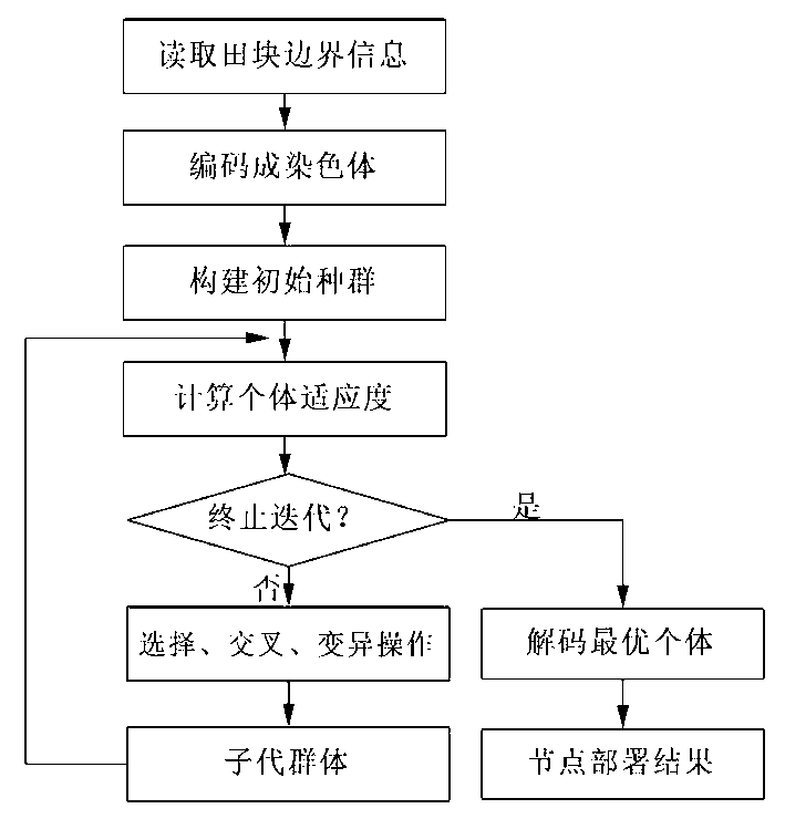
[0036] Such as figure 1 As shown, the present invention proposes a wireless sensor network node intelligent deployment method based on farmland electronic map, which specifically includes the following steps:

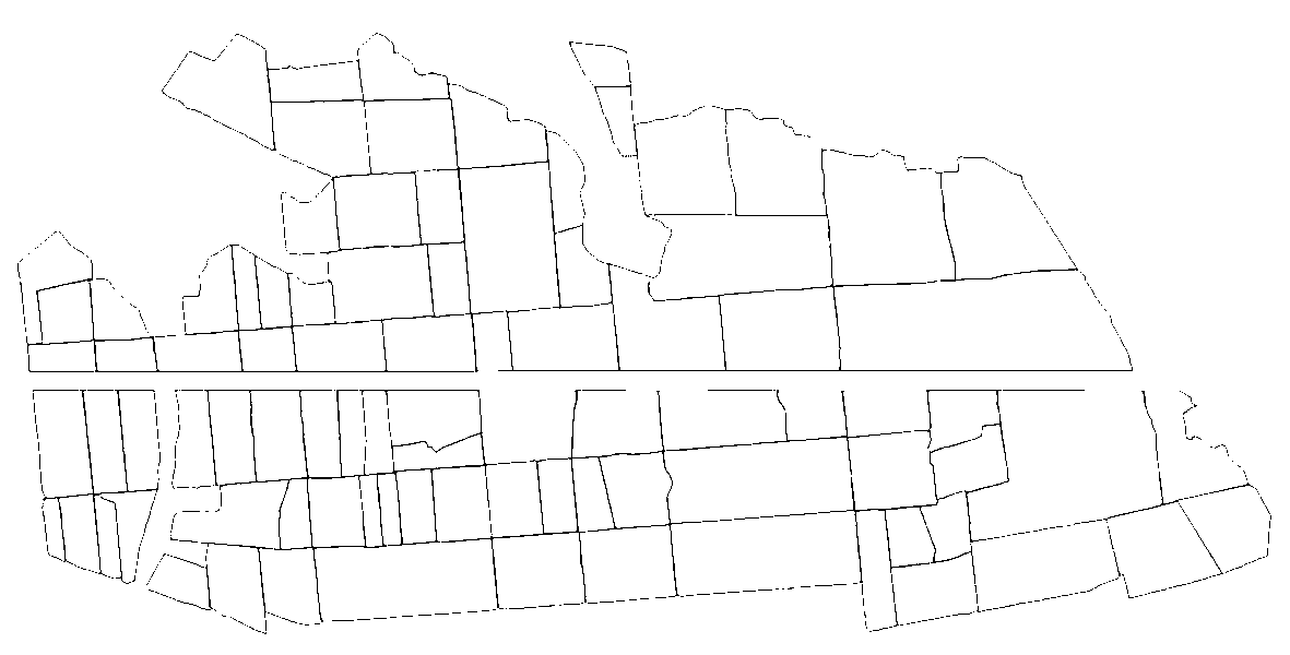
[0037] 1. Read the vector electronic map (*.shp file) of farmland and obtain the minimum longitude of each field boundary Longitude minimum latitude and maximum latitude i∈[1,n], n is the number of fields; specify the gateway location, longitude Lon gw and latitude Lat gw , specifies the transmission distance R of the node.

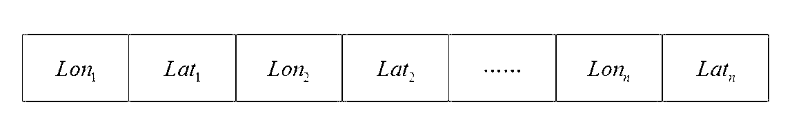
[0038] 2. Construction of chromosomes: Use real number codes to randomly generate the location of each field deployment node, that is, the longitude Lon i and latitude Lat i , according to the sequence of the deployment position of each field node to construct chromosomes in series. Among them, i∈[1,n], n is ...


PUM


Abstract

The invention discloses an intelligent deployment method of a wireless sensor network node based on a farmland electronic map, and belongs to the field of digital agriculture. The boundary information of the maximal and the minimal longitudes and latitudes of each filed are read through the electronic map, and chromosome (individual body) of a genetic algorithm is built according to the boundary information. The optimization target of the genetic algorithm is that only a node exists in each field; and at least two neighbor nodes within a communication range are arranged near each node to achieve bi-connection, and at least one connection in a gateway direction exists in the bi-connection. Intelligent deployment of the wireless sensor network node of the farmland is finally achieved by evolution of the genetic algorithm according to the optimization target. Intelligent deployment of the wireless sensor network node of a large farmland can be rapidly and efficiently achieved by the method disclosed by the invention.

Description

technical field [0001] The invention relates to an intelligent deployment method for farmland wireless sensor network nodes, belonging to the technical field of digital agriculture. technical background [0002] WSN (wireless sensor network, wireless sensor network) can monitor, sense, and collect monitoring object information in real time through a variety of integrated micro-sensors, process information through embedded systems, and sense through self-organizing multi-hop wireless communication networks. It can provide real-time farmland environment and crop growth information for the diagnosis and regulation of digital agricultural production. The location of wireless sensor network node deployment will significantly affect the accuracy of monitoring data and the reliability of network data transmission, so the deployment of wireless sensor network nodes is one of the research focuses in the actual application process. [0003] After searching the existing technical lite...

Claims


Application Information

Patent Timeline
IPC IPC(8): H04W16/18H04W84/18G08C17/02
Inventor 曹卫星刘乃森倪军朱艳姚霞田永超
Owner NANJING AGRICULTURAL UNIVERSITY
Why Eureka
Try Eureka