
Method and system for three-dimensional distance measurement of ground objects in polarimetric synthetic aperture radar data

A synthetic aperture radar and distance measurement technology, applied in radio wave measurement systems, measurement devices, reflection/re-radiation of radio waves, etc., can solve problems such as combination of categories without decomposition methods, achieve convenient calculation and reduce differences , the effect of improving the accuracy

Active Publication Date: 2017-01-18
SHENZHEN INST OF ADVANCED TECH CHINESE ACAD OF SCI
View PDF10 Cites 0 Cited by
  • Summary
  • Abstract
  • Description
  • Claims
  • Application Information

AI Technical Summary

Problems solved by technology

[0005] The above target decomposition methods have been widely used in object classification, however, there is no such decomposition method combined with category separability in the prior art

Method used


Image

  • Method and system for three-dimensional distance measurement of ground objects in polarimetric synthetic aperture radar data
  • Method and system for three-dimensional distance measurement of ground objects in polarimetric synthetic aperture radar data
  • Method and system for three-dimensional distance measurement of ground objects in polarimetric synthetic aperture radar data

Examples


Embodiment Construction

[0018] The present invention will be described in further detail below in conjunction with the accompanying drawings and specific embodiments.

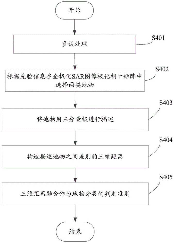
[0019] refer to figure 1 As shown, it is a flow chart of a preferred embodiment of the method for measuring the three-dimensional distance of ground and objects based on polarimetric synthetic aperture radar data according to the present invention.

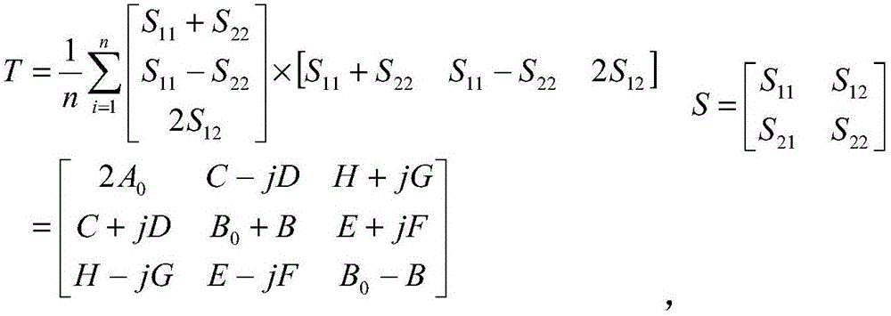
[0020] Step S401, multi-view processing, constructing a polarization coherent matrix describing the target. details as follows:

[0021] The multi-view processing is to average the n*m ​​windows of the single-view data, and represent the ground objects in the form of polarization coherence matrix:

[0022] T = 1 n Σ i = 1 n ...


PUM


Abstract

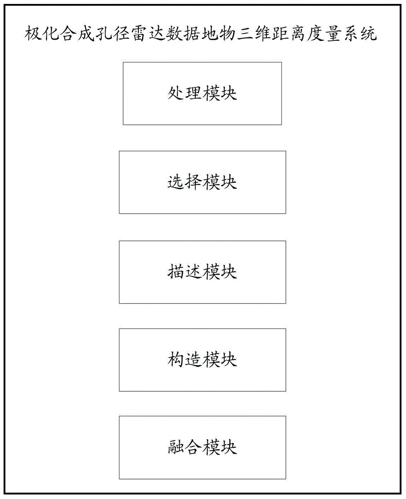
The invention relates to a method for measuring polarimetric synthetic aperture radar data ground object three-dimensional distance. The method comprises the following steps of multi-look processing, wherein a polarization coherence matrix of a target is constructed, any two kinds of ground objects are selected from a complete-polarization SAR image polarization coherence matrix according to apriori information, the ground objects are described through three components, distance calculation is respectively carried out on the three components, and the three-dimensional distance describing the difference between the ground objects is constructed; three-dimensional distance fusion used as the judgment rule of ground object classification. The invention further relates to a system for measuring the polarimetric synthetic aperture radar data ground object three-dimensional distance. The method and the system can be simply and conveniently applied to polarimetric synthetic aperture radar data processing software, and high classification accuracy is obtained.

Description

technical field [0001] The invention relates to a method and a system for measuring three-dimensional distances of ground objects based on polarization synthetic aperture radar data. Background technique [0002] With the development of radar technology, polarization synthetic aperture radar (POLSAR) has become the development trend of synthetic aperture radar (SAR). It has extensive research and application value. Land cover classification is one of the important applications of POLSAR. Compared with single-polarization SAR, the polarization parameters extracted by POLSAR can effectively reflect the biological and physical parameters of land objects, and can improve the accuracy of land object classification. [0003] POLSAR obtains its polarization scattering matrix by measuring the scattered echoes in each resolution unit on the ground. In the process of multi-view processing of POLSAR data, it is necessary to carry out the set average operation in the window, and this ...

Claims


Application Information

Patent Timeline
Patent Type & Authority Patents(China)
IPC IPC(8): G01S13/90
CPCG01S7/41G01S13/08G01S13/90G01S13/935G01S13/9076
Inventor 李洪忠陈劲松梁守真
Owner SHENZHEN INST OF ADVANCED TECH CHINESE ACAD OF SCI
Learn More