A vegetation classification method and device suitable for optical remote sensing satellite images

A satellite image and optical remote sensing technology, applied in the field of optical remote sensing satellite image, can solve unscientific problems, reduce calculation errors and improve the accuracy of vegetation classification

Active Publication Date: 2017-04-12
CHINESE ACAD OF SURVEYING & MAPPING
View PDF2 Cites 3 Cited by
  • Summary
  • Abstract
  • Description
  • Claims
  • Application Information

AI Technical Summary

Problems solved by technology

Due to VI s with VI v It changes with time and space, and the values ​​of different images should be different, even for the same image due to the difference of soil type and vegetation type, VI s with VI v will be different, therefore, it is unscientific to only use fixed empirical values ​​to calculate vegetation coverage

Method used


Image

  • A vegetation classification method and device suitable for optical remote sensing satellite images
  • A vegetation classification method and device suitable for optical remote sensing satellite images
  • A vegetation classification method and device suitable for optical remote sensing satellite images

Examples


Embodiment

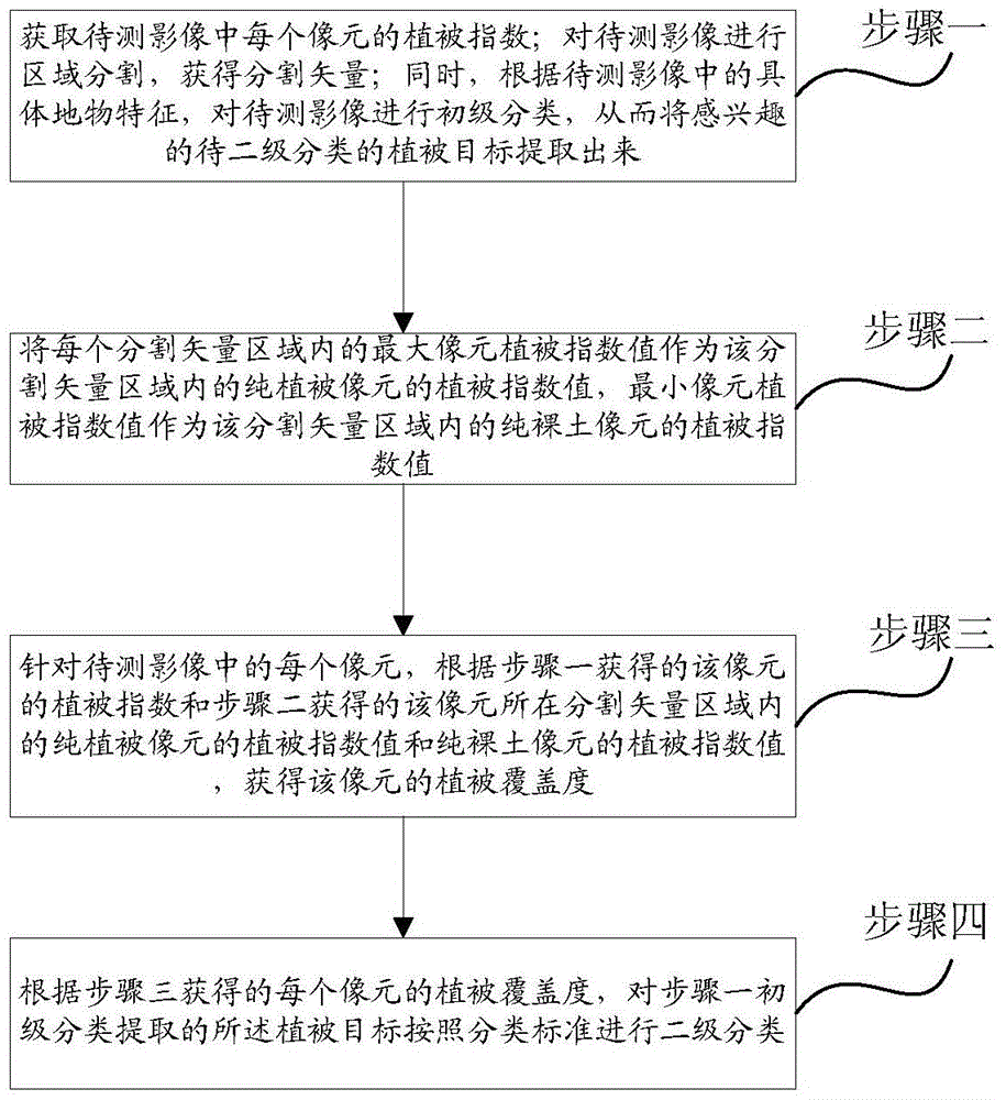
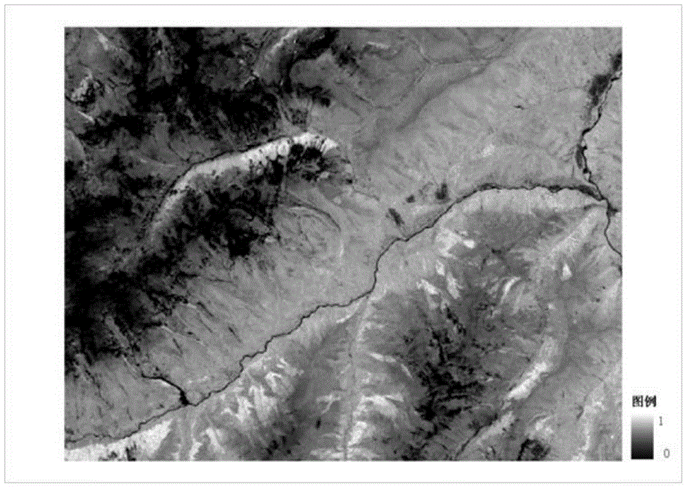
[0032] Taking a Landsat TM (Landsat System Thematic Mapper) image as an example to carry out secondary classification of high, medium and low coverage of grassland as an example, the principle of the method of the present invention is further described.

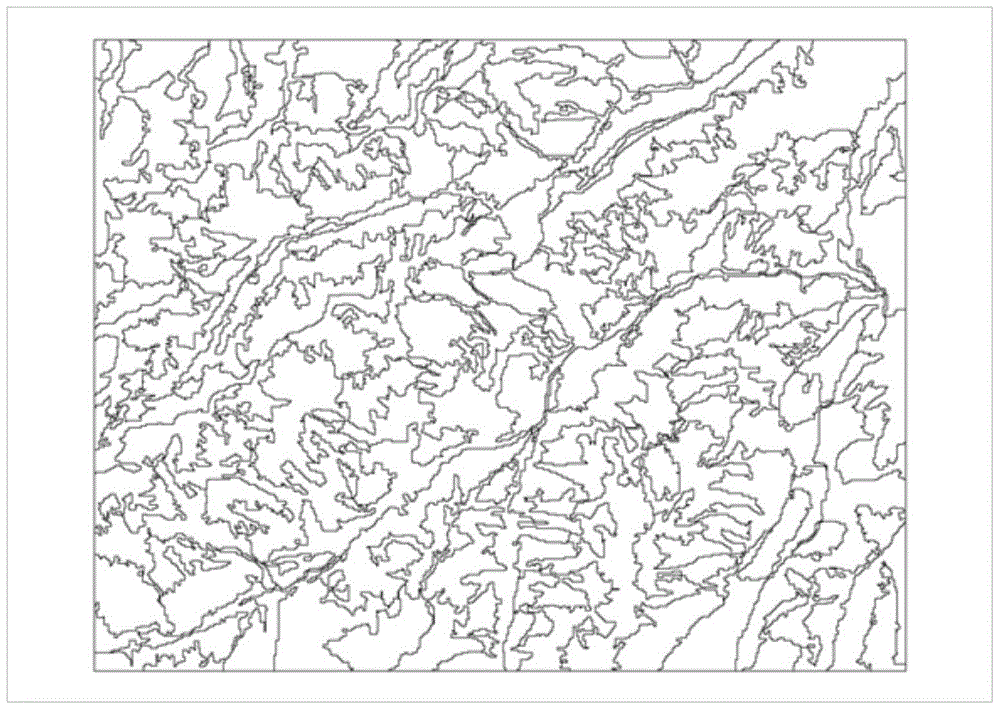
[0033] Step 1. Obtain the vegetation index of each pixel in the image to be tested; perform region segmentation on the image to be tested to obtain the segmented vector region; Interested vegetation targets to be classified are extracted.

[0034] (1) Calculate the pixel vegetation index

[0035] There are many types of vegetation indices, such as normalized difference vegetation index, vertical vegetation index, soil-adjusted vegetation index, and vegetation condition index. Different vegetation indices can be selected according to different needs as the vegetation index for calculating vegetation coverage. In this example, the normalized difference vegetation index (NDVI) is selected, and the normalized difference vegetat...


PUM


Abstract

The invention discloses a method and device suitable for classifying vegetation through optical remote sensing satellite images. The method includes the steps of firstly, carrying out region segmentation on the images to be tested to obtain segmentation vector regions, obtaining vegetation index values VIv of different pure vegetation pixels of the different segmentation vector regions and vegetation index values VIs of different pure exposed soil pixels of the different segmentation vector regions, and then obtaining the pointed fractional vegetation cover rather than calculating the fractional vegetation cover through fixed empirical values. Values of the different images are different, even in the same image, the VIs and the VIv of the regions with different soil types and different vegetation types are different, the fractional vegetation cover calculation error caused by the regionalism difference and the vegetation type difference can be reduced through the method and device, and the effect of improving the vegetation classification accuracy is achieved.

Description

technical field [0001] The invention relates to the field of optical remote sensing satellite images, in particular to a vegetation classification method and device suitable for optical remote sensing satellite images. Background technique [0002] Remote sensing images are image data that reflect the spatial distribution and spectral information of the earth's surface features and spectral information acquired by spaceborne or airborne sensors. It has the characteristics of wide coverage and short imaging period. With the development of remote sensing image classification technology, remote sensing image Classification techniques are increasingly used in vegetation monitoring. In remote sensing monitoring of vegetation, a particularly important aspect is the calculation of vegetation coverage (FVC). At present, the linear spectral separation (LSU) method is mostly used in the field of remote sensing to estimate the vegetation coverage of multispectral and hyperspectral ima...

Claims


Application Information

Patent Timeline
Patent Type & Authority Patents(China)
IPC IPC(8): G06K9/62
Inventor 翟亮燕琴桑会勇邱程锦李巍魏石磊祖彭蕾窦鹏
Owner CHINESE ACAD OF SURVEYING & MAPPING
Why Eureka
Try Eureka