Digital finder method employing geostationary satellite of stationary orbit

A geostationary orbit and geosynchronous technology, applied in the field of digital star finding, can solve problems such as impreciseness, little value available, and existence of theoretical foundations

Inactive Publication Date: 2014-04-16
XIAN CENT OF GEOLOGICAL SURVEY CGS +1
View PDF5 Cites 8 Cited by
  • Summary
  • Abstract
  • Description
  • Claims
  • Application Information

AI Technical Summary

Problems solved by technology

[0019] Obviously, although the derivation process of the existing star-seeking control parameters is simple, there are (incorrect or imprecise) problems in the theoretical basis. The star-seeking method at the ground point does not match the actual situation. not big

Method used


Image

  • Digital finder method employing geostationary satellite of stationary orbit
  • Digital finder method employing geostationary satellite of stationary orbit
  • Digital finder method employing geostationary satellite of stationary orbit

Examples


Embodiment Construction

[0100] In order to better understand the technical problems solved by the present invention and the technical solutions provided, the present invention will be further described in detail below in conjunction with the accompanying drawings and embodiments. The specific embodiments described here are only used to explain the implementation of the present invention, but not to limit the present invention.

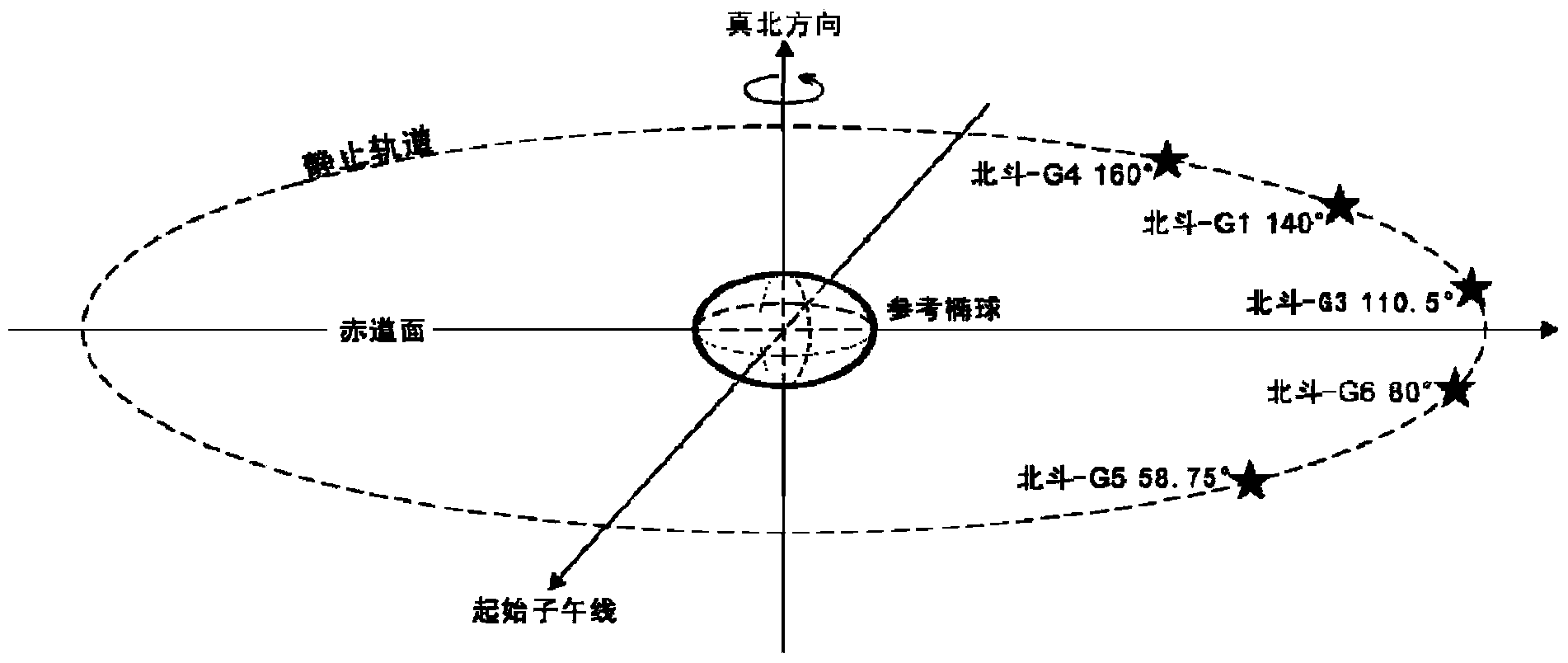
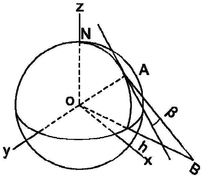
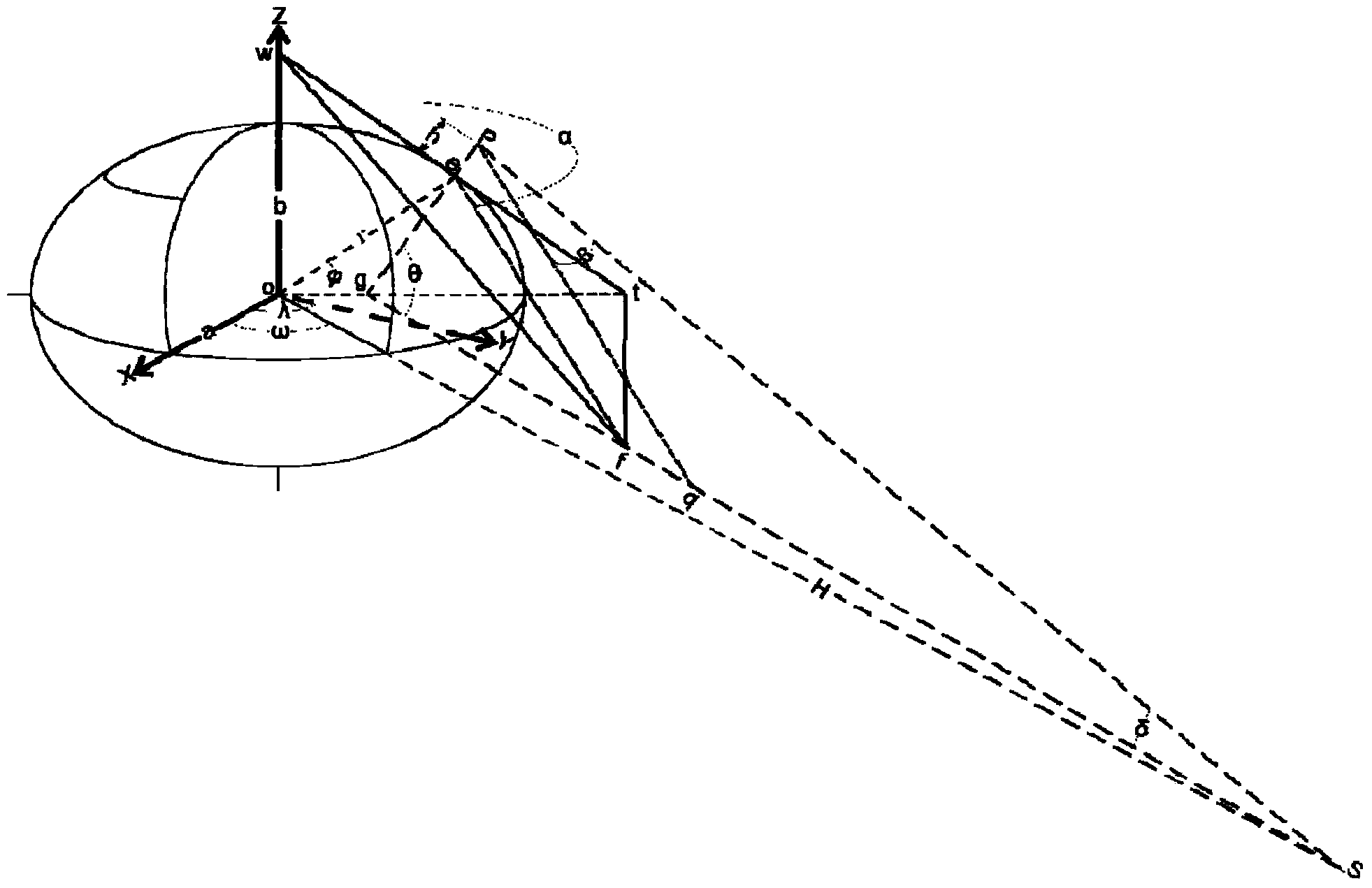
[0101] In a preferred embodiment, image 3 and Figure 6 An exemplary schematic diagram showing the principle and flow chart of a geostationary geostationary satellite digital star-finding method; the process of the star-finding method includes:

[0102] N1: directly collect the position information of the ground point through GPS or Beidou terminal equipment; input the parameters of the position information of the ground point through the call command based on the http protocol;

[0103] N2: According to the semi-major axis a and semi-minor axis b of the ellipsoid and the ...


PUM


Abstract

The invention relates to the technical field of a geostationary satellite of a stationary orbit, and particularly discloses a digital finder method employing a geostationary satellite of a stationary orbit. The digital finder method comprises the following steps: directly collecting position information of a ground point through a global position system (GPS) or Beidou terminal equipment; inputting parameters of position information of the ground point through a call instruction based on a http protocol; calculating through a position processing module of the appointed ground point, an ellipsoid secondary variable calculation module, a sighting distance processing module from the appointed ground point to the appointed satellite, an elevation processing module from the appointed ground point to the appointed satellite, and a true north azimuth processing module from the appointed ground point to the appointed satellite; solving the results of a sighting distance L from any ground point to the satellite, the elevation beta from any ground point to the satellite and an azimuth angle alpha from any ground point to the satellite; carrying out conversion through a data conversion module, displaying the finder result in a human-computer interaction interface, and determining the relative positions of the ground point and the satellite through the finder result. The digital finder method is rigorous in theory, efficient, and high in calculating result accuracy.

Description

technical field [0001] The invention relates to the technical field of geostationary geostationary satellites, in particular to a method for realizing digital star-seeking through geostationary geostationary satellites in field geological surveys. Background technique [0002] The space segment of the "Beidou" satellite navigation system consists of 5 geostationary orbits and 30 non-stationary orbit satellites, among which 5 geostationary satellites ( figure 1 Beidou-G4, G1, G3, G6, G5) have three major functions of short message communication, general positioning and timing service, and its short message communication can transmit up to 77 effective bytes per frequency, and the horizontal positioning accuracy Usually about 100m, the satellite is about 35766922m above the ground. The positioning and communication technology of Beidou satellite is in the stage of popularization and application in the Asia-Pacific region. Its short message communication function can provide s...

Claims


Application Information

Patent Timeline
Patent Type & Authority Applications(China)
IPC IPC(8): G01C1/00G01C3/00
CPCG01C1/00G01C3/00G01S19/42
Inventor 王占昌王飞伍锦程石小亚朱小飞
Owner XIAN CENT OF GEOLOGICAL SURVEY CGS
Why Eureka
Try Eureka