A Method for Automatically Identifying Exit Points in Watershed Digitization Process

A technology for automatic identification and exit point, applied in electrical digital data processing, special data processing applications, instruments, etc., can solve problems such as low efficiency, achieve the effect of improving efficiency, ensuring positioning accuracy, and avoiding human intervention

Active Publication Date: 2016-08-17
HOHAI UNIV
View PDF4 Cites 0 Cited by
  • Summary
  • Abstract
  • Description
  • Claims
  • Application Information

AI Technical Summary

Problems solved by technology

[0006] Purpose of the invention: To provide a method for automatically identifying the exit point in the process of watershed digitization, so as to solve the problem that the existing technology needs to manually correct the exit point and the problem of low efficiency

Method used


Image

  • A Method for Automatically Identifying Exit Points in Watershed Digitization Process
  • A Method for Automatically Identifying Exit Points in Watershed Digitization Process
  • A Method for Automatically Identifying Exit Points in Watershed Digitization Process

Examples


Embodiment Construction

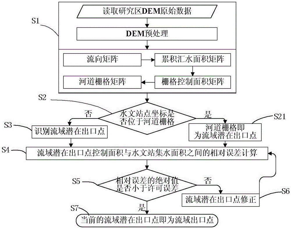
[0049] Such as Figure 1 to Figure 8 As shown, a method for automatic identification of exit points in a watershed digitization process of the present invention comprises the following steps:

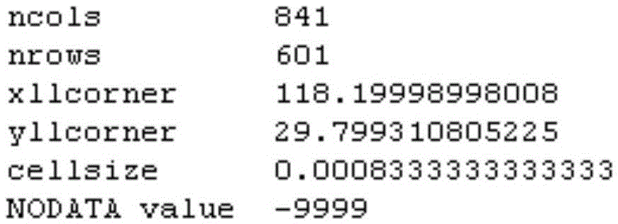
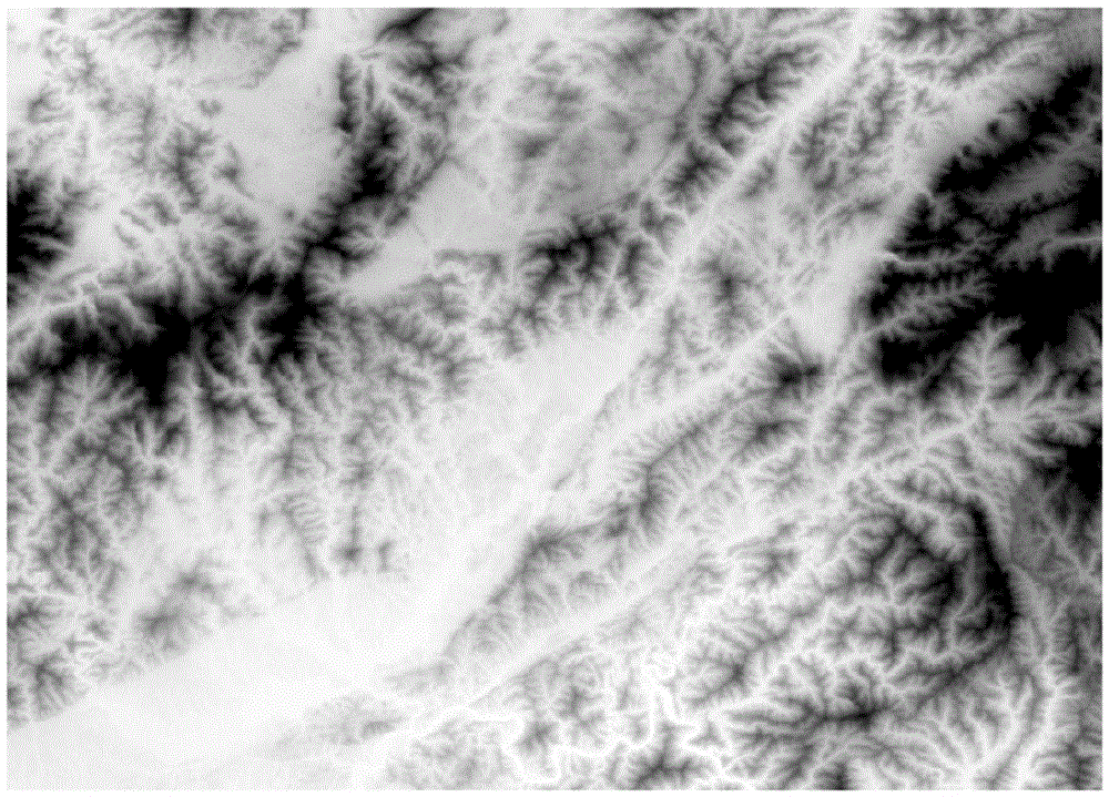
[0050] S1. Read the original DEM data in ArcInfo ASCII format in the WGS84 latitude and longitude coordinate system of the research area, and preprocess it; then extract the flow direction matrix of the research area according to the D8 algorithm; extract the cumulative catchment area matrix of the research area through the flow direction data; Based on this, multiply the upstream cumulative grid number of each grid unit by the area of ​​a single grid unit to extract the grid control area matrix; finally, reclassify the grid control area matrix according to the given threshold, Filter out the river grid and extract the river grid matrix;

[0051]S2. Based on the latitude and longitude coordinates of the hydrological station, the position of the hydrological station in the river grid ma...


PUM


Abstract

The invention discloses a method for automatically recognizing exit points during a drainage basin digitalization process. The method includes: reading the original data of a digital elevation model of a to-be-researched area and performing preprocessing; positioning the positions of hydrology stations in a riverway grid matrix, and judging whether the hydrology stations are located on the riverway grids or not; extracting the control area of the potential exit points of a drainage basin according to a grid control area matrix, and calculating the relative error between the area and the hydrology station water collecting area; judging whether the absolute value of the relative error is smaller than a set allowed area error or not; correcting the potential exit points of the drainage basin according to a flowing direction matrix; finishing recognition. By the method, automatic recognition and correction of the potential exit points of the drainage basin can be achieved, positioning precision of the exit points is guaranteed, human intervention is avoided, and drainage basin digitalization efficiency is increased.

Description

technical field [0001] The present invention relates to the digitization of watersheds, and more particularly to methods of identifying exit points in the process of digitizing watersheds. Background technique [0002] In order to better describe hydrological phenomena, explore and reveal hydrological laws, hydrological research is gradually moving towards digitalization. In recent years, with the emergence of large-scale and high-precision digital elevation models (DEM), digital hydrological research has been further developed develop. Using DEM to digitize the watershed has become the premise of constructing the hydrological model of the watershed and conducting hydrological simulation and research. [0003] DEM raw data is the basic data for watershed digitization. When using this basic data for watershed digitization, the key is how to identify the outlet point of the watershed accurately and conveniently. The accurate positioning of the watershed outlet point has an i...

Claims


Application Information

Patent Timeline
Patent Type & Authority Patents(China)
IPC IPC(8): G06F19/00
Inventor 姚成李致家余钟波章玉霞安冬
Owner HOHAI UNIV
Why Eureka
Try Eureka