

Panoramic-image-based dangerous falling rock surveying method
A panoramic image and dangerous rockfall technology, which is applied in the field of information extraction and three-dimensional dangerous rockfall investigation based on panoramic image, can solve the problem that it is difficult to meet the continuous improvement of engineering construction quality, safety and efficiency requirements, poor precision, and large field workload. and other problems, to achieve the effect of improving survey efficiency and accuracy, improving remote sensing interpretation efficiency, and facilitating retrieval and extraction
- Summary
- Abstract
- Description
- Claims
- Application Information
AI Technical Summary
Problems solved by technology
Method used
Image

Examples
Embodiment Construction
[0022] The present invention will be further described in detail below in conjunction with the accompanying drawings and specific embodiments to facilitate a clear understanding of the present invention, but they do not limit the present invention.
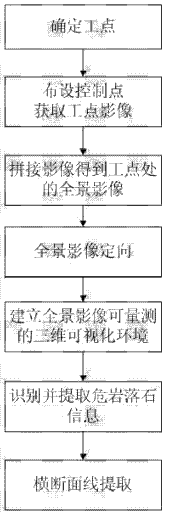
[0023] Such as figure 1 As shown, the method of the embodiment of the present invention includes the following steps:
[0024] The first step is to determine the areas along the project line containing dangerous rockfalls as work points according to the existing engineering survey data; use the engineering survey data to determine the approximate distribution position of dangerous rockfalls in the project, and delineate the areas containing dangerous rockfalls on the topographic map The scope is as dangerous rock falling site; the materials that can be referred here mainly include: the aerial and satellite images collected in the stages of project pre-feasibility study, feasibility study, preliminary design, etc., and the site surv...
PUM
 Abstract
Description
Claims
Application Information