

Lightweight geographical analysis method for facility agriculture meteorology early warning
A facility agriculture and analysis method technology, which is applied in the field of lightweight geographical analysis of facility agriculture meteorological early warning, can solve the problems of waste of manpower, repeated tasks, huge server burden, etc., and achieve the effect of reducing burden, avoiding mistakes and manpower consumption
- Summary
- Abstract
- Description
- Claims
- Application Information
AI Technical Summary
Problems solved by technology
Method used
Image

Examples
Embodiment Construction
[0033] Refer to attached Figure 1~5 , the present invention a kind of facility agricultural meteorological early warning lightweight geographical analysis method, comprises the following steps:
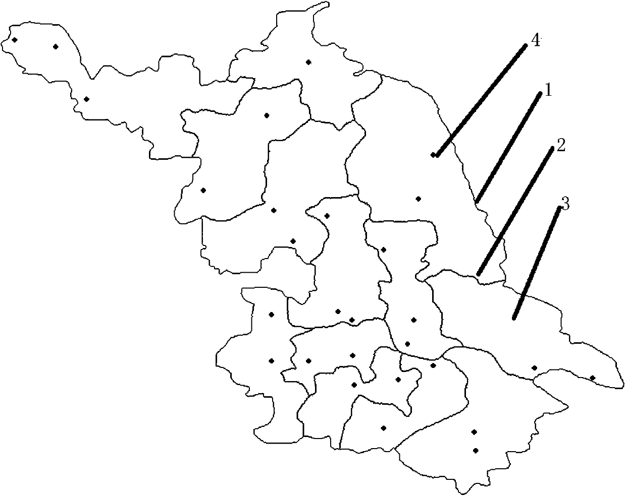
[0034] 1) Obtain regional geographical information of facility agricultural meteorological early warning;
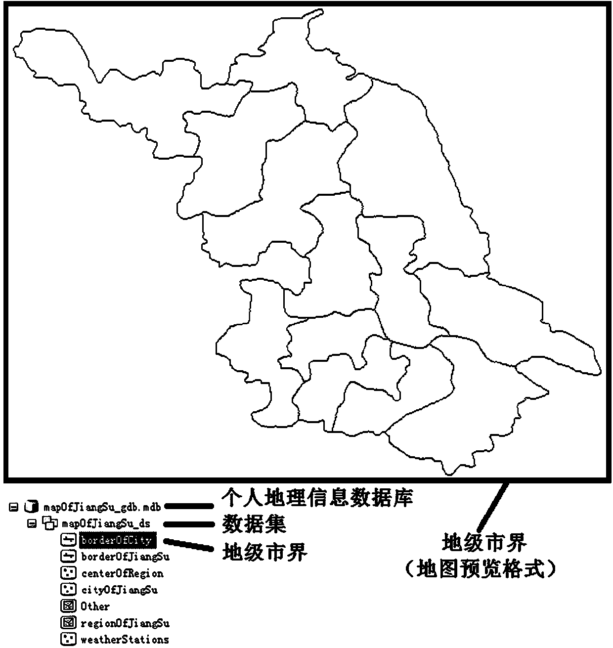
[0035] 2) Establish geographic information database of facility agricultural meteorological early warning area;
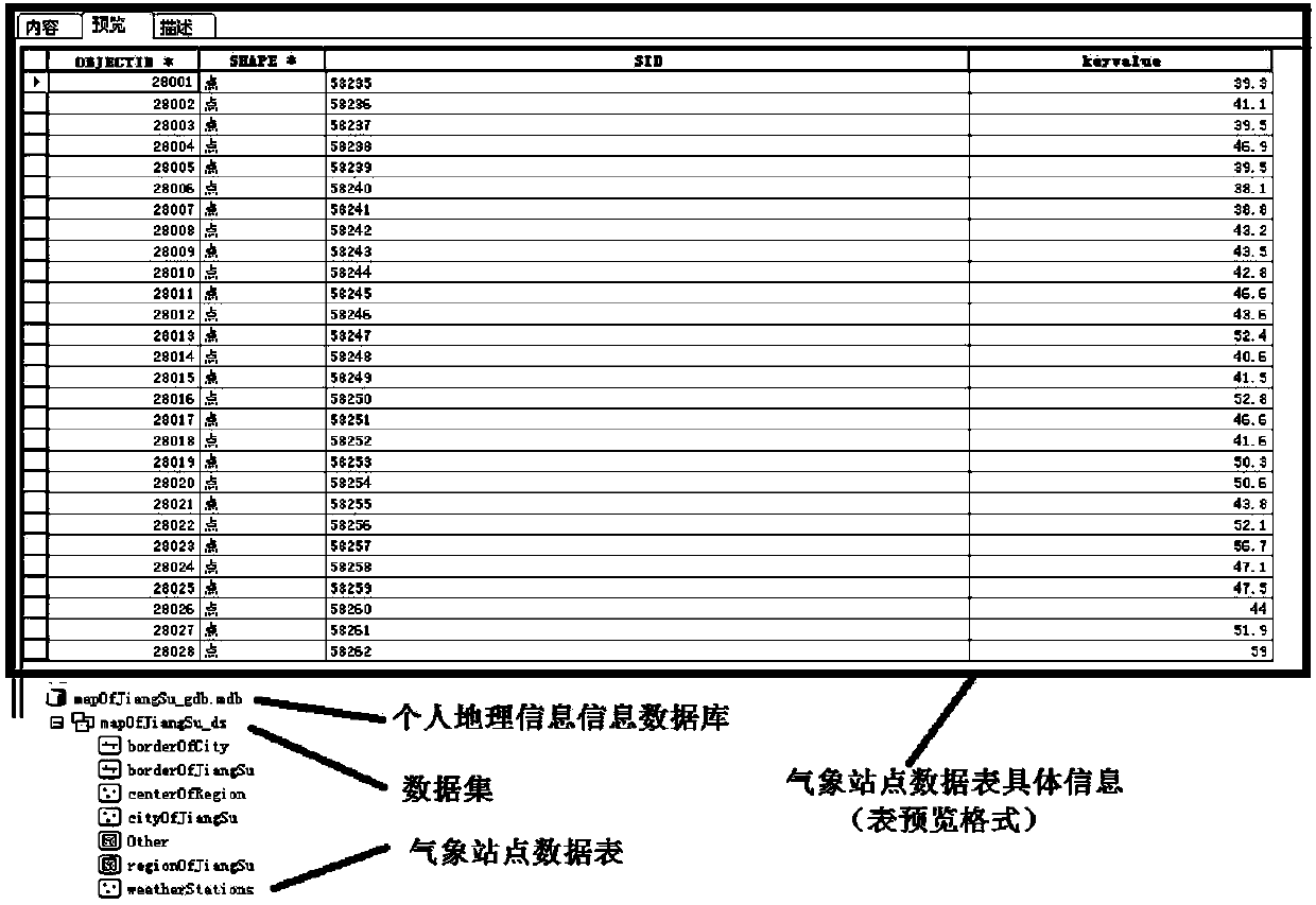
[0036] 3) Obtain the data of each meteorological station of the facility agricultural meteorological early warning system;
[0037] 4) Perform interpolation analysis on each meteorological station;
[0038] 5) Carry out isoline drawing and isosurface division on the geographic data for interpolation analysis;
[0039] 6) Export the data after geographic analysis to the pictures required by the user.
[0040] Taking Jiangsu Province as an example, the implementation steps of specific technologies will be described in detail.
[0041] A lightweight geographical a...
PUM
 Abstract
Description
Claims
Application Information