Geosynchronous orbit satellite microwave image resolution improving method
A geosynchronous orbit, resolution technology, applied in image enhancement, image data processing, instruments, etc., can solve the problems of reducing the Wiener filter resolution enhancement effect, disadvantageous to the high timeliness detection advantage of geosynchronous orbit, etc.
- Summary
- Abstract
- Description
- Claims
- Application Information
AI Technical Summary
Problems solved by technology
Method used
Image

Examples
Embodiment Construction
[0058] The present invention will be further described in detail below with reference to the accompanying drawings and embodiments.
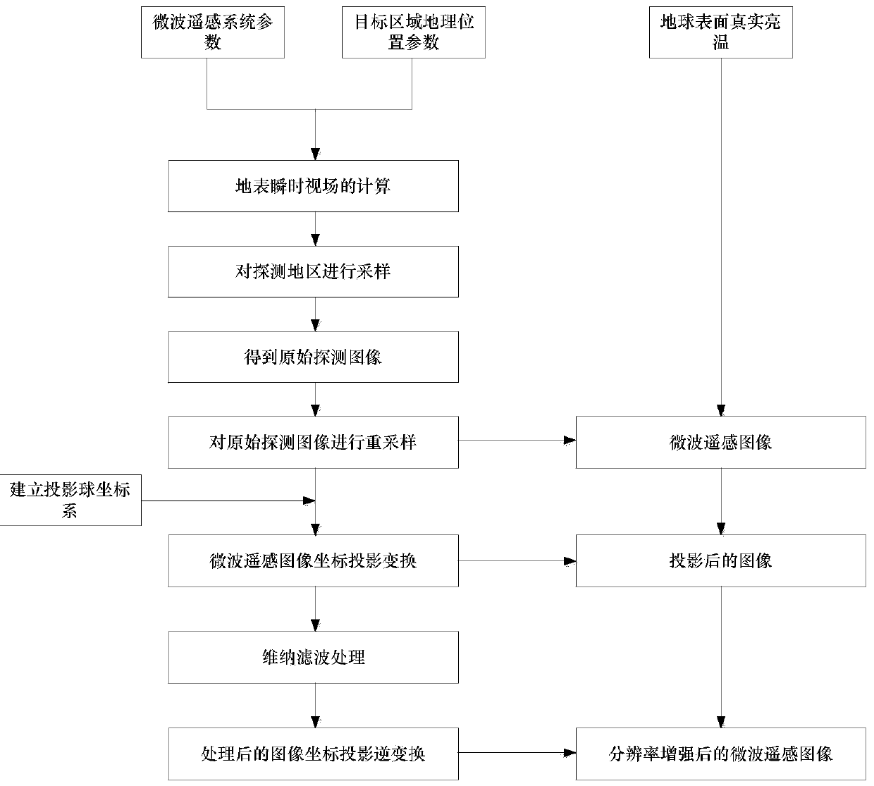
[0059] The present invention provides a method for enhancing the resolution of a geosynchronous orbit satellite microwave remote sensing image, such as figure 1 shown, by the following steps:
[0060] Step 1: Set the parameters of the microwave remote sensing system of the geostationary orbit satellite, including the detection frequency f (54GHz), spatial resolution (instantaneous field of view width) D (94km), sampling interval Δs (10km), noise (0.5K), detection range 1000km×1000km; and the geographic location parameters of the target area, including the coordinates of the center position of the target area (20°E, 20°N).
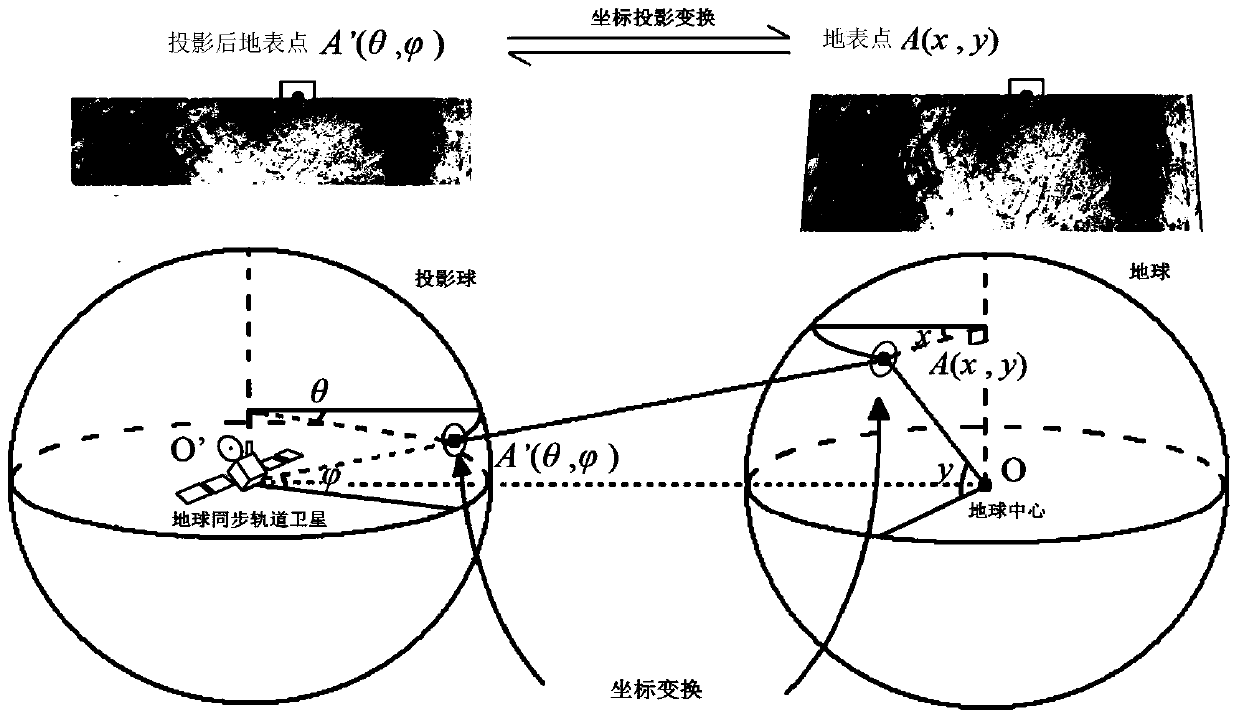
[0061] Step 2: According to the parameters in step 1, obtain the microwave remote sensing image by the following method;
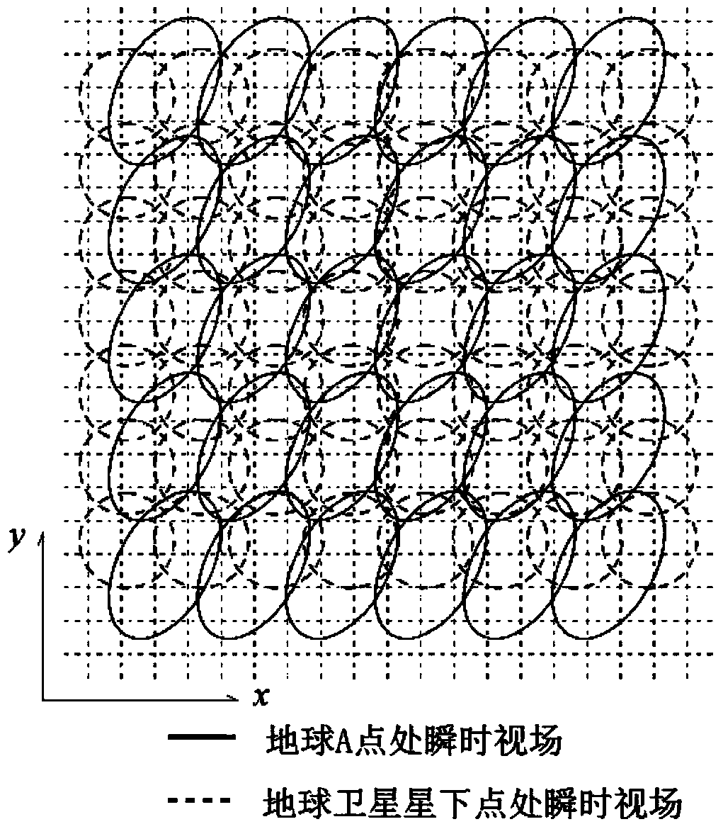
[0062] a. Obtain a sampling matrix with the earth surface point C as the center of the instantaneous...
PUM
 Abstract
Description
Claims
Application Information
 - R&D Engineer
- R&D Manager
- IP Professional
- Industry Leading Data Capabilities
- Powerful AI technology
- Patent DNA Extraction
Browse by: Latest US Patents, China's latest patents, Technical Efficacy Thesaurus, Application Domain, Technology Topic.
© 2024 PatSnap. All rights reserved.Legal|Privacy policy|Modern Slavery Act Transparency Statement|Sitemap