Satellite cloud-avoiding observation method

A satellite and cloud-avoiding technology, which is applied in the field of earth observation of remote sensing satellites, can solve problems such as inability to find gaps, unavailable imaging data in target areas, and wasted imaging opportunities, so as to reduce time, increase imaging flexibility, and improve imaging The effect of chance

Active Publication Date: 2014-07-30
AEROSPACE DONGFANGHONG SATELLITE
View PDF3 Cites 12 Cited by
  • Summary
  • Abstract
  • Description
  • Claims
  • Application Information

AI Technical Summary

Problems solved by technology

Due to cloud and fog occlusion in the corresponding direction of the satellite, the imaging data of the target area is often unavailable
[0004] However, for the sky above the target area, not every angle is covered by clouds and fog, and there are often gaps in the clouds or cloud gaps due to the height difference of the cl...

Method used


Image

  • Satellite cloud-avoiding observation method
  • Satellite cloud-avoiding observation method
  • Satellite cloud-avoiding observation method

Examples


Embodiment Construction

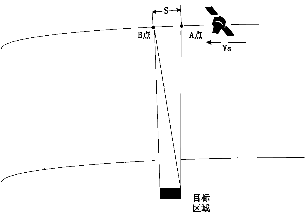
[0018] The satellite cloud-avoidance observation method of the present invention is characterized in that prior information is added, and by adding a new cloud identification device and a reasonable layout with the imaging load, the search for the gap in the cloud and the satellite cloud-avoidance imaging are realized, which significantly improves the satellite's acquisition of important targets. Observation information opportunities, while saving on-board resources.

[0019] 1. Design stage:

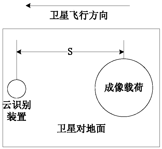
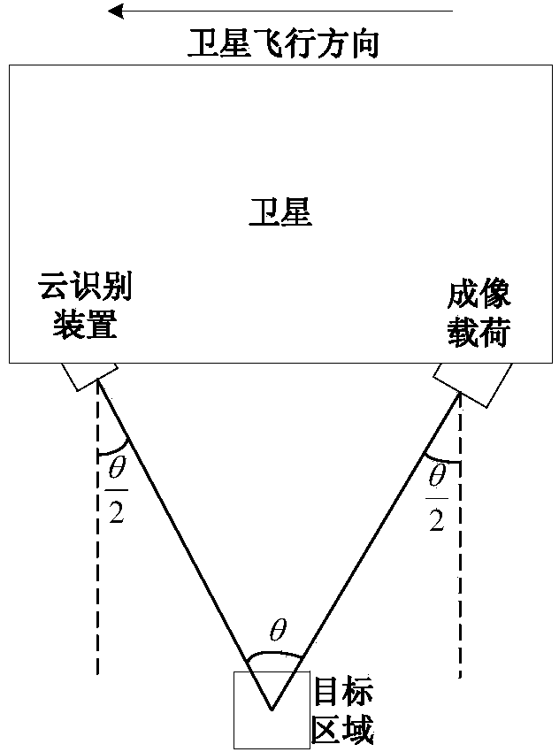
[0020] (1) Through analysis and calculation, the installation geometric relationship between the cloud recognition device and the satellite imaging payload is determined, and the geometric relationship includes the installation position and angle.

[0021] Here, the cloud identification device is composed of a small camera and a data processor. The small camera has the same field of view as the imaging load to provide prior information for scene matching for the imaging load. To distin...


PUM


Abstract

The invention discloses a satellite cloud-avoiding observation method which comprises the following steps: (1) respectively mounting a cloud identification device and an imaging load on the ground of a satellite along the satellite flight direction, wherein the cloud identification device is in the front, and the imaging load is in the rear; (2) determining the observation starting and ending positions of the imaging load in an orbit period in the imaging process aiming at a target area according to the attitude maneuver capability of the satellite; (3) enabling the view field of the cloud identification device and the view field of the imaging load to point to the target area through attitude maneuver between the satellite observation starting and ending positions, imaging the target area through the cloud identification device, calculating a cloud coverage rate, and transmitting an imaging load imaging starting construction or imaging stopping instruction according to a relationship between a calculation result and a preset threshold value; (4) repeating the step (3) in each orbit period, and thus finishing imaging of the target area. According to the method, due to additional arrangement of the cloud identification device and reasonable layout of the imaging load, cloud gap finding and satellite cloud-avoiding imaging are realized.

Description

technical field [0001] The invention relates to an earth observation method of a remote sensing satellite. Background technique [0002] Reliable and continuous earth observation remote sensing data is an important information source for the earth environment operational monitoring system and multi-resource base database. As the remote sensing method closest to naked eye observation, optical satellites have the strongest data readability, and are currently the most widely used and extremely important way to obtain remote sensing data. [0003] For optical satellites, the occlusion of clouds and fog has become the biggest factor affecting the acquisition of satellite remote sensing data. Incomplete statistics show that invalid data due to cloud and fog occlusion can reach more than 50% of the total data obtained. At present, the implementation of satellite imaging tasks mainly relies on the ground-based injection instructions in advance, and performs imaging with a preset a...

Claims


Application Information

Patent Timeline
IPC IPC(8): G01C11/00
CPCG01C11/00G01S7/41G01S17/89
Inventor 侯小瑾周宇吕大旻杜杉杉张严李阳
Owner AEROSPACE DONGFANGHONG SATELLITE
Why Eureka
Try Eureka