Geological model boundary modification method and device
A geological model, boundary technology, applied in 3D modeling, image data processing, instruments, etc., can solve the problem of the loss of the original shape of the boundary model
- Summary
- Abstract
- Description
- Claims
- Application Information
AI Technical Summary
Problems solved by technology
Method used
Image
Examples
Embodiment 1
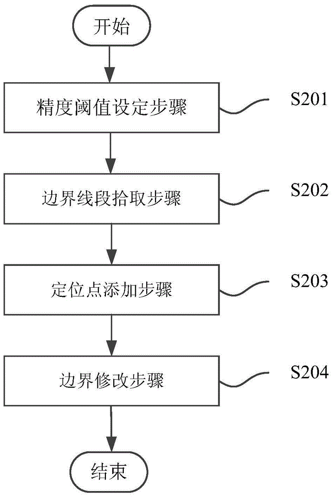
[0037] figure 2 It is a flow chart of the geological model boundary modification method in Embodiment 1 of the present invention. Include the following steps:
[0038] Step S201, the accuracy threshold setting step, setting the distance threshold from the positioning point to be added to the boundary line segment;
[0039] Step S202, the boundary line segment picking step, captures the position information of the positioning point to be added specified by the human-computer interaction device, and picks the boundary line segment according to the distance threshold and the position information of the positioning point to be added;
[0040] Step S203, the step of adding an anchor point, determining a fidelity anchor point on the picked boundary line segment, and using the position of the fidelity anchor point as the adding position of the anchor point to be added.
[0041] Preferably, the method provided in this embodiment also includes:
[0042] Step S204, boundary modifyin...
Embodiment 2
[0044] image 3 It is a flow chart of the geological model boundary modification method in the second embodiment of the present invention. The method provided in this embodiment is used to modify the two-dimensional polygon boundary in the existing three-dimensional geological model, such as Figure 4 As shown, the curve ABCDE is a part of the polygon boundary representing a certain two-dimensional geological region, including several boundary line segments AB, BC, CD, DE.
[0045] The method includes the following steps.
[0046] Step S301, the accuracy threshold setting step, setting the distance threshold L between the positioning point to be added and the boundary line segment.
[0047] Step S302, the boundary line segment picking step, captures the position information of the positioning point to be added designated by the human-computer interaction device, and picks the boundary line segment according to the distance threshold and the position information of the positi...
Embodiment 3
[0067] Figure 5 It is a schematic diagram of the geological model boundary modifying device according to the second embodiment of the present invention. The geological model boundary modifying device 500 provided in this embodiment includes the following modules.
[0068] The accuracy threshold setting module 501 is configured to set a distance threshold between the positioning point to be added and the boundary line segment.
[0069] The boundary line segment picking module 502 is used to capture the position information of the positioning point to be added specified by the human-computer interaction device, and pick up the boundary line segment according to the distance threshold and the position information of the positioning point to be added; specifically, the boundary line segment picking module 502 The picking module calculates the distance from the positioning point to be added to the boundary line segment according to the location information of the positioning poin...
PUM
 Abstract
Description
Claims
Application Information
 - R&D
- Intellectual Property
- Life Sciences
- Materials
- Tech Scout
- Unparalleled Data Quality
- Higher Quality Content
- 60% Fewer Hallucinations
Browse by: Latest US Patents, China's latest patents, Technical Efficacy Thesaurus, Application Domain, Technology Topic, Popular Technical Reports.
© 2025 PatSnap. All rights reserved.Legal|Privacy policy|Modern Slavery Act Transparency Statement|Sitemap|About US| Contact US: help@patsnap.com


