Method and device for GIS map rasterization processing and method and system for complaint handling
A GIS map and processing method technology, applied in the field of network management, can solve the problem of inaccurate data in the grid, and achieve the effect of improving completeness and accuracy, improving efficiency, improving accuracy and intuitive presentation
- Summary
- Abstract
- Description
- Claims
- Application Information
AI Technical Summary
Problems solved by technology
Method used
Image
Examples
Embodiment Construction
[0021] The present invention will be described in detail below in conjunction with the accompanying drawings.
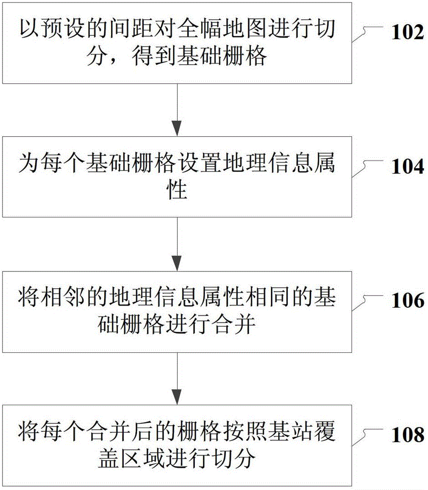
[0022] like figure 1 As shown, the present invention provides a kind of GIS map rasterization processing method embodiment, specifically comprises the following steps:
[0023] Step 102, select a grid spacing, and divide the whole map according to the traditional grid division method to form a basic grid;
[0024] Step 104, setting geographic information attributes for each basic grid; geographic information attributes include: topography information attributes and feature information attributes;
[0025] Combining the basic grid with ground objects and landform data for classification and labeling, the specific combination rules are as follows: first, the first classification of grid information is carried out according to landform information such as mountains, rivers, and forest areas; secondly, according to residential areas, parks and green spaces , Streets, c...
PUM
 Abstract
Description
Claims
Application Information
 - R&D
- Intellectual Property
- Life Sciences
- Materials
- Tech Scout
- Unparalleled Data Quality
- Higher Quality Content
- 60% Fewer Hallucinations
Browse by: Latest US Patents, China's latest patents, Technical Efficacy Thesaurus, Application Domain, Technology Topic, Popular Technical Reports.
© 2025 PatSnap. All rights reserved.Legal|Privacy policy|Modern Slavery Act Transparency Statement|Sitemap|About US| Contact US: help@patsnap.com


