
Low-altitude wind shear wind speed estimating method based on space-time optimal processor
A low-altitude wind shear and wind speed estimation technology, used in instruments, fluid velocity measurement, velocity/acceleration/shock measurement, etc. The effect of wind speed
- Summary
- Abstract
- Description
- Claims
- Application Information
AI Technical Summary
Problems solved by technology
Method used
Image

Examples
Embodiment Construction
[0028] The method for estimating low-altitude wind shear wind speed based on the space-time optimal processor provided by the present invention will be described in detail below in conjunction with the accompanying drawings and specific embodiments.
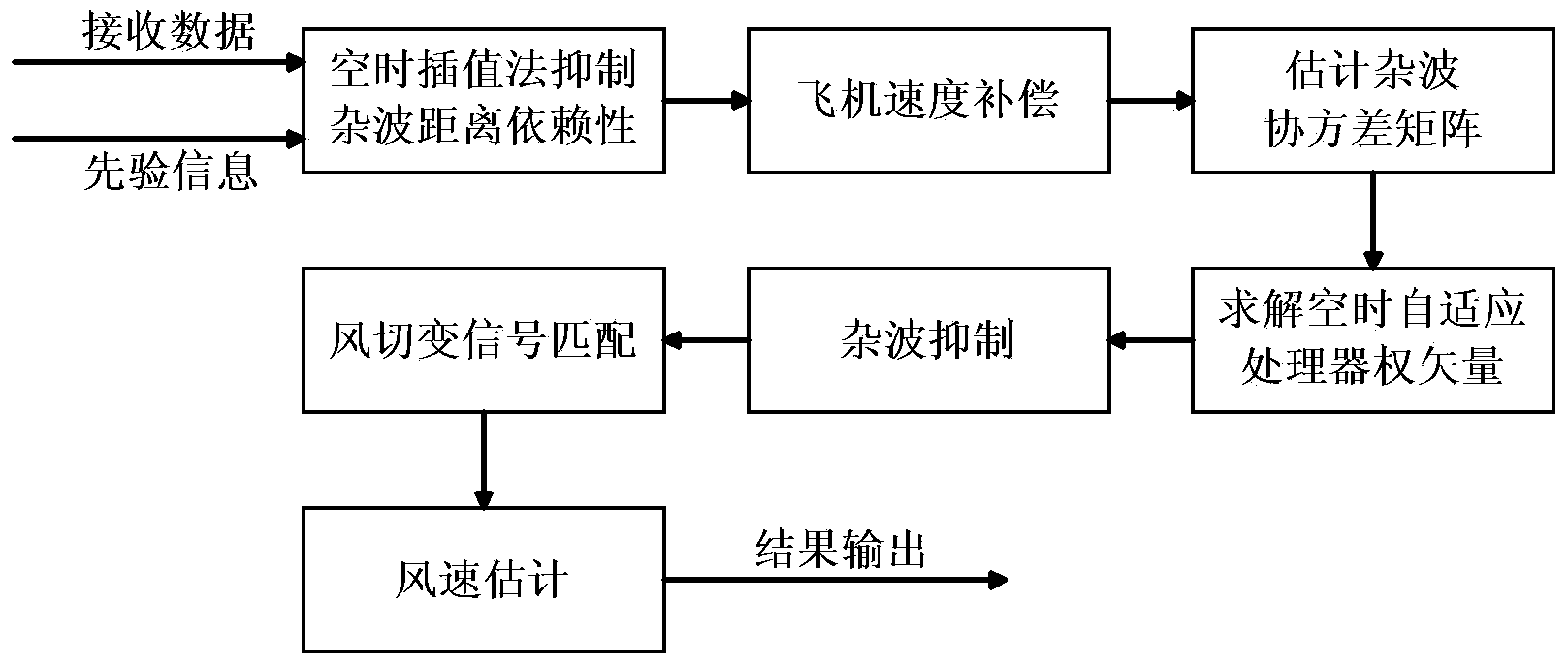
[0029] Such as figure 1 As shown, the low-altitude wind shear wind speed estimation method based on the space-time optimal processor provided by the present invention includes the following steps carried out in order:
[0030] 1) Read aircraft state parameters, radar antenna scanning parameters, etc. from the associated airborne equipment as prior information:
[0031] The aircraft speed, flight altitude, main lobe azimuth and pitch angle of antenna scanning are read from the airborne navigation equipment as prior information for signal processing.
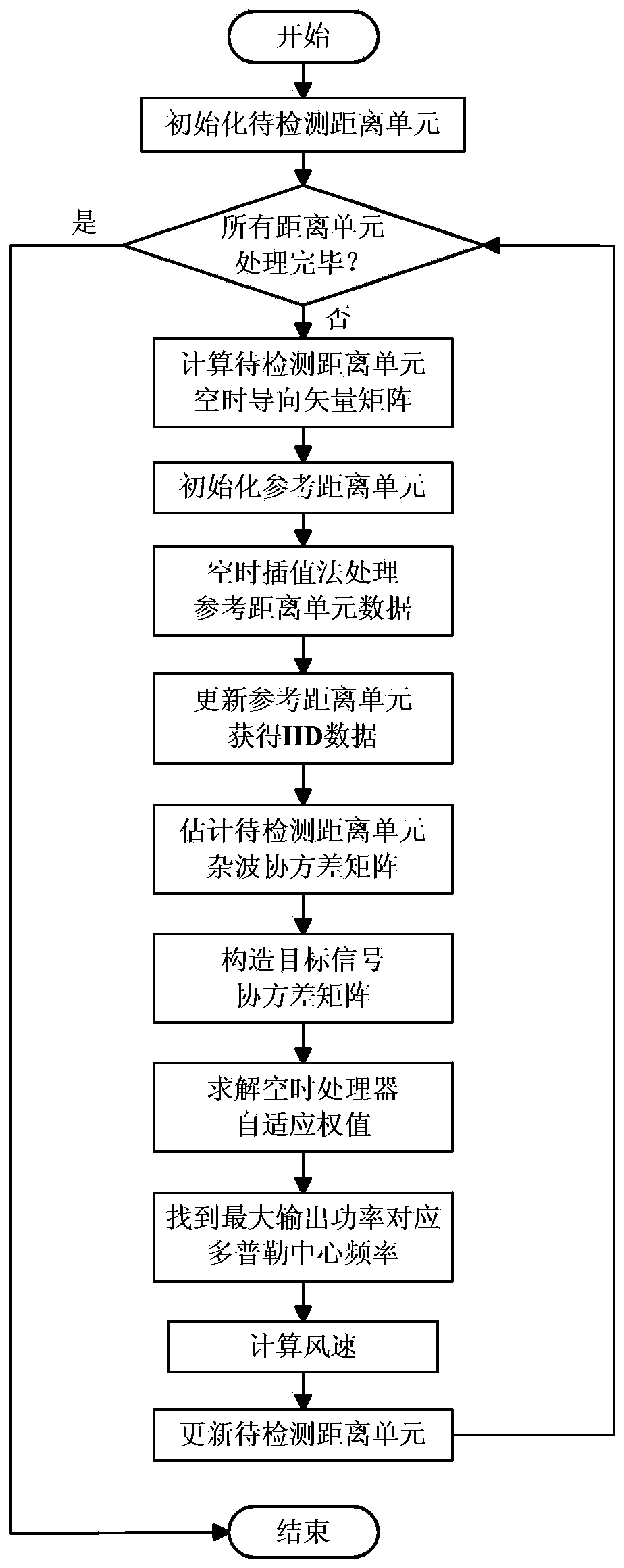
[0032] 2) Select the distance unit to be detected, and use the space-time interpolation method to correct the distance dependence of ground clutter:
[0033] The present invention ...
PUM
 Abstract
Description
Claims
Application Information