

Radar beyond visual range base line passive cooperative localization method
A collaborative positioning and radar technology, applied in the radio wave measurement system, radio wave reflection/re-radiation, re-radiation utilization, etc., can solve the problems of poor positioning accuracy and angle measurement error, and achieve the effect of improving accuracy
- Summary
- Abstract
- Description
- Claims
- Application Information
AI Technical Summary
Problems solved by technology
Method used
Image


Examples
Embodiment Construction
[0021] Implementation process and software flow such as figure 2 As shown, the specific description is the following process.
[0022] S1 Coordinate transformation of radar sites 1 and 2: Sites 1 and 2 are expressed as , , where λ is the latitude, is the longitude, h high. pass , to calculate and obtain the coordinates in the geocentric Cartesian coordinate system of stations 1 and 2 , . use function The coordinate transformation process of Site 1 is as follows:
[0023] (1)
[0024] Among them, the semi-major axis of the earth m, semi-minor axis m, eccentricity . use function The process of coordinate transformation of site 2 is the same as that of site 1.
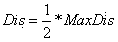
[0025] S2 Initially generate virtual target detection distance: Assuming that the virtual target is the target to be located, set the virtual target The distance from site 1 is ,make , let the search step size be ,in It is the maximum detection distance for the radar to pa...
PUM
 Abstract
Description
Claims
Application Information