Ground surface deformation high-resolution interferometric synthetic aperture radar (InSAR) monitoring method along high speed railway

A high-resolution, high-speed railway technology used in radio wave measurement systems, measuring devices, reflection/re-radiation of radio waves, etc.

Inactive Publication Date: 2014-10-22
CHINA AERO GEOPHYSICAL SURVEY & REMOTE SENSING CENT FOR LAND & RESOURCES
View PDF3 Cites 62 Cited by
  • Summary
  • Abstract
  • Description
  • Claims
  • Application Information

AI Technical Summary

Problems solved by technology

It can effectively solve the problems of high-resolution InSAR full coverage monitoring of high-speed railways, as well as the identification and separation of high-speed...

Method used


Image

  • Ground surface deformation high-resolution interferometric synthetic aperture radar (InSAR) monitoring method along high speed railway
  • Ground surface deformation high-resolution interferometric synthetic aperture radar (InSAR) monitoring method along high speed railway
  • Ground surface deformation high-resolution interferometric synthetic aperture radar (InSAR) monitoring method along high speed railway

Examples


Embodiment Construction

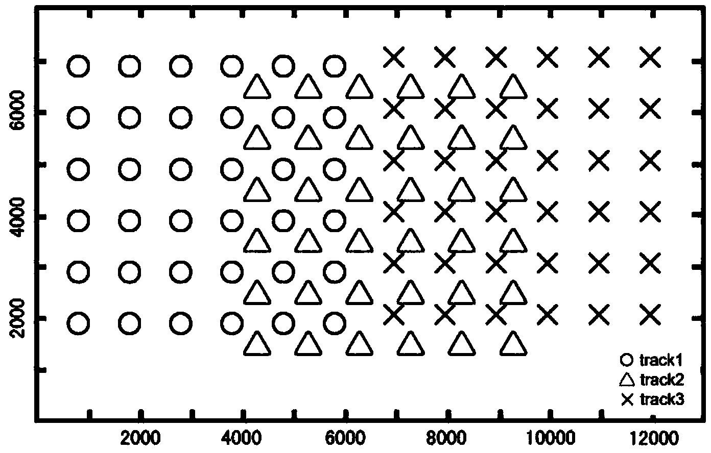
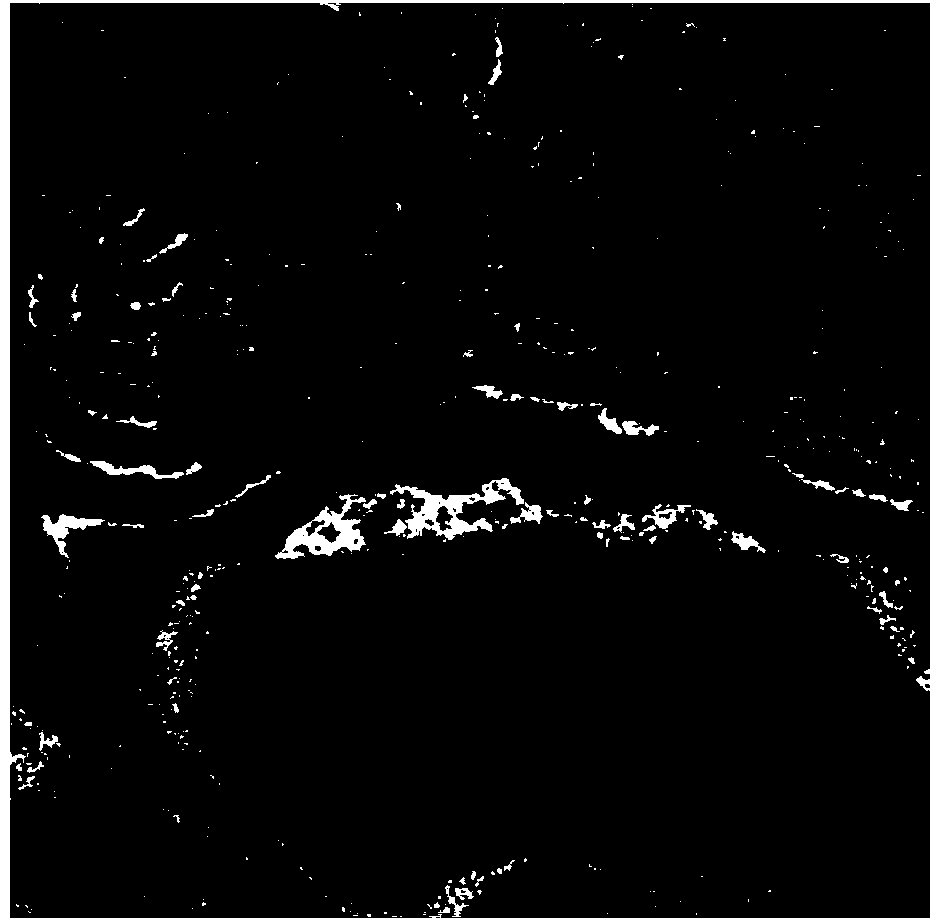
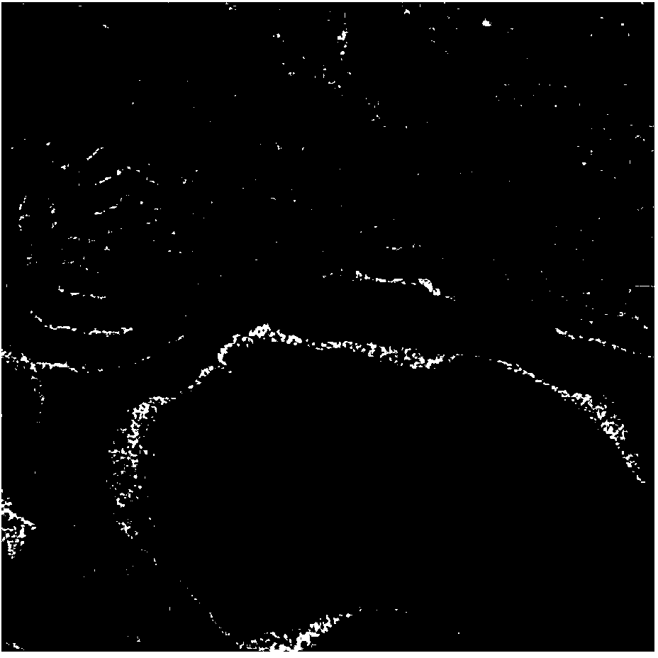
[0084] Taking the high-resolution InSAR monitoring target deformation on the Beijing-Tianjin high-speed railway line as an example, the specific operation steps of the present invention in practical engineering application are illustrated. figure 1.Schematic diagram of the distribution of coherent targets corresponding to the same ground object under adjacent parallel tracks; Fig. 2(a) is the interferogram before unified correction of the reference datum of InSAR topographic measurement results; Fig. 2(b) is the interferogram after unified correction of the reference datum of InSAR topographic measurement results Figure; Figure 3 (a) is the coherent target candidate point map on the high-speed rail line identified; Fig. 3 (b) is the ground object target map corresponding to the coherent target candidate point on the high-speed rail line identified; Figure 4 .Schematic diagram of target composition on the high-speed railway line; the coherent target on the high-speed railway li...


PUM


Abstract

Disclosed is a ground surface deformation high-resolution interferometric synthetic aperture radar (InSAR) monitoring method along a high speed railway. The method includes four steps of (1) selection of high-resolution SAR data, (2) a high-resolution InSAR high speed railway area deformation information extraction method, (3) a multi-track deformation rate result integrating method and (4) a high speed railway target recognition and deformation extraction method. By means of the ground surface deformation high-resolution InSAR monitoring method along the high speed railway, the high speed railway can be completely covered and monitored by a high-resolution InSAR, recognition and separation of high speed railway subgrade settlement and area surface subsidence can be effectively achieved, and InSAR accurate monitoring level of high speed railway ground surface deformation in China can be greatly improved.

Description

technical field [0001] The invention relates to a high-resolution InSAR monitoring method for surface deformation along a high-speed railway, belonging to the field of synthetic aperture radar interferometry (InSAR). It can effectively solve the problems that high-resolution SAR single-track images cannot completely cover the research area, and the identification and separation of high-speed railway embankment settlement and regional ground settlement. It can greatly improve the InSAR fine monitoring level of my country's high-speed railway surface deformation. Background technique [0002] The core goal of radar interferometry technology research is to measure the elevation of ground objects (topographic mapping) and invert parameters such as deformation in the direction of radar line of sight. In the past, InSAR technology mainly used medium-resolution (20-30m spatial resolution) radar data, such as ERS, ENVISAT, ALOS, and RADARSAT, etc., and the measurement results were t...

Claims


Application Information

Patent Timeline
IPC IPC(8): G01S13/90
CPCG01S13/9023
Inventor 葛大庆张玲李曼刘斌郭小方
Owner CHINA AERO GEOPHYSICAL SURVEY & REMOTE SENSING CENT FOR LAND & RESOURCES
Why Eureka
Try Eureka