Radar analog data merging method for navigation simulator simulation

A technology of analog data and simulator, applied in the direction of electrical digital data processing, special data processing applications, instruments, etc., can solve the problem that the accuracy of radar simulation image does not meet the navigation requirements, cannot effectively distinguish the coastline boundary line of the chart, and lose radar simulation Image and other issues to achieve the effect of saving computing resources, simplifying judgments, and reducing the amount of data

Active Publication Date: 2014-11-19
DALIAN MARITIME UNIVERSITY
View PDF3 Cites 11 Cited by
  • Summary
  • Abstract
  • Description
  • Claims
  • Application Information

AI Technical Summary

Problems solved by technology

[0004] 1. If the simulated ship's position leaves the chart range of the currently read radar simulation data, the radar simulation image will be lost
[0005] 2. If you read a radar simulation data in a small-scale chart with a large range, the accuracy of the radar simulation image does not meet the navigation requirement

Method used


Image

  • Radar analog data merging method for navigation simulator simulation
  • Radar analog data merging method for navigation simulator simulation
  • Radar analog data merging method for navigation simulator simulation

Examples


Embodiment Construction

[0045] The present invention will be further described below in conjunction with the accompanying drawings. The present invention is divided into six steps of screening, segmentation, sorting, deduplication, merging, and edge joining. The specific implementation of the present invention will be described below in conjunction with the accompanying drawings and the attached table in the waters near a certain port:

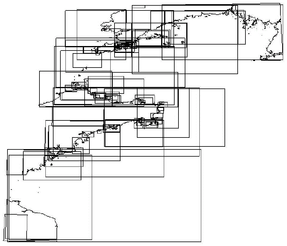
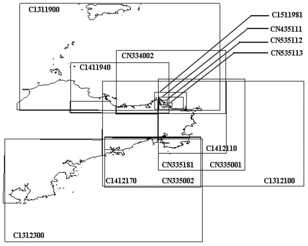
[0046] According to the IHO standard classification, the S-57 standard chart is divided into six categories for different navigation purposes: Overview, General, Coastal, Approach, Harbor, and Berths ( Berthing). Generally, when using radar for lookout in nautical practice, an appropriate range should be selected: 12-24n mile range can be used for ocean navigation; 6-12n mile range can be used for coastal navigation; both far and near ranges should be used for narrow waterway navigation, with 2-6n mile as the main range . Such as figure 1 As shown, taking a certa...


PUM


Abstract

The invention discloses a radar analog data merging method for navigation simulator simulation. The method comprises the following steps that nautical charts with different measuring scales are screened according to navigation purposes of the nautical charts and the distances between the nautical charts and reference points; radar analog data are cut; the cut nautical charts are ranked according to two principles; redundant data of an overlapping region of every two adjacent nautical charts are screened in sequence; a gap in a merged polygon is filled so as to form a rectangle, and a new mapsheet is constructed; edge matching is conducted on shorelines, from the nautical charts with the different measuring scales, in merged radar analog data. According to the method, due to the fact that the nautical charts involved during navigation are screened according to the reference points of navigational areas and the navigation purposes of the nautical charts, the quantity of the radar analog data is greatly reduced under the premise that the accuracy of the radar analog data is guaranteed. Due to the fact that characteristic rules of forward angles in the radar analog data are worked out, the shorelines and boundaries generated due to chart subdivision are distinguished accordingly, and influences, caused by chart subdivision making, on the accuracy of the radar analog data are eliminated.

Description

technical field [0001] The invention relates to the application fields of computer data processing and navigation simulation, in particular to a method for automatically extracting, processing and merging radar simulation data used for navigation simulator simulation. Background technique [0002] The International Maritime Organization (IMO) promulgated the "1972 International Regulations for Avoiding Collisions at Sea", which stipulates the specific requirements for the correct use of radar and radar plotting. In traditional nautical training, trainees only learn theory at school, and practical experience can only be obtained through on-board practice. This training method takes a long time and costs a lot. In recent years, navigation simulators have developed rapidly and have great advantages over traditional training methods. IMO has added specific requirements for navigation simulators in the Manila Amendment to the International Convention on Standards of Training, Ce...

Claims


Application Information

Patent Timeline
IPC IPC(8): G06F17/50
Inventor 张新宇尹勇金一丞姚舜张显库任鸿翔任俊生张秀凤刘秀文孙霄峰神和龙谷伟
Owner DALIAN MARITIME UNIVERSITY
Why Eureka
Try Eureka