Method for utilizing satellite remote sensing to monitor forest fire
A technology for satellite remote sensing and forest fires, which is applied to electrical fire alarms, fire alarms that rely on radiation, and fire alarms. It can solve the problems of high cost and large forest fire monitoring errors, and achieve low cost Effect
- Summary
- Abstract
- Description
- Claims
- Application Information
AI Technical Summary
Problems solved by technology
Method used
Image
Examples
Embodiment Construction
[0014] It should be noted that, in the case of no conflict, the embodiments in the present application and the features in the embodiments can be combined with each other. The present invention will be described in detail below with reference to the accompanying drawings and examples.
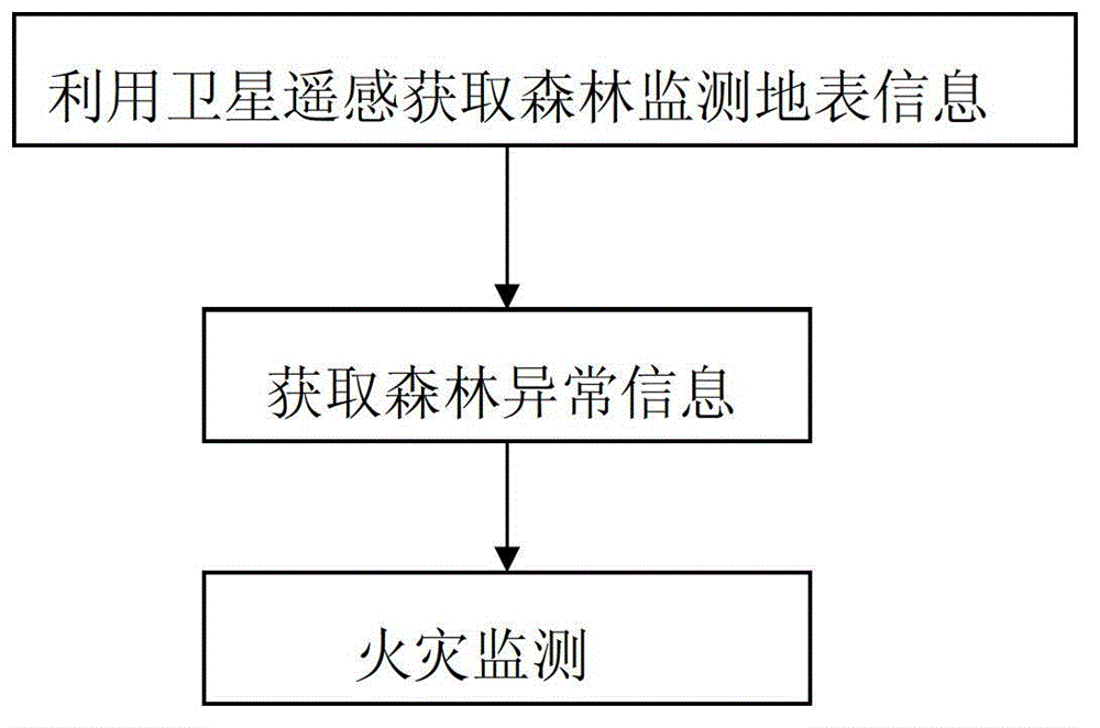
[0015] figure 1 It is a main flow chart of a method for monitoring forest fires using satellite remote sensing according to an embodiment of the present invention. Referring to Fig. 1, the method mainly includes: obtaining satellite monitoring surface information through satellite remote sensing, obtaining forest anomaly information according to the obtained satellite monitoring surface information, and monitoring fire information according to the forest anomaly information.
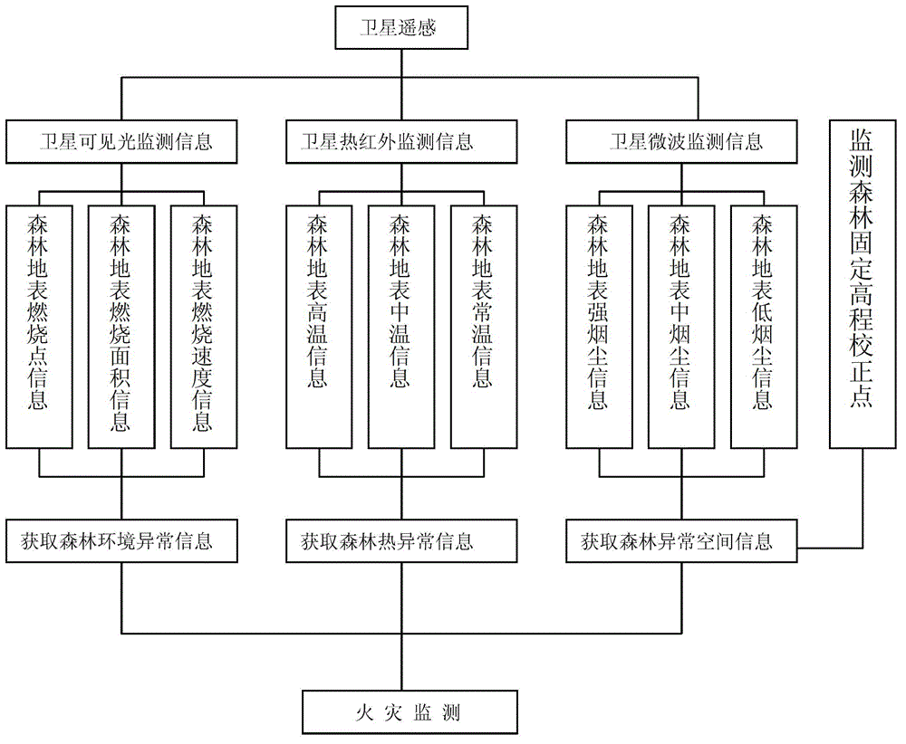
[0016] figure 2 It is a specific technical structural diagram of a method for monitoring forest fires using satellite remote sensing according to an embodiment of the present invention; figure 2 Shows the specific ste...
PUM
 Abstract
Description
Claims
Application Information
 - R&D
- Intellectual Property
- Life Sciences
- Materials
- Tech Scout
- Unparalleled Data Quality
- Higher Quality Content
- 60% Fewer Hallucinations
Browse by: Latest US Patents, China's latest patents, Technical Efficacy Thesaurus, Application Domain, Technology Topic, Popular Technical Reports.
© 2025 PatSnap. All rights reserved.Legal|Privacy policy|Modern Slavery Act Transparency Statement|Sitemap|About US| Contact US: help@patsnap.com


