

Method for automatically eliminating wrongly-matched registration points in remote sensing image
A remote sensing image, error matching technology, applied in the field of remote sensing image processing, can solve the problems of orthorectification error, easy to appear a large number, difficult to obtain, etc., to achieve the effect of mismatching feature point pairs
- Summary
- Abstract
- Description
- Claims
- Application Information
AI Technical Summary
Problems solved by technology
Method used
Image

Examples
Embodiment Construction
[0020] The present invention will be further described below in conjunction with the accompanying drawings and embodiments.
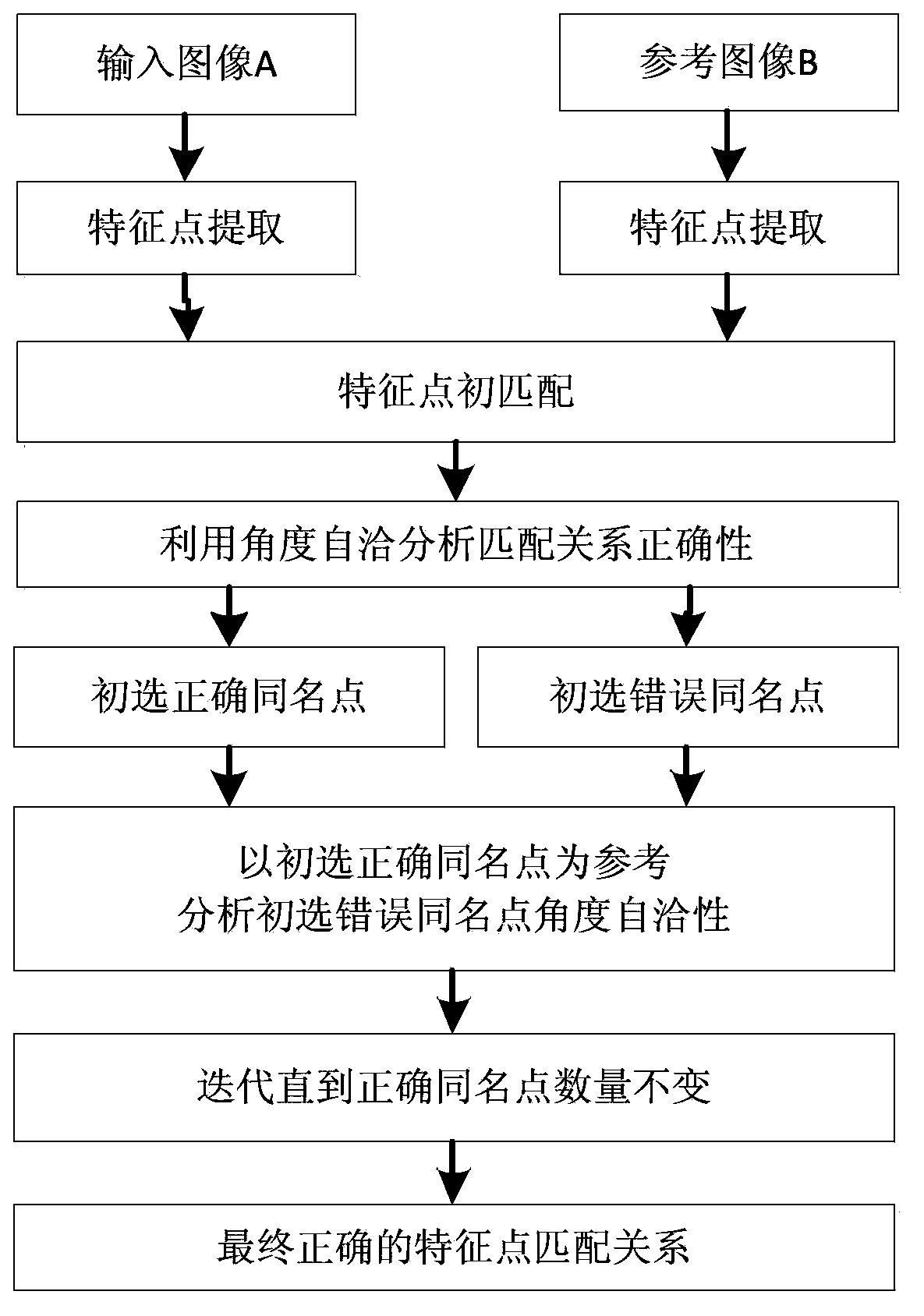
[0021] A remote sensing image automatic registration point mismatch elimination method, such as figure 2 shown, including the following steps:
[0022] Step 1, image acquisition: use Quick Bird or IKONOS sensor to acquire high spatial resolution image A and image B in different phases;
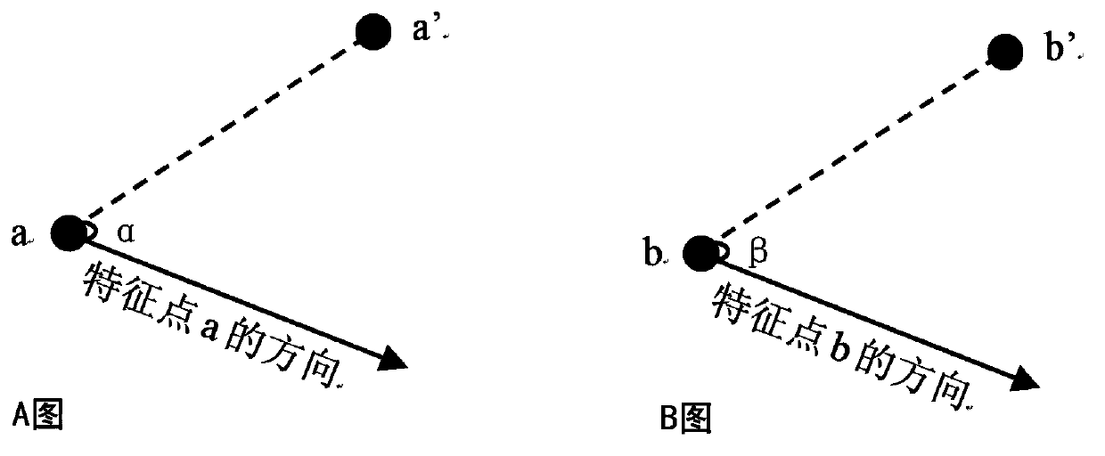
[0023] Step 2, extract feature points and establish the initial matching relationship: use SIFT or SURF method to extract feature points in image A and image B respectively, and obtain feature point set {PixA i |i=1, 2,...M} and {PixB j|j=1, 2,...N}, use the FlannBasedMatcher method for feature point matching, and get the initial set of points with the same name U relation ={PixA i , PixB i |i=1, 2,...min(M, N)}; then U relation The feature points in the image are composed of the feature point set U in the A image A ={PixA i |i=1, 2,...min(M, N)}, and the featu...
PUM
 Abstract
Description
Claims
Application Information