
Water function zone and water resource partition mapping technology

A technology for water functional zones and water resources, applied in special data processing applications, instruments, electrical digital data processing, etc.

Inactive Publication Date: 2015-01-07
CHINA INST OF WATER RESOURCES & HYDROPOWER RES
View PDF2 Cites 3 Cited by
  • Summary
  • Abstract
  • Description
  • Claims
  • Application Information

AI Technical Summary

Problems solved by technology

However, the electronic maps and other products currently on the market have only established the line-surface correspondence between water function areas and water resource partitions (water volume simulation units); there is still a lack of method steps for determining the overall correspondence of the watershed.

Method used


Image

  • Water function zone and water resource partition mapping technology

Examples


Embodiment Construction

[0013] The present invention will be further described below in conjunction with the accompanying drawings.

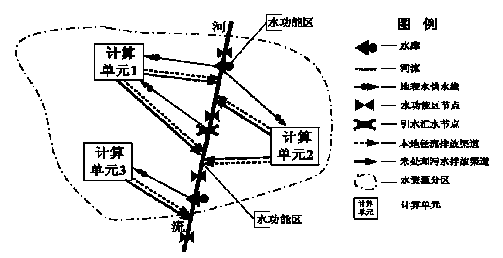
[0014] like figure 1 As shown, the water function zone and water resources zoning mapping technology described in the present invention adopts the following method steps:

[0015] Step 1: superimpose the control nodes at the upper and lower ends of the water function area according to the upstream and downstream relationship of the watershed and the area of ​​the unit, so as to realize the effective combination of the water resource division unit and the water function area;

[0016] Step 2: According to the distribution of river sections in the water function area in the calculation unit, list the corresponding relationship between the water function area and the calculation unit, and find out the corresponding relationship between the calculation unit and the confluence and sewage discharge of multiple water function areas one by one;

[0017] Step 3: Determination ...


PUM


Abstract

The invention relates to a water function zone and water resource partition mapping technology. The water function zone and water resource partition mapping technology includes that overlapping control nodes of the upper and lower ends of each water function zone with a unit planar range according to the upstream and downstream relationship of a drainage basin; listing the corresponding relationship between each water function zone and a calculating unit according to the distribution of the river reach of the water function zone in the calculating unit, and finding out the corresponding relationships between the calculating unit and the confluence and sewage discharge of a plurality of water function zones one by one; determining distribution coefficients; determining the confluence area proportion of the water function zones involved in each calculating unit; arranging the corresponding unit relationships of all the water function zones to form the one-to-many corresponding relationship between the water function zones and the calculating unit. The water function zone and water resource partition mapping technology uses the water function zones and water resource partitions (calculating partitions) capable of being quantified to plan the runoff and water-break processing relationships of the units; each calculating unit is corresponding to one or more water function zones, and meanwhile, each water function zone can run through the corresponding relationship of one or more calculating units to realize the uniformity of two types of corresponding relationships.

Description

technical field [0001] The invention relates to a technology for mapping water function zones and water resource partitions. Background technique [0002] Water function zone is defined as a water function zone that meets the needs of human beings for the rational development, utilization, conservation and protection of water resources, according to the natural conditions of water resources and the status quo of development and utilization, in accordance with the requirements of comprehensive basin planning, water resource protection and economic and social development, and according to its leading The function is to delineate the scope and implement the corresponding water environment quality standards for water areas. The purpose of water function zoning is to coordinate the development, utilization and protection of water resources, the relationship between the whole and the parts, and determine the function and function sequence of the water area according to the natural...

Claims


Application Information

Patent Timeline
IPC IPC(8): G06F19/00
Inventor 游进军
Owner CHINA INST OF WATER RESOURCES & HYDROPOWER RES
Learn More