

Taxi GPS (Global Positioning System) record based airport bus station and path planning method
A technology for taxis and airports, applied in data processing applications, forecasting, calculations, etc., to solve problems such as difficult landing operations
- Summary
- Abstract
- Description
- Claims
- Application Information
AI Technical Summary
Problems solved by technology
Method used
Image


Examples
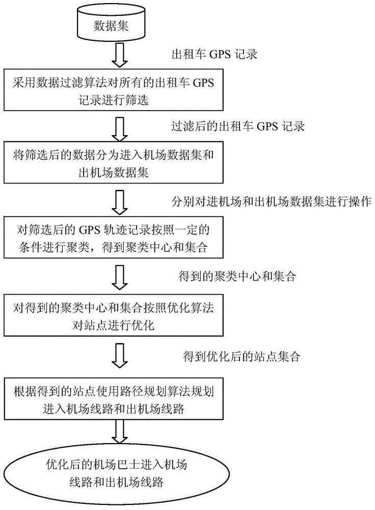
Embodiment
[0110] In this embodiment, the data sets generated by all taxis in city A within a week are used for experiments.
[0111] For the original data set obtained, first filter out invalid data: use blue dots on the map to represent the starting point, and red dots to represent the end point. After displaying these data records on the map, there are many records whose start and end points are both Not in the airport taxi stop area; at this time, draw a circular area with the airport stop as the center and a radius of 1km, and filter out the data whose starting point or end point is within this circular area; the filtered data combines part of the starting point and Eliminate the data whose end point distance is less than 1km and the driving time of a record is less than 5 minutes, and get the most required data set S use .
[0112] Second, take the data set S use Split into two parts of the data set, classified according to the color displayed by the dots in the airport stop area...
PUM
 Abstract
Description
Claims
Application Information