Image map-based urban monitoring system

A monitoring system and picture technology, applied in the directions of maps/plans/charts, geographic information databases, special data processing applications, etc., can solve the problems of high cost, long cycle and high risks of urban monitoring systems, and achieve the effect of reducing research and development risks.

Inactive Publication Date: 2015-02-25
SHANGHAI AVCON INFORMATION TECH
View PDF4 Cites 7 Cited by
  • Summary
  • Abstract
  • Description
  • Claims
  • Application Information

AI Technical Summary

Problems solved by technology

This directly leads to the high cost, long period and high risk of building an urban monitoring system based on offline vector maps

Method used


Image

  • Image map-based urban monitoring system
  • Image map-based urban monitoring system

Examples


Embodiment Construction

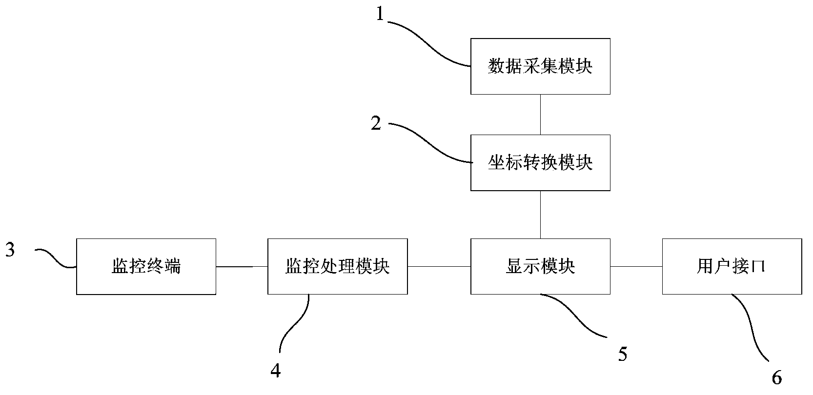
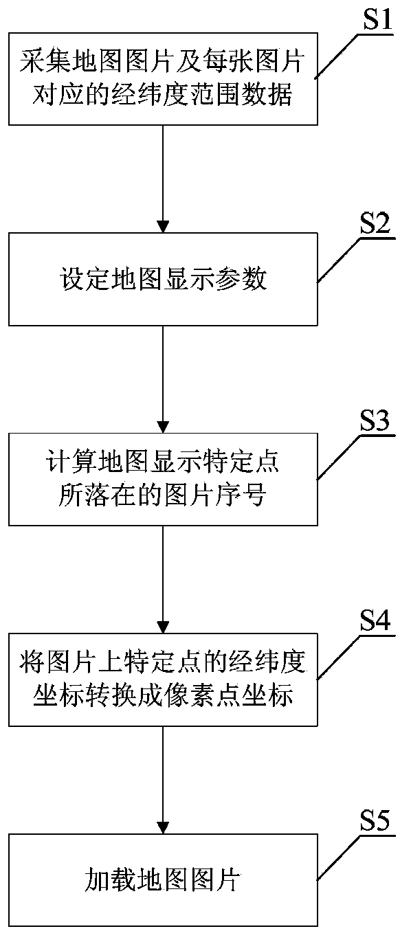
[0011] Embodiments of the present invention are described below through specific examples, and those skilled in the art can easily understand other advantages and effects of the present invention from the content disclosed in this specification. The present invention can also be implemented or applied through other different specific implementation modes, and various modifications or changes can be made to the details in this specification based on different viewpoints and applications without departing from the spirit of the present invention.

[0012] Please refer to attached picture. It should be noted that the diagrams provided in this embodiment are only schematically illustrating the basic idea of ​​the present invention, and only the components related to the present invention are shown in the diagrams rather than the number, shape and shape of the components in actual implementation. Dimensional drawing, the type, quantity and proportion of each component can be change...


PUM


Abstract

The invention provides an image map-based urban monitoring system comprising a data acquisition module, a coordinate conversion module, at least one monitoring terminal, a monitoring processing module, a displaying module and a user interface; the data acquisition module is used for capturing map data of other map systems; the monitoring terminals are used for collecting information of a site under monitoring; the monitoring processing module is used for processing the information collected by the monitoring terminals; the displaying module is used for loading a map image and the monitoring terminals and displaying the map image; the user interface is used for interaction with users. Preferably, the data acquisition module captures the map images one by one and their longitude and latitude ranges under each map scale and generates different scale layers. The image map-based urban monitoring system allows map displaying to be achieved with no need for original vector map data, leading to lower development costs of non-online vector E-maps, shorter development cycle thereof and lower development expenditures thereof.

Description

technical field [0001] The invention relates to a city monitoring system, in particular to a monitoring system based on a picture electronic map. Background technique [0002] With the development and construction of national smart cities, the urban monitoring system has played an increasingly important role. The city monitoring system needs to be closely integrated with the electronic map. [0003] Electronic maps can be based on offline maps (referring to access map data without access to the Internet, all map data comes from the internal server of the LAN) or online maps. Existing electronic map solutions are mainly based on online maps, such as Baidu Maps and Google Maps. However, some special organizations or units have their own private network and cannot or are inconvenient to access the Internet due to special reasons. These organizations or units can only choose solutions based on offline maps. [0004] Building an offline map (currently offline maps are usually ...

Claims


Application Information

Patent Timeline
Patent Type & Authority Applications(China)
IPC IPC(8): G06F17/30G09B29/00
CPCG06F16/29G09B29/00
Inventor 冯小卫周小川龙国煊洪亮杨超惠
Owner SHANGHAI AVCON INFORMATION TECH
Why Eureka
Try Eureka