Car positioning method and device applied to GPS satellite signal dead zone

A satellite signal and vehicle positioning technology, applied in the field of vehicle positioning and navigation, can solve the problem that vehicles cannot be accurately positioned

Inactive Publication Date: 2015-03-25
CHINESE NONFERROUS METAL SURVEY & DESIGN INSTITUE OF CHANGSHA
View PDF3 Cites 11 Cited by
  • Summary
  • Abstract
  • Description
  • Claims
  • Application Information

AI Technical Summary

Problems solved by technology

[0006] The purpose of the present invention is to provide a vehicle positioning method and a vehicle positioning device used in the GPS satellite signal blind area, to solve the technical problem that the vehicle cannot be accurately positioned in an environment where the GPS satellite signal blind area and the number of GSM and CDMA communication base stations are limited.

Method used


Image

  • Car positioning method and device applied to GPS satellite signal dead zone
  • Car positioning method and device applied to GPS satellite signal dead zone
  • Car positioning method and device applied to GPS satellite signal dead zone

Examples


Embodiment Construction

[0059] The embodiments of the present invention will be described in detail below with reference to the accompanying drawings, but the present invention can be implemented in various ways defined and covered by the claims.

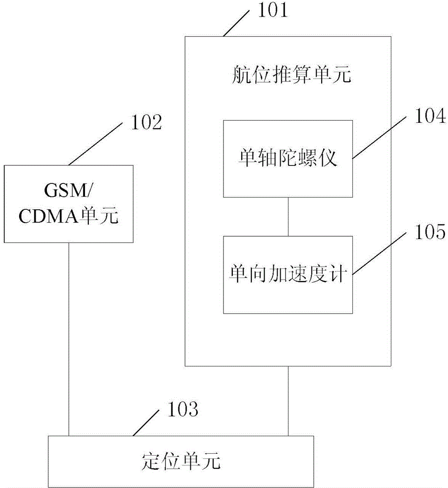
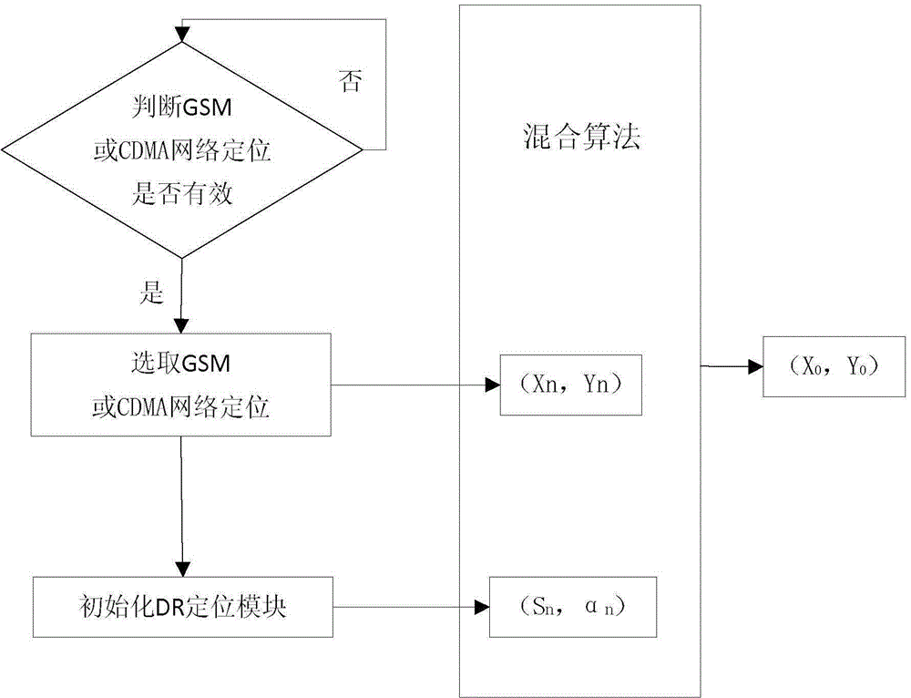
[0060] see figure 1 , a vehicle positioning method used in the GPS satellite signal blind area, the vehicle can be a mining vehicle, the positioning method comprises steps:

[0061] A. Calculate the estimated position of the vehicle using the time difference of arrival of at least one of the GSM network and CDMA network signals:

[0062] Position calculation equation based on GSM / CDMA network signal:

[0063] R i,j =cΔτ i =R i -R j (1)

[0064] R i = ( X i - x n ) 2 + ...


PUM


Abstract

The invention provides a car positioning method and device applied to a GPS satellite signal dead zone. The method includes the steps of firstly, outputting initial position information of a mine car through a CDMA network and GSM network hybrid positioning algorithm; secondly, obtaining positioning information of a DR system; thirdly, distributing two system positioning weights to a mobile communication network and the DR system through a computer system to obtain the final positioning result of the mine car. By means of the method, by taking the actual situation of a remote area into comprehensive consideration and through the mobile communication network positioning method and the DR system positioning method, the situation that a GNSS module signal is shielded and normal positioning can not be achieved is eliminated, the problems that through a mobile network, the positioning accuracy is low, and the long-term accuracy of the DR system is low are solved, the problem that due to the fact that a mine lot is not completely covered with a single communication network, data can not be sent is solved, cost and operating expenses are saved, and the system can be relatively easily maintained and upgraded in the later period.

Description

technical field [0001] The invention relates to the field of vehicle positioning and navigation, in particular to a vehicle positioning method and a vehicle positioning device used in GPS satellite signal blind areas. Background technique [0002] The GPS satellite positioning system has been widely used around the world, but because the GPS system observes at least 4 GPS satellites at the same time to locate, mountainous mountains, dense trees, and tunnels often block GPS signals, resulting in remote areas, especially mining areas. For many locations, the GPS system does not work properly. [0003] Dead reckoning (DR) positioning is a technology that calculates the position at the next time by measuring the distance and azimuth of the movement under the condition of knowing the current position. It calculates the vehicle's driving distance, speed and driving direction through signals from sensors such as gyroscopes and accelerometers. In a short period of time, this metho...

Claims


Application Information

Patent Timeline
Patent Type & Authority Applications(China)
IPC IPC(8): G01S5/06G01C21/28
CPCG01C21/28G01S5/06
Inventor 粟闯杜年春金俊
Owner CHINESE NONFERROUS METAL SURVEY & DESIGN INSTITUE OF CHANGSHA
Why Eureka
Try Eureka