Grassland biomass remote sensing inversion method considering grassland height factor

A technology of grassland biology and height factor, which is applied in the field of grassland biomass remote sensing inversion considering the grassland height factor and remote sensing quantitative inversion of grassland biomass, which can solve the problem of remote sensing information saturation, poor fitting degree, and inability to accurately reflect biological Quantity changes and other problems, to overcome the consistency and stability, improve the effect of precision

Active Publication Date: 2015-07-15
SHANGHAI INST OF TECHNICAL PHYSICS - CHINESE ACAD OF SCI
View PDF5 Cites 29 Cited by
  • Summary
  • Abstract
  • Description
  • Claims
  • Application Information

AI Technical Summary

Problems solved by technology

[0004] However, one of the biggest problems in the vegetation index model is the lack of consistency and stability between different forms of vegetation.
Li Deren pointed out that when remote sensing data are used to estimate areas with relatively high biomass, there is

Method used


Image

  • Grassland biomass remote sensing inversion method considering grassland height factor
  • Grassland biomass remote sensing inversion method considering grassland height factor
  • Grassland biomass remote sensing inversion method considering grassland height factor

Examples


Embodiment Construction

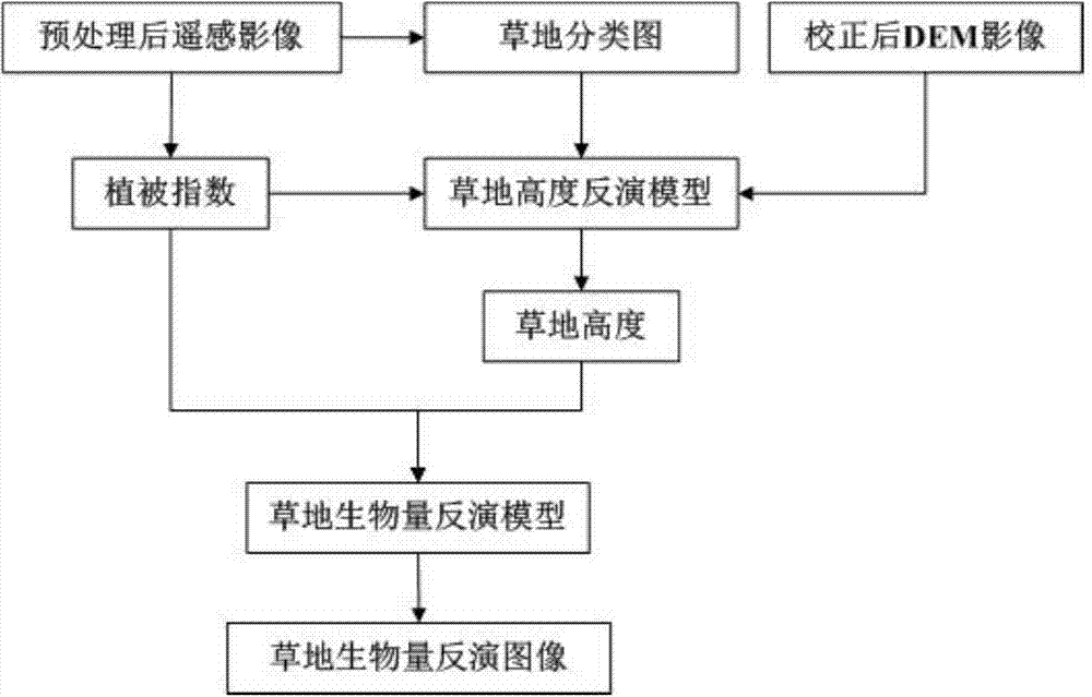
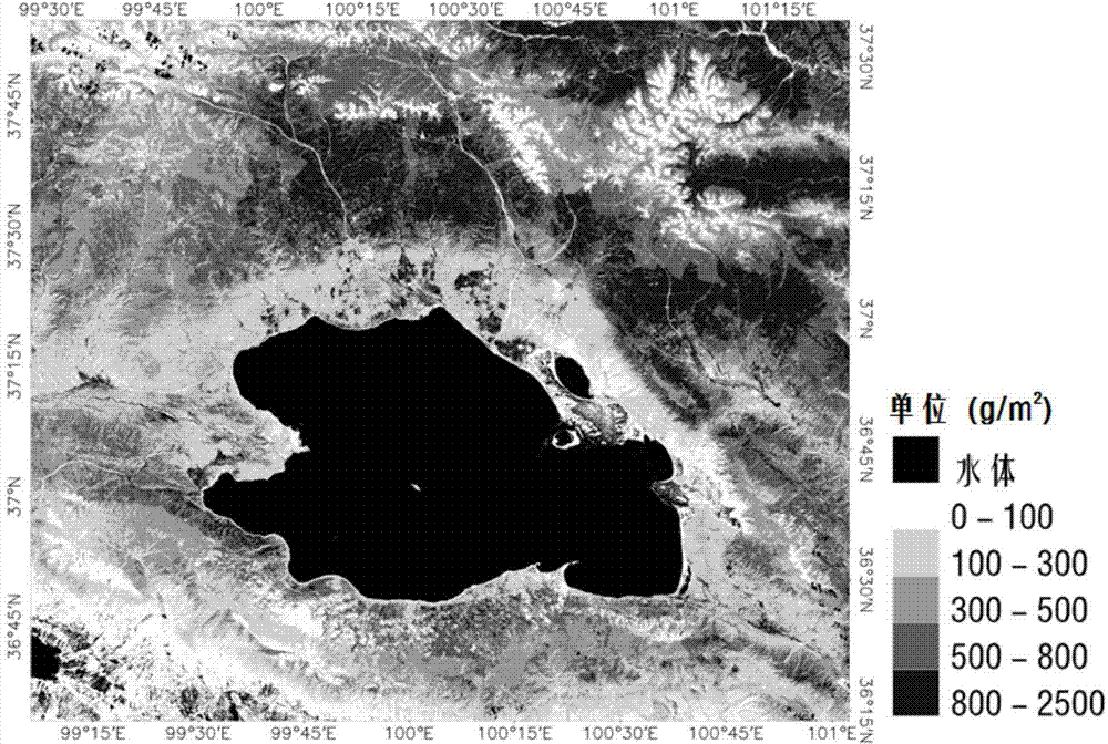
[0030] According to the present invention, HJ-1CCD data are used to invert the aboveground biomass of grassland in the area around Qinghai Lake. Firstly, the HJ-1CCD data in the study area (September 2, 2012, 5083 rows * 5931 columns) were subjected to geometric correction, radiometric correction and atmospheric correction, and then water mask and vegetation coverage area extraction were performed on the obtained albedo images. deal with. According to the existing grassland classification system in Qinghai Province, 8 grassland types in the area around the lake were classified, and a grassland classification map of the study area was generated. On this basis, the aboveground biomass of the grassland was retrieved by comprehensively using the albedo image, grassland classification image, DEM data and other data in the study area.

[0031] The details are as follows:

[0032] (1) Acquisition of ground survey point data

[0033] The acquisition of grassland biomass and grass h...


PUM


Abstract

The invention discloses a grassland biomass remote sensing inversion method considering a grassland height factor. According to the method, a statistical model among the grassland height, the vegetation index and the grassland biomass is established with a multi-element stepwise linear regression analysis method according to research area ground survey point data, inversion calculation is performed on research area remote sensing image data on the basis, and the grassland height variable is acquired through the grassland type, NDVI (normalized differential vegetation index) and DEM (digital elevation model) inversion. The method has the advantages that the grassland height factor is added to a grassland biomass inversion model, so that the grassland biomass remote sensing inversion accuracy can be increased, the defect that traditional vegetation index model methods lack consistency and stability for grassland in different forms can be overcome, and the method is reliable and has the practical value.

Description

technical field [0001] The invention relates to the technical field of quantitative remote sensing applications, in particular to a grassland biomass remote sensing inversion method considering grassland height factors, which is used for remote sensing quantitative inversion of grassland aboveground biomass. Background technique [0002] Grassland is the largest terrestrial ecosystem in my country. It not only has ecological functions such as water conservation and soil and water conservation, but also is the material basis for the development of grassland animal husbandry. Aboveground biomass of grassland refers to the weight of living plant material contained in the unit area above the ground surface, which is one of the important parameters of grassland ecosystem. Real-time dynamic detection of grassland growth and estimation of its yield not only helps to grasp the feedback between climate change and grassland ecosystem, but also has important significance for guiding he...

Claims


Application Information

Patent Timeline
IPC IPC(8): G06K9/00G01S17/89
Inventor 巩彩兰马维维胡勇孟鹏刘丰轶徐菲菲
Owner SHANGHAI INST OF TECHNICAL PHYSICS - CHINESE ACAD OF SCI
Why Eureka
Try Eureka