Agricultural meteorological factor online spatial visualization analysis method

A technology of meteorological elements and analysis methods, which is applied in the field of online spatial visualization analysis of agricultural meteorological elements, can solve problems such as low efficiency, cumbersome and complicated data sorting, and poor visualization effects, and achieve a high degree of automation

Inactive Publication Date: 2015-08-19
XIAN UNIV OF TECH
View PDF3 Cites 12 Cited by
  • Summary
  • Abstract
  • Description
  • Claims
  • Application Information

AI Technical Summary

Problems solved by technology

[0005] The purpose of the present invention is to provide an analysis method for online spatial visualization of agricultural meteorological elements, which solves the problem of using relevant geographic analysis software in the prior art in the process of drawing thematic maps of agricultural meteorological elements, adopting manual data input methods, and data sorting Relatively cumbersome and complicated, low efficiency, poor visualization effect

Method used


Image

  • Agricultural meteorological factor online spatial visualization analysis method
  • Agricultural meteorological factor online spatial visualization analysis method
  • Agricultural meteorological factor online spatial visualization analysis method

Examples


Embodiment Construction

[0016] The present invention will be described in detail below in conjunction with the accompanying drawings and specific embodiments.

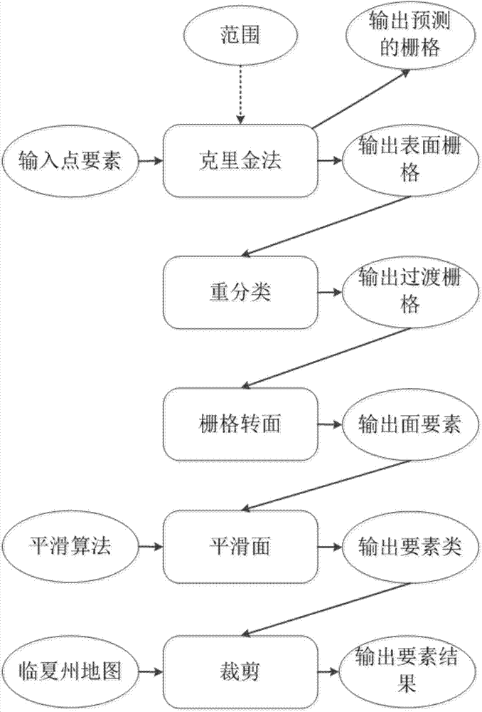
[0017] The online visualization analysis method for the thematic map of agricultural meteorological elements of the present invention mainly includes the following steps:

[0018] Step 1. Make the map base map of the thematic map of agricultural meteorological elements and publish the map service;

[0019] Step 2, establishing a geographic information processing model of meteorological elements and publishing a Geoprocessing (GP for short) service;

[0020] Step 3. Obtain the data of each meteorological station in the thematic map of agricultural meteorological elements;

[0021] Step 4, the Web front end calls the map service and the geoprocessing service to realize the visualization of the target data of the meteorological station.

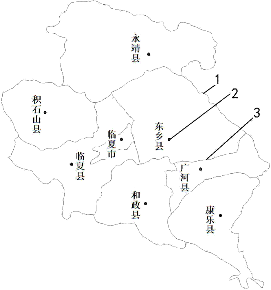
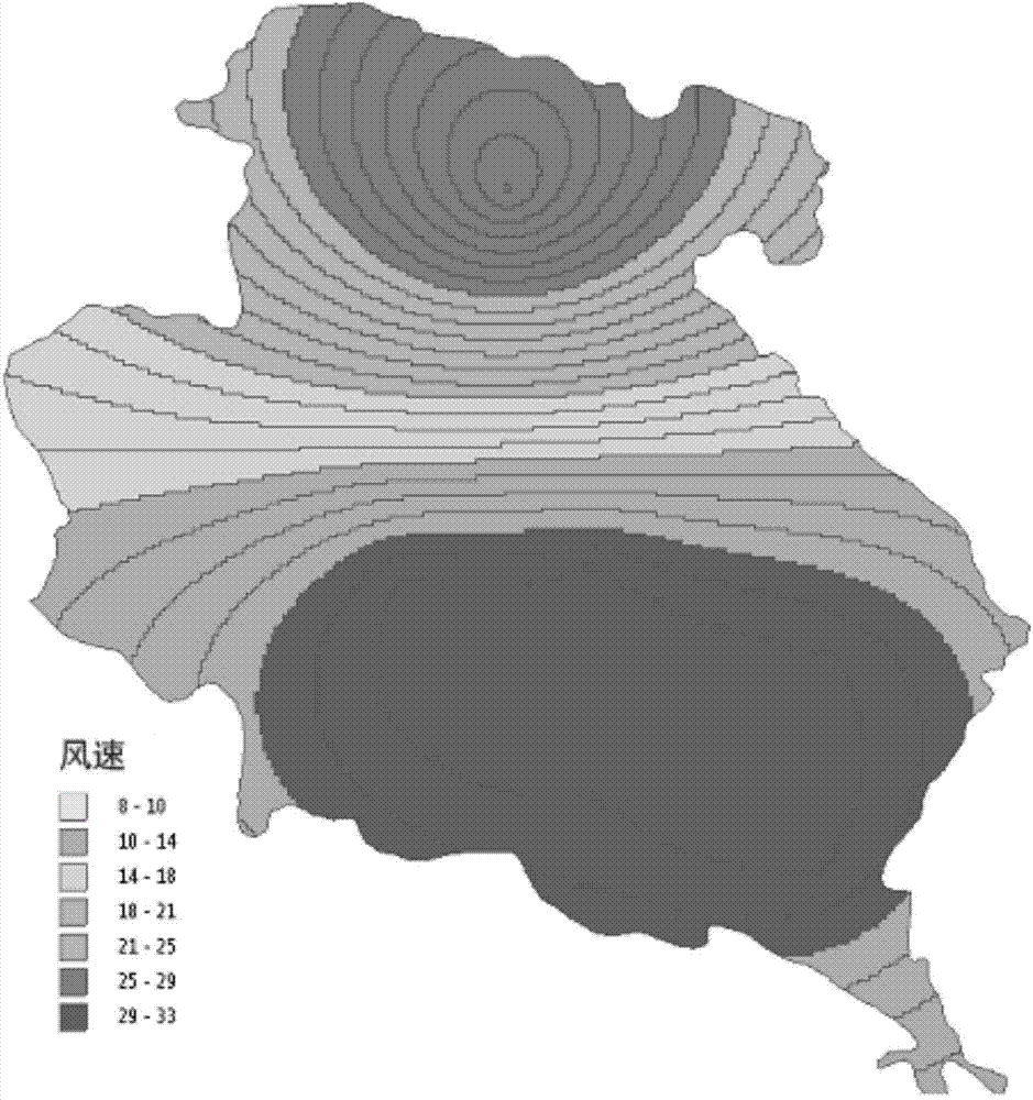
[0022] Taking Linxia Prefecture, Gansu Province as an example, the specific realization process will be di...


PUM


Abstract

The invention discloses an agricultural meteorological factor online spatial visualization analysis method. The method includes the following steps that: step 1, a base map of an agricultural meteorological factor thematic map is produced, and map services are distributed; step 2, a geographic information processing model of meteorological factors is established, and geoprocessing services are distributed; step 3, the data of each meteorological station in the agricultural meteorological factor thematic map are obtained; and step 4, a Web front-end calls the map services and the geoprocessing services, and the visualization of target data in the meteorological stations can be realized. With the agricultural meteorological factor online spatial visualization analysis method of the invention adopted, thematic map production in the agricultural meteorological monitoring and evaluation and agricultural meteorological disaster prediction and early warning field at present can be simplified; and references can be provided for data visualization analysis in other industries. The agricultural meteorological factor online spatial visualization analysis method has the advantages of high efficiency, convenience and high automation degree.

Description

technical field [0001] The invention belongs to the technical field of monitoring and evaluation of agricultural meteorological elements and disaster prediction, and analyzes based on the visualization of meteorological elements of ArcGIS Server, in particular to an analysis method for online spatial visualization of agricultural meteorological elements. Background technique [0002] Agricultural meteorological elements mainly include sunshine hours, temperature, relative humidity, precipitation, etc. Monitoring and evaluation is to make an objective analysis of these existing data, so as to predict and warn meteorological disasters, and finally ensure the orderly progress of agricultural production and avoid some losses caused by meteorological disasters. [0003] At present, most of the thematic maps of agricultural meteorological elements are drawn using relevant geographical analysis software, with the help of related development software under the stand-alone or C / S arc...

Claims


Application Information

Patent Timeline
IPC IPC(8): G06Q50/02G06F17/50
Inventor 缪亚林孟金涛强欣冀鑫肖倩张洁
Owner XIAN UNIV OF TECH
Why Eureka
Try Eureka