

A multi-scale simulation method for land use and traffic
A simulation method and multi-scale technology, applied in data processing applications, special data processing applications, instruments, etc., can solve problems such as difficulties in market economic models, and achieve the effect of improving accuracy
- Summary
- Abstract
- Description
- Claims
- Application Information
AI Technical Summary
Problems solved by technology
Method used
Image

Examples
Embodiment Construction
[0045] The embodiments of the present invention will be further described below in conjunction with the accompanying drawings and technical solutions.
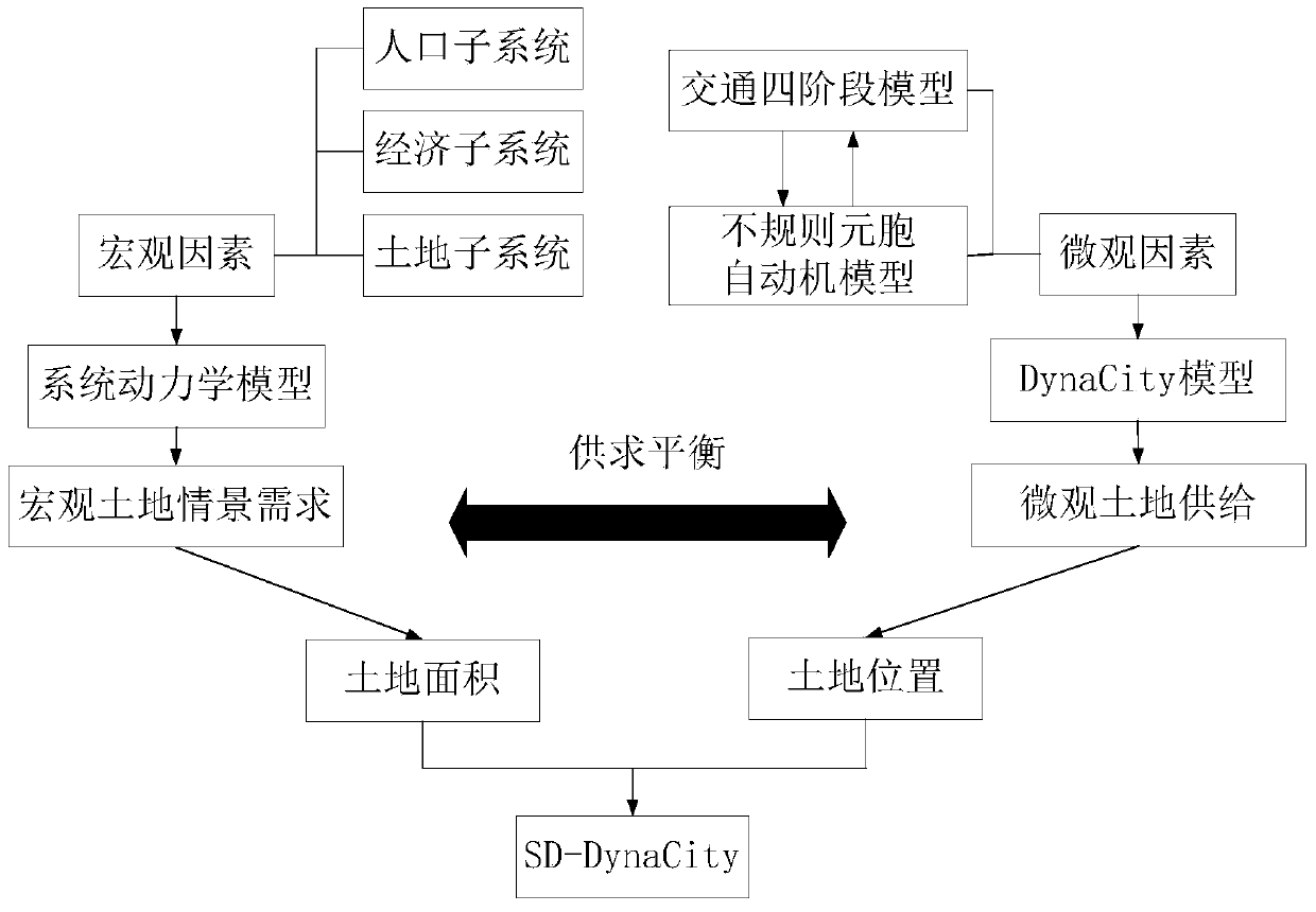
[0046] The present invention aims to provide a multi-scale model of land use and traffic to simulate changes in urban land and traffic, such as urban land evolution, traffic accessibility, road congestion, and the like.
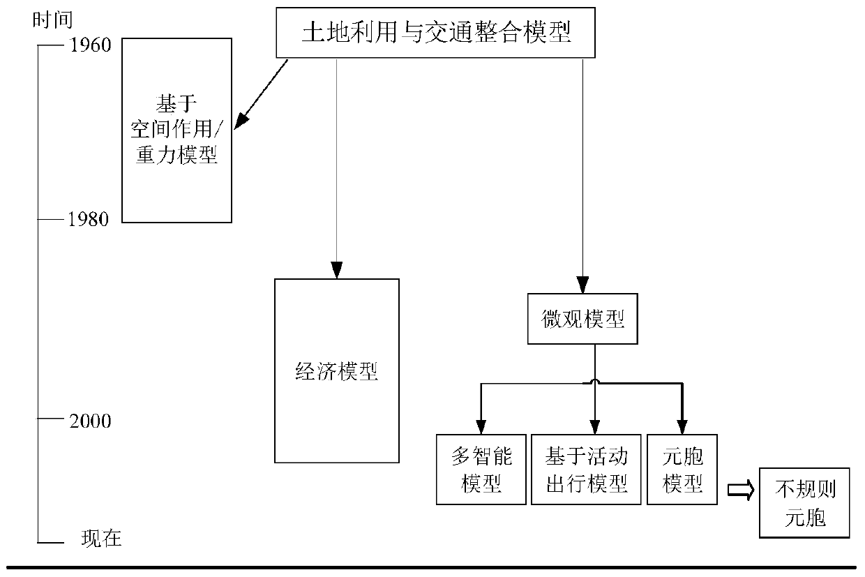
[0047] The invention is based on the theory of land use and traffic integration, system dynamics model theory, cellular automata model theory and scenario planning theory.
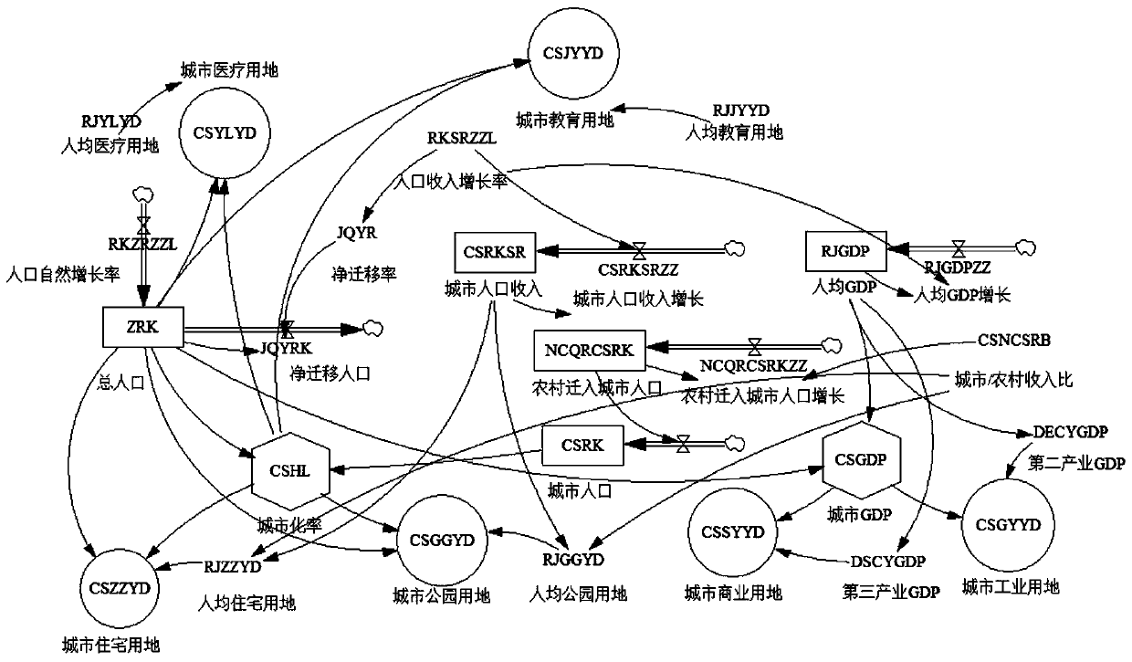
[0048] Step 1: Program setting. Firstly, the key variables are determined, which requires the analysis of three issues: 1. The scale of urban space expansion during the planning period (urban land demand); 2. The spatial form of urban land during the planning period (urban land allocation); 3. Planning During the period, urban traffic is in harmony with urban space. Determine the content of different simulation scenarios based on key va...
PUM
 Abstract
Description
Claims
Application Information