Small-sized unmanned aerial vehicle-mounted millimeter wave interference synthetic aperture mapping radar

A technology of interferometric synthetic aperture and surveying and mapping radar, which is applied in the direction of radio wave measurement system, radio wave reflection/re-radiation, and measuring devices, etc. It can solve the problems of inability to obtain height information, high price, heavy weight, etc., and improve the efficiency of surveying and mapping , easy to promote, light weight effect

Inactive Publication Date: 2015-10-21
SUZHOU TUSHI ELECTRONICS TECH CO LTD
View PDF4 Cites 3 Cited by
  • Summary
  • Abstract
  • Description
  • Claims
  • Application Information

AI Technical Summary

Problems solved by technology

Among them, the image obtained by the visible light mapping method has high resolution and low cost, but it can only obtain two-dimensional plane image information and cannot obtain height information, and it is seriously affected by the weather. It cannot work normally under cloudy or dark conditions; LiDAR can obtain 3D image information including height information, but it is also limited by the climate, and cannot work normally under cloudy, foggy, rainy weather conditions and strong light work, and its large size, heavy weight, high requirements for small UAV platforms, and expensive; small synthetic aperture radar is not affected by the climate, and can work normally all day and all day, but it can only obtain two-dimensional plane images information

Method used

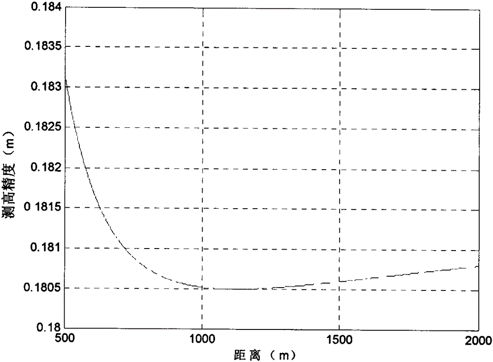
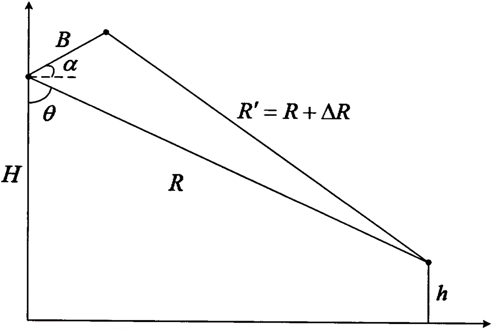

Image

  • Small-sized unmanned aerial vehicle-mounted millimeter wave interference synthetic aperture mapping radar
  • Small-sized unmanned aerial vehicle-mounted millimeter wave interference synthetic aperture mapping radar
  • Small-sized unmanned aerial vehicle-mounted millimeter wave interference synthetic aperture mapping radar

Examples


Embodiment Construction

[0023] The specific implementation manners of the present invention will be further described below in conjunction with the drawings and examples. The following examples are only used to illustrate the technical solution of the present invention more clearly, but not to limit the protection scope of the present invention.

[0024] The technical scheme of concrete implementation of the present invention is:

[0025] A small UAV-borne millimeter-wave interference synthetic aperture surveying and mapping radar, including the following modules: servo device, first antenna, second antenna, first radio frequency front end, second radio frequency front end, channel extension, main control device, integrated navigator , power supply unit;

[0026] The first antenna and the second antenna are carried by the servo device and move under the drive of the servo device;

[0027] The first radio frequency front end is fixed behind the first antenna, moves together with the first antenna, a...


PUM


Abstract

The invention discloses a small-sized unmanned aerial vehicle-mounted millimeter wave interference synthetic aperture mapping radar, including the following modules: a servo device, a first antenna, a second antenna, a first radio frequency front end, a second radio frequency front end, a channel extension, a master control device, a combined navigator and a power supply device. The small-sized unmanned aerial vehicle-mounted millimeter wave interference synthetic aperture mapping radar adopts single-transmitting double-receiving antennas, performs synthetic aperture imaging on mapping areas at the same time, and uses signals phases in two images to interfere, so as to obtain height dimension information, thereby obtaining a three-dimensional image.

Description

technical field [0001] The invention relates to a small unmanned aerial vehicle-borne millimeter-wave interference synthetic aperture surveying and mapping radar. Background technique [0002] With the rapid development of small UAV technology, the method of using small UAVs for surveying and mapping has gradually become an important method in the field of civil surveying and mapping. At present, the surveying and mapping methods used by small UAVs mainly include visible light, laser radar, and small synthetic aperture radar. Among them, the image obtained by the visible light mapping method has high resolution and low cost, but it can only obtain two-dimensional plane image information and cannot obtain height information, and it is seriously affected by the weather. It cannot work normally under cloudy or dark conditions; LiDAR can obtain 3D image information including height information, but it is also limited by the climate, and cannot work normally under cloudy, foggy,...

Claims


Application Information

Patent Timeline
Patent Type & Authority Applications(China)
IPC IPC(8): G01S13/90
CPCG01S13/9023
Inventor 孙英钦
Owner SUZHOU TUSHI ELECTRONICS TECH CO LTD
Why Eureka
Try Eureka