Survey station layout intelligent optimization method of spatial measurement positioning system

A space measurement positioning and intelligent optimization technology, which is applied in special data processing applications, instruments, electrical digital data processing, etc., can solve the problems of lack of adaptive survey station layout optimization methods, etc.

Active Publication Date: 2015-11-18
LINGYUN GROUP WUHAN
View PDF1 Cites 18 Cited by
  • Summary
  • Abstract
  • Description
  • Claims
  • Application Information

AI Technical Summary

Problems solved by technology

[0007] The technical problem to be solved by the present invention is to overcome the deficiencies of the prior art, aiming at the lack of a survey station layout optimization method with wider adaptability in engineering practice, and th

Method used


Image

  • Survey station layout intelligent optimization method of spatial measurement positioning system
  • Survey station layout intelligent optimization method of spatial measurement positioning system
  • Survey station layout intelligent optimization method of spatial measurement positioning system

Examples


Embodiment Construction

[0084] specific implementation plan
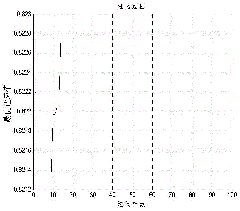
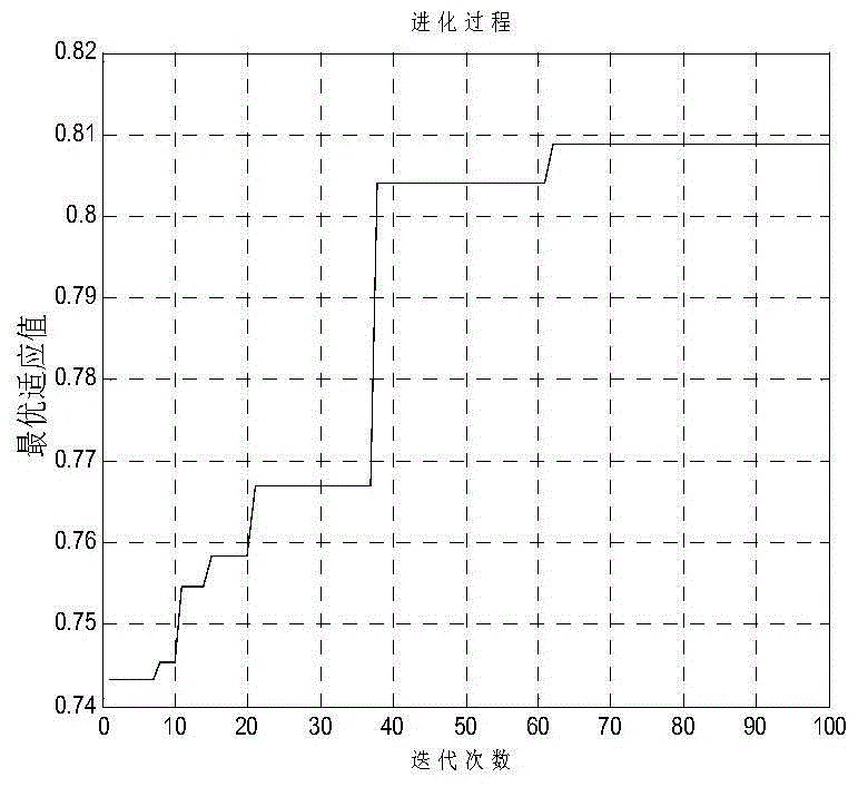
[0085] The core idea of ​​the present invention is to optimize the modeling of the station layout of the space measurement and positioning system and solve it based on the improved genetic algorithm. Therefore, the present invention establishes the mathematical function relationship between the positioning error of the station, the coverage area, and the cost of use, that is, the station The mathematical model of the layout optimization objective, considering the different dimensions of different models, uses the normalization method to transform the layout optimization problem of the spatial measurement and positioning system into a single-objective optimization problem, and finally uses the improved genetic algorithm for global optimization to obtain the optimal Excellent solution.

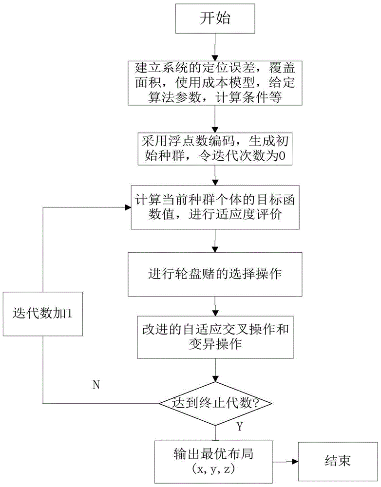
[0086] refer to figure 1 Algorithm flow chart, the present invention is based on the improved genetic algorithm's space measurement positioning system stat...


PUM


Abstract

A survey station optimization deployment problem is one of important problems in use of a spatial measurement positioning system. The present invention provides a survey station layout intelligent optimization method of a spatial measurement positioning system, so that an optimized survey station layout can fully cover a tested area under certain costs and a requirement of measurement accuracy can be met. According to the present invention, a proper positioning error model is established from three aspects of constraint analysis, optimization objective, and optimization means, a multi-goal optimizing function is defined, and survey station layout optimization of the spatial measurement positioning system is implemented by using a practical intelligent optimization algorithm. According to the survey station layout intelligent optimization method of a spatial measurement positioning system, a survey station network optimization deployment problem of the spatial measurement positioning system in an engineering application is effectively resolved. As a quantity of survey stations increases, the method has good expansibility, provides a new method for a multi-station networking measurement layout optimization problem based on an angle intersection principle, and has important theoretical value and practical significance.

Description

technical field [0001] The invention belongs to the technical field of large-scale three-dimensional coordinate measurement on industrial sites, and in particular relates to an intelligent optimal deployment method for a station of a multi-station network measurement system, and in particular to an intelligent optimization method for station layout of a space measurement and positioning system. Background technique [0002] In large-scale engineering measurement, the measured object not only has a large geometric size, but also requires high relative measurement accuracy (better than 10ppm), a large number of key points to be measured, multiple measurement tasks coexist, and is greatly affected by the external environment. Therefore, measurement methods and usage All measuring tools are unique. The network multi-station measurement system has great potential to balance the contradiction between measurement range, measurement accuracy and measurement efficiency, and provides ...

Claims


Application Information

Patent Timeline
IPC IPC(8): G06F17/50
Inventor 熊芝岳翀宋小春李冬林杨怀玉涂君
Owner LINGYUN GROUP WUHAN
Why Eureka
Try Eureka