High-resolution remote sensing image multi-scale self-adaptive decision fusion segmentation method

A multi-scale segmentation and high-resolution technology, applied in image analysis, image enhancement, image data processing, etc., can solve the problem of different optimal segmentation scales

Active Publication Date: 2016-02-17
INST OF REMOTE SENSING & DIGITAL EARTH CHINESE ACADEMY OF SCI
View PDF3 Cites 11 Cited by
  • Summary
  • Abstract
  • Description
  • Claims
  • Application Information

AI Technical Summary

Problems solved by technology

However, high-resolution remote sensing images have multi-scale characteristics, and the optimal segmentation scales for different ground objects are different. It is difficult to fully describe and characterize all the scale features of the ground objects in the real world by using a single scale

Method used


Image

  • High-resolution remote sensing image multi-scale self-adaptive decision fusion segmentation method
  • High-resolution remote sensing image multi-scale self-adaptive decision fusion segmentation method
  • High-resolution remote sensing image multi-scale self-adaptive decision fusion segmentation method

Examples


Embodiment Construction

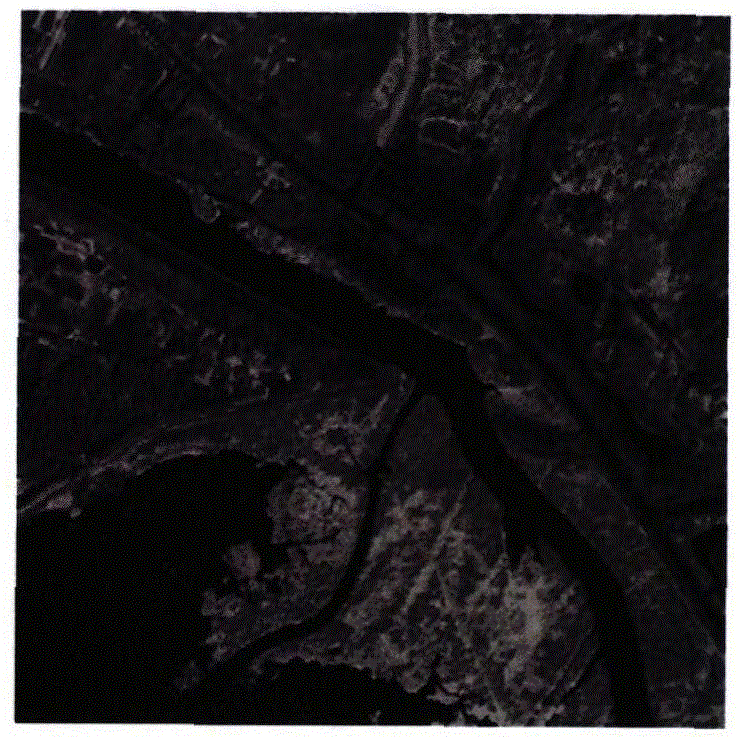
[0028] 1. attached figure 2 The QuickBird high-resolution remote sensing image used for multi-scale adaptive decision-making fusion segmentation has an image size of 400*400 pixels and a spatial resolution of 0.6 meters.

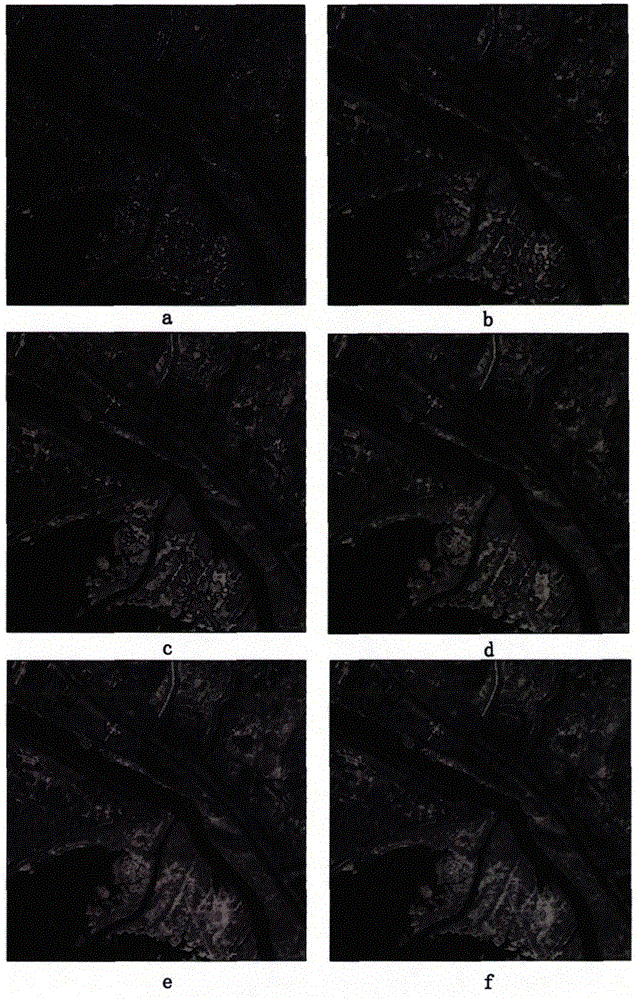
[0029] 2. Attachment figure 2 In the high-resolution remote sensing image, the fractal network evolution segmentation algorithm is used, and the multi-scale segmentation results obtained by setting a series of incremental scale segmentation parameters constitute the multi-scale segmentation model of the image. The segmentation parameters of the fractal network evolution segmentation algorithm include three parts: scale parameter, spectral weight coefficient and compactness weight coefficient. A series of incremental segmentation parameters, the scale parameter is set from 10 to 200, the scale increment interval is 10, there are 20 segmentation scales in total, the spectral weight of each scale is set to 0.9, and the compactness weight of each scale is set...


PUM


Abstract

The invention provides a high-resolution remote sensing image multi-scale self-adaptive decision fusion segmentation method. Firstly, a series of increasing scale parameters are set by applying a fractal network evolution segmentation algorithm so that a multi-scale segmentation sequence is obtained; secondly, regional multi-scale Moran's I index and critical segmentation scale and under-segmentation Moran's I index thresholds are defined; and finally under-segmentation of regions is judged one by one with the maximum segmentation scale acting as an initial critical scale, if the judgment result is yes, down-scaling is performed through recursion in turn till the minimum segmentation scale layer or the current layer without under-segmentation region with the first time of minimum scale of the multi-scale Moran's I index acting as a new critical scale, and finally a segmentation result is obtained through combination of spatial inheritance relationship between multi-scale segmentation layers. Multi-scale segmentation information is fused, the contradiction between over-segmentation and under-segmentation and easy segmentation and accuracy can be effectively reduced, and the method can be widely applied to the field of object-oriented project target recognition.

Description

technical field [0001] The invention is a practical multi-scale adaptive decision-making fusion segmentation method for high-resolution remote sensing images, and the method is suitable for segmentation of high-resolution remote sensing images such as GF-1, GF-2, WorldView, and QuickBird. The invention can be widely used in the fields of object-oriented thematic target recognition, land use classification and change detection, and the like. Background technique [0002] The launch of a large number of high-resolution remote sensing satellites has greatly improved the ability to obtain high-resolution satellite remote sensing data, and mankind has entered a new era of multi-source high-resolution earth observation data acquisition. With the improvement of the spatial resolution of satellite remote sensing images, the amount of data and information in the image is increasing, and the spatial structure and detailed information of the image are also richer. However, higher spat...

Claims


Application Information

Patent Timeline
Patent Type & Authority Applications(China)
IPC IPC(8): G06T7/00
CPCG06T2207/10032
Inventor 王桂周何国金刘建波张兆明王猛猛
Owner INST OF REMOTE SENSING & DIGITAL EARTH CHINESE ACADEMY OF SCI
Why Eureka
Try Eureka