Method and system for automatic cloud detection of multi-spectral remote sensing satellite images
A technology of remote sensing satellites and satellite images, applied in the field of surveying and mapping science, can solve problems such as low efficiency
- Summary
- Abstract
- Description
- Claims
- Application Information
AI Technical Summary
Problems solved by technology
Method used
Image
Examples
Embodiment Construction
[0079] The technical solution of the present invention will be described in detail below in conjunction with the embodiments and accompanying drawings.
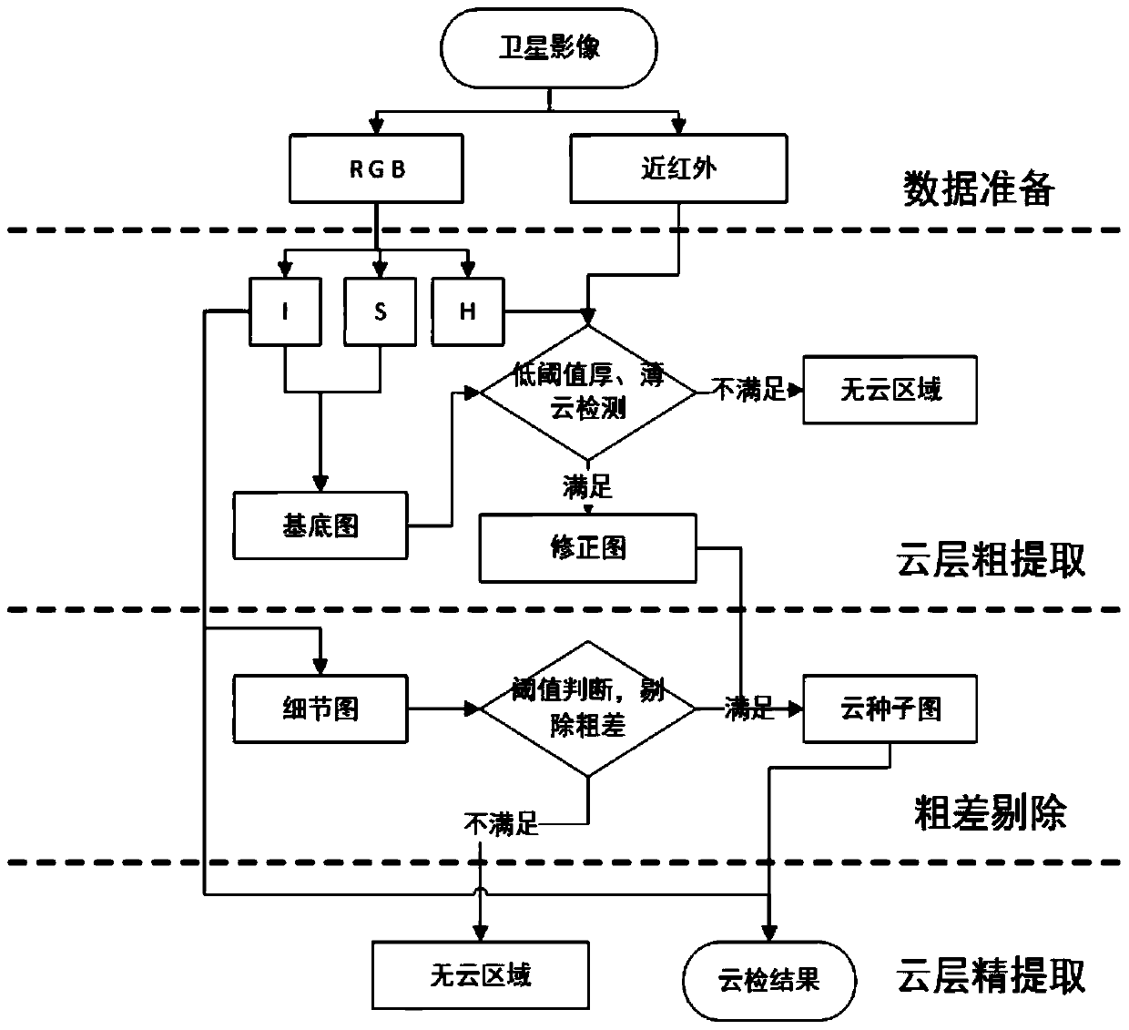
[0080] The present invention provides a fast, accurate and fully automatic automatic cloud detection method for multi-spectral remote sensing satellite images based on threshold segmentation and texture information. It mainly uses the spectrum and texture information of the image for cloud extraction, and firstly uses the spectral information for preliminary detection of cloud results. , and then use the texture information to eliminate the errors in the initial detection results, and finally use the spectral information to accurately detect the cloud layer. The input data are all kinds of high-resolution remote sensing satellite images that can provide data in red, green, blue, and near-infrared bands. see figure 1 The specific implementation method provided by the embodiment includes the following steps:
[0081] Step 1: ...
PUM
 Abstract
Description
Claims
Application Information
 - R&D
- Intellectual Property
- Life Sciences
- Materials
- Tech Scout
- Unparalleled Data Quality
- Higher Quality Content
- 60% Fewer Hallucinations
Browse by: Latest US Patents, China's latest patents, Technical Efficacy Thesaurus, Application Domain, Technology Topic, Popular Technical Reports.
© 2025 PatSnap. All rights reserved.Legal|Privacy policy|Modern Slavery Act Transparency Statement|Sitemap|About US| Contact US: help@patsnap.com


