

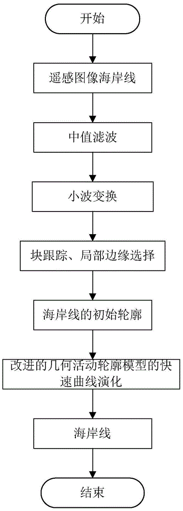
Geometric active contour model-based coastline detection method for remote sensing image
A geometric active contour, remote sensing image technology, applied in the field of image processing, can solve problems such as the coastline is not true, the coastline has a weak boundary, and the image is easily affected by noise, etc., to achieve complete coastline detection, solve weak boundary problems, and save time.
- Summary
- Abstract
- Description
- Claims
- Application Information
AI Technical Summary
Problems solved by technology
Method used
Image

Examples
Embodiment 1
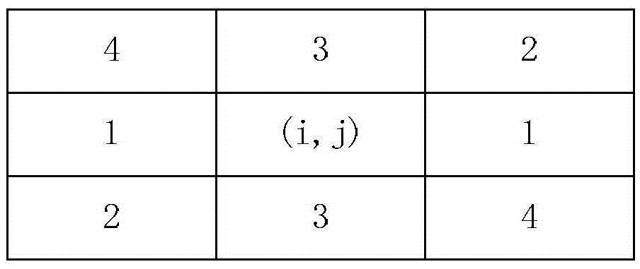
[0041] Embodiment 1: The image is segmented by the method of wavelet transform, and the present invention selects two-dimensional discrete stationary wavelet transform. In the process of finding the modulus maximum value, the area to which the argument belongs is different, and the neighborhood pixels selected for comparison are different. The four zones to which the argument belongs and their corresponding comparison directions are as follows: figure 2 As shown, the basis for quantizing the argument is as follows:
[0042] when When , it is considered as the horizontal direction and marked as zone 1; when When it is considered to be 45 degrees from the horizontal direction, it is marked as zone 2; when or When , it is considered to be perpendicular to the horizontal direction and marked as zone 3; when When it is considered to be negative 45 degrees from the horizontal, it is marked as Zone 4.
[0043] Select domain pixels according to the area of the argument t...
PUM
 Abstract
Description
Claims
Application Information