
Indoor and outdoor integrated high-precision positioning and navigation system as well as positioning method thereof

An indoor and outdoor positioning, positioning and navigation technology, which is applied in the indoor and outdoor integrated high-precision positioning and navigation system and its positioning field, can solve the problems of low accuracy, difficult to achieve accuracy for personnel and item positioning and navigation, etc.

Active Publication Date: 2016-04-27
ZHENGZHOU LOCARIS ELECTRONICS TECH CO LTD
View PDF5 Cites 74 Cited by
  • Summary
  • Abstract
  • Description
  • Claims
  • Application Information

AI Technical Summary

Problems solved by technology

[0006] The invention provides an indoor and outdoor integrated high-precision positioning and navigation system and its positioning method. It adopts a joint positioning method based on ultra-broadband indoor positioning and outdoor satellite positioning based on ranging mode, and adopts an intelligent switching mechanism to solve the current problems. The positioning and navigation of people and objects in a large area is difficult to achieve and the accuracy is not high. Using the ranging mode can avoid positioning deviation caused by large signal interference and mutual interference between signals

Method used


Image

  • Indoor and outdoor integrated high-precision positioning and navigation system as well as positioning method thereof
  • Indoor and outdoor integrated high-precision positioning and navigation system as well as positioning method thereof
  • Indoor and outdoor integrated high-precision positioning and navigation system as well as positioning method thereof

Examples


Embodiment Construction

[0061] Describe the present invention in detail below in conjunction with accompanying drawing and specific embodiment, but protection scope of the present invention is not limited thereto:

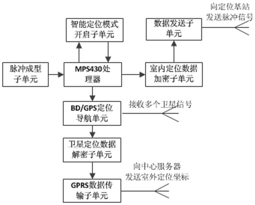
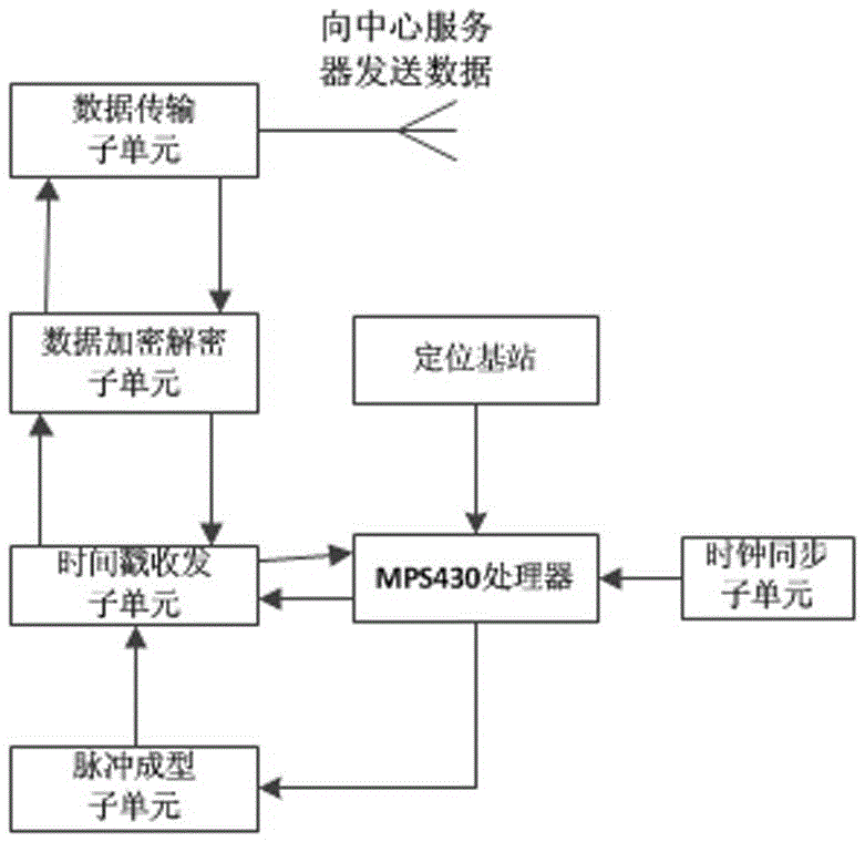
[0062] Such as figure 1 As shown, an indoor and outdoor integrated high-precision positioning and navigation system, the system includes a map data construction unit, an indoor ultra-wideband positioning and navigation unit, an outdoor BD / GPS positioning and navigation unit, an indoor and outdoor positioning data fusion unit, a central server unit and a terminal Display unit;

[0063] The map data construction unit is used to realize the construction of map data by loading an outdoor electronic map and constructing an indoor three-dimensional map scene by using three-dimensional modeling. The method of constructing the indoor map is to use 3D laser scanning, oblique photography and other methods to scan the data in the early stage, and use the 3DMAX platform to construct the data. First,...


PUM


Abstract

The invention relates to the technical field of wireless communication networks, in particular to an indoor and outdoor integrated high-precision positioning and navigation system as well as a positioning method thereof. The system comprises a map data construction unit, an indoor ultra-wideband positioning and navigation unit, an outdoor BD / GPS positioning and navigation unit, an indoor and outdoor positioning data fusion unit, a central server unit and a terminal display unit, wherein the indoor ultra-wideband positioning and navigation unit is used for performing indoor space positioning in a ranging mode, the outdoor BD / GPS positioning and navigation unit is used for performing outdoor space positioning through a Beidou satellite navigation / GPS satellite navigation system, the indoor and outdoor positioning data fusion unit is used for judging whether a positioning label is indoor or outdoor and can intelligently switch positioning modes according to the judgment result and fuse indoor and outdoor positioning manners. Problems that positioning and navigation of personnel and objects in a large-range area are difficult to realize, not high in precision and the like at present are solved, and large signal interference and positioning deviation caused by mutual interference among signals can be avoided in the ranging mode.

Description

technical field [0001] The invention relates to the technical field of wireless communication networks, in particular to an indoor and outdoor integrated high-precision positioning and navigation system and a positioning method thereof. Background technique [0002] With the continuous development of wireless communication network technology, the application software for the location information management of personnel and objects has been initially applied in the fields of personnel positioning and navigation, cargo calibration and tracking, etc., but indoor and outdoor integrated positioning and navigation systems are basically It is still in the blank stage. Due to the current low indoor positioning accuracy and poor multi-system integration, the application of indoor and outdoor integrated positioning and navigation systems cannot be widely promoted. The existing multiple positioning and navigation systems also have the following disadvantages: [0003] (1) The accuracy...

Claims


Application Information

Patent Timeline
Patent Type & Authority Applications(China)
IPC IPC(8): G01C21/20G01S19/48G01S19/33
CPCG01C21/206G01S19/33G01S19/48
Inventor 郧刚李冀肖岩袁子伦何雪锋刘清丽屈亚锋
Owner ZHENGZHOU LOCARIS ELECTRONICS TECH CO LTD
Learn More