
Undulating ground surface waveform inversion method based on auxiliary coordinate system
A waveform inversion and undulating surface technology, applied in the field of petroleum geophysical exploration, can solve problems such as the inability to completely eliminate distortion and the difficulty of accurate calculation of static corrections.
- Summary
- Abstract
- Description
- Claims
- Application Information
AI Technical Summary
Problems solved by technology
Method used
Image

Examples
Embodiment Construction
[0073] Below in conjunction with accompanying drawing and specific embodiment the present invention is described in further detail:
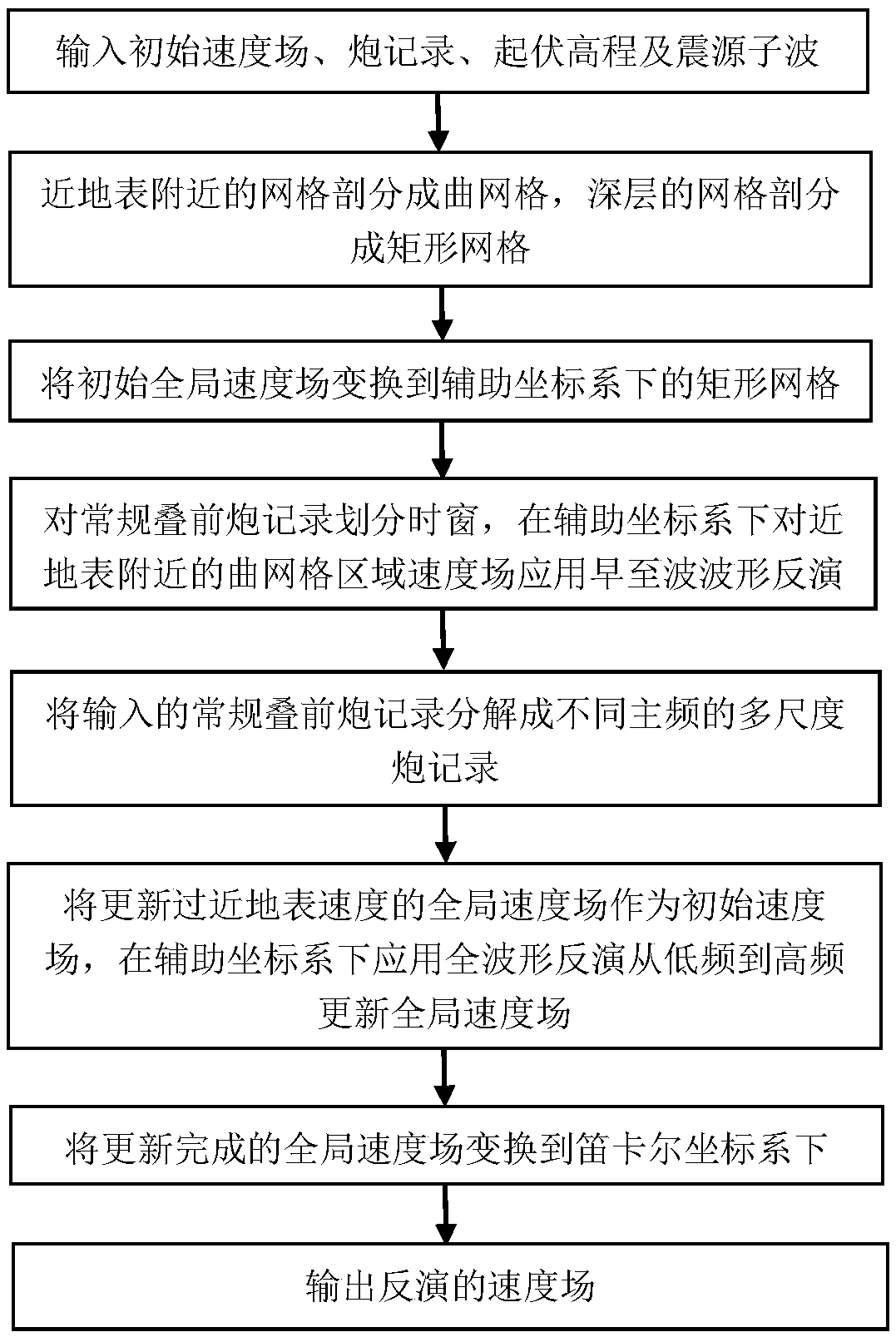
[0074] A flow chart of a method for inversion of undulating surface waveforms based on an auxiliary coordinate system (such as figure 1 shown), including the following steps:
[0075] Input the initial global velocity field, conventional pre-stack shot records, fluctuation elevation and source wavelet, and establish an observation system;
[0076] Grid division is performed according to the initial global velocity field and fluctuation elevation, the grid near the surface is divided into curved grids, and the deep grid is divided into rectangular grids;
[0077] Transform the initial global velocity field to a rectangular grid in the auxiliary coordinate system;
[0078] Divide the time window for conventional pre-stack shot records, apply early-arrival wave waveform inversion to the velocity field of the curved grid area near the surface in t...
PUM
 Abstract
Description
Claims
Application Information