Intelligent method and intelligent integrated system for village-town area land use planning
A land and planning technology, applied in data processing applications, instruments, calculations, etc., can solve problems such as impact accuracy and incomparability of driving factors
- Summary
- Abstract
- Description
- Claims
- Application Information
AI Technical Summary
Problems solved by technology
Method used
Image
Examples
Embodiment Construction
[0074] Below in conjunction with accompanying drawing, further describe the present invention through embodiment, but do not limit the scope of the present invention in any way.
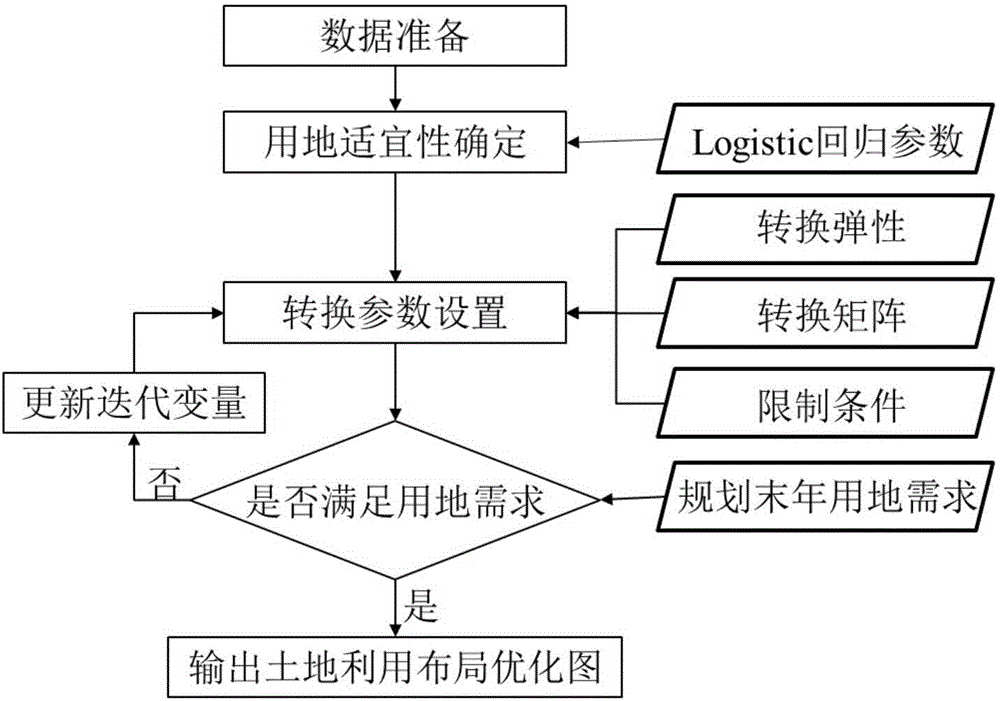
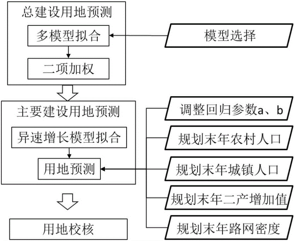
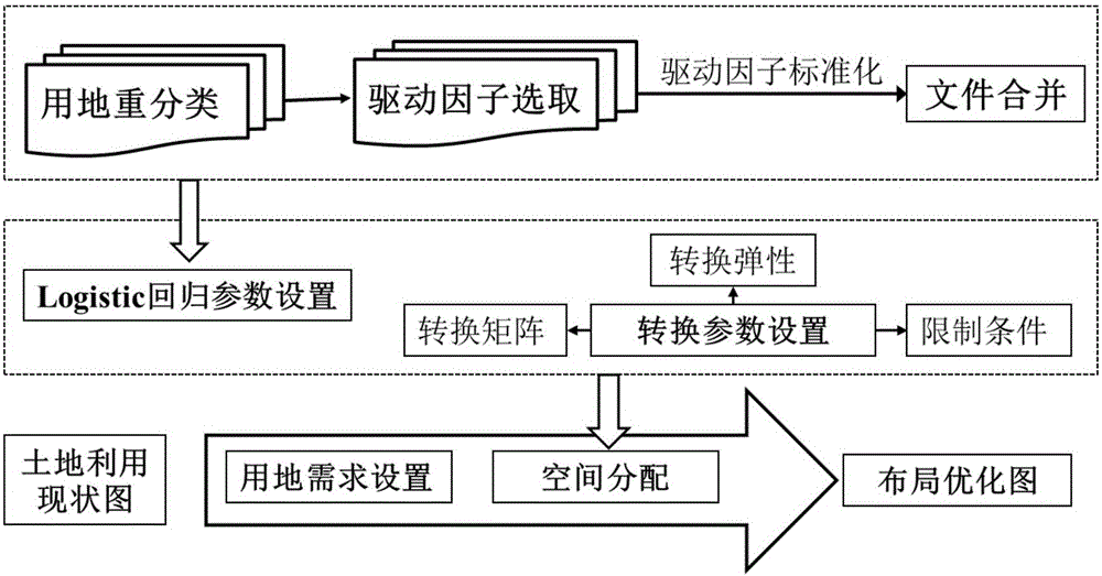
[0075]The invention provides an intelligent method for land use planning in villages and towns. By combining multiple methods, the purpose of improving the results of land use space layout optimization is achieved. In the present invention, on the basis of using linear model, exponential model, parabolic model and gray forecasting model to predict the total construction land, combined with the prediction result of the main construction land area by the allometric growth model, the final prediction of the construction land is determined As a result, the prediction result is used as the land use demand condition in the optimized CLUE-S model to realize the optimization of land use spatial layout under the reasonable prediction of construction land. Land types in land use planning generally include fore...
PUM
 Abstract
Description
Claims
Application Information
 - R&D
- Intellectual Property
- Life Sciences
- Materials
- Tech Scout
- Unparalleled Data Quality
- Higher Quality Content
- 60% Fewer Hallucinations
Browse by: Latest US Patents, China's latest patents, Technical Efficacy Thesaurus, Application Domain, Technology Topic, Popular Technical Reports.
© 2025 PatSnap. All rights reserved.Legal|Privacy policy|Modern Slavery Act Transparency Statement|Sitemap|About US| Contact US: help@patsnap.com


