Infrared image sea-sky-line detection algorithm based on line gradient accumulation
A sea-antenna detection and infrared image technology, which is applied in image enhancement, image analysis, image data processing, etc., can solve the problems of low signal-to-noise ratio and multi-interference, and unsatisfactory effects
- Summary
- Abstract
- Description
- Claims
- Application Information
AI Technical Summary
Problems solved by technology
Method used
Image
Examples
Embodiment Construction
[0065] The present invention will be further described below in conjunction with the accompanying drawings and specific embodiments.
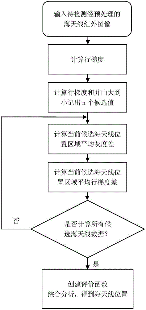
[0066] ① Input the preprocessed sea antenna infrared image to be detected;
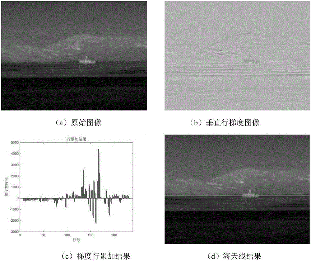
[0067] ② Calculate the row gradient;
[0068] ③ Calculate the line gradient sum, and select several peaks from them, and record the number of lines where they are located, as the candidate position of the sea antenna;
[0069] ④ Select the position of the candidate sea antenna in turn, and calculate the difference between the average gray value and the average line gradient of the area above and below the candidate sea antenna;
[0070] ⑤ Create an evaluation function, synthesize the known data, and obtain the position of the sea antenna through comprehensive evaluation;
[0071] ⑥ Output the sea antenna position information to the original image.
[0072] In the present invention, the specific process of step ② is: read in the infrared image preprocessed by ①, and ...
PUM
 Abstract
Description
Claims
Application Information
 - R&D
- Intellectual Property
- Life Sciences
- Materials
- Tech Scout
- Unparalleled Data Quality
- Higher Quality Content
- 60% Fewer Hallucinations
Browse by: Latest US Patents, China's latest patents, Technical Efficacy Thesaurus, Application Domain, Technology Topic, Popular Technical Reports.
© 2025 PatSnap. All rights reserved.Legal|Privacy policy|Modern Slavery Act Transparency Statement|Sitemap|About US| Contact US: help@patsnap.com


