Insar high-precision and high-resolution dem acquisition method combined with external control points
A high-resolution, acquisition method technology, applied in the field of high-resolution and high-precision DEM, to achieve the effects of low cost, high resolution and large monitoring range
- Summary
- Abstract
- Description
- Claims
- Application Information
AI Technical Summary
Problems solved by technology
Method used
Image
Examples
Embodiment Construction
[0056] The present invention will be further described below in conjunction with the accompanying drawings and embodiments.
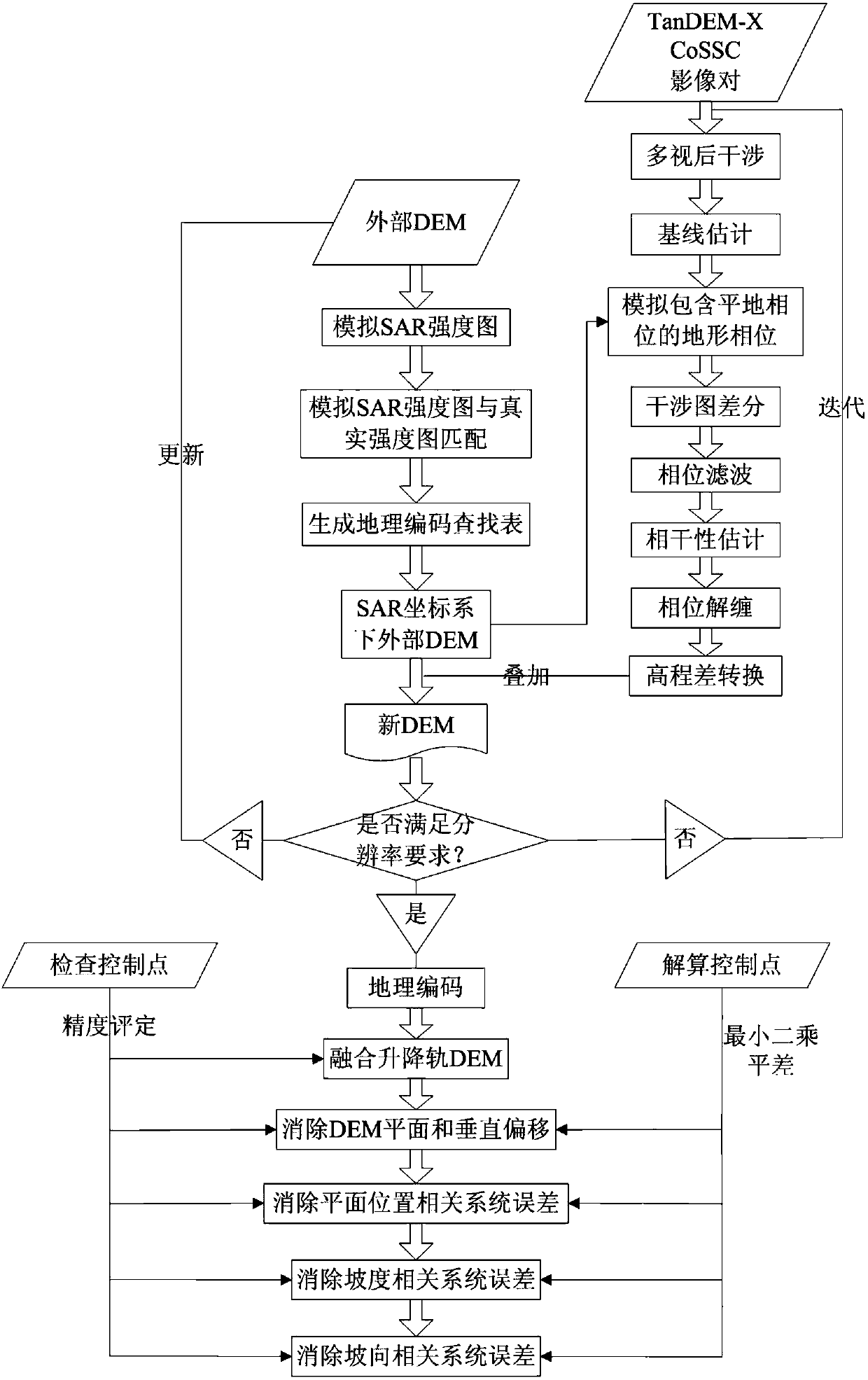
[0057] An InSAR high-precision and high-resolution DEM acquisition method combined with external control points, the external control points are external control points, such as figure 1 shown, including:
[0058] Step 1. Process the single-track image pair through bi-base InSAR differential interferometry to obtain the single-track DEM;
[0059] Step 1.1, customize the image pair according to the coordinate range of the DEM demand area, the image pair includes the main image and the auxiliary image;
[0060] Step 1.2, multiply the main image and the auxiliary image conjugate to generate an initial interferogram;
[0061] Step 1.3, estimate the baseline from the orbital data, and simulate the topographic phase map including the flat-Earth phase from the external DEM according to the baseline;
[0062] Step 1.4, subtracting the topographic phase map f...
PUM
 Abstract
Description
Claims
Application Information
 - R&D
- Intellectual Property
- Life Sciences
- Materials
- Tech Scout
- Unparalleled Data Quality
- Higher Quality Content
- 60% Fewer Hallucinations
Browse by: Latest US Patents, China's latest patents, Technical Efficacy Thesaurus, Application Domain, Technology Topic, Popular Technical Reports.
© 2025 PatSnap. All rights reserved.Legal|Privacy policy|Modern Slavery Act Transparency Statement|Sitemap|About US| Contact US: help@patsnap.com


