Multichannel measurement information configuration method based on space grid data alignment
A technology of information configuration and grid data, applied in radio wave measurement systems, instruments, etc., can solve problems such as spatial vertical and horizontal mismatch, reduce calculation amount, etc., achieve high detection performance, reduce calculation amount, and reduce calculation cost.
- Summary
- Abstract
- Description
- Claims
- Application Information
AI Technical Summary
Problems solved by technology
Method used
Image

Examples
Embodiment Construction
[0037] In order to facilitate those skilled in the art to understand the technical content of the present invention, the content of the present invention will be further explained below in conjunction with the accompanying drawings.
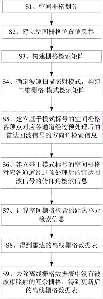
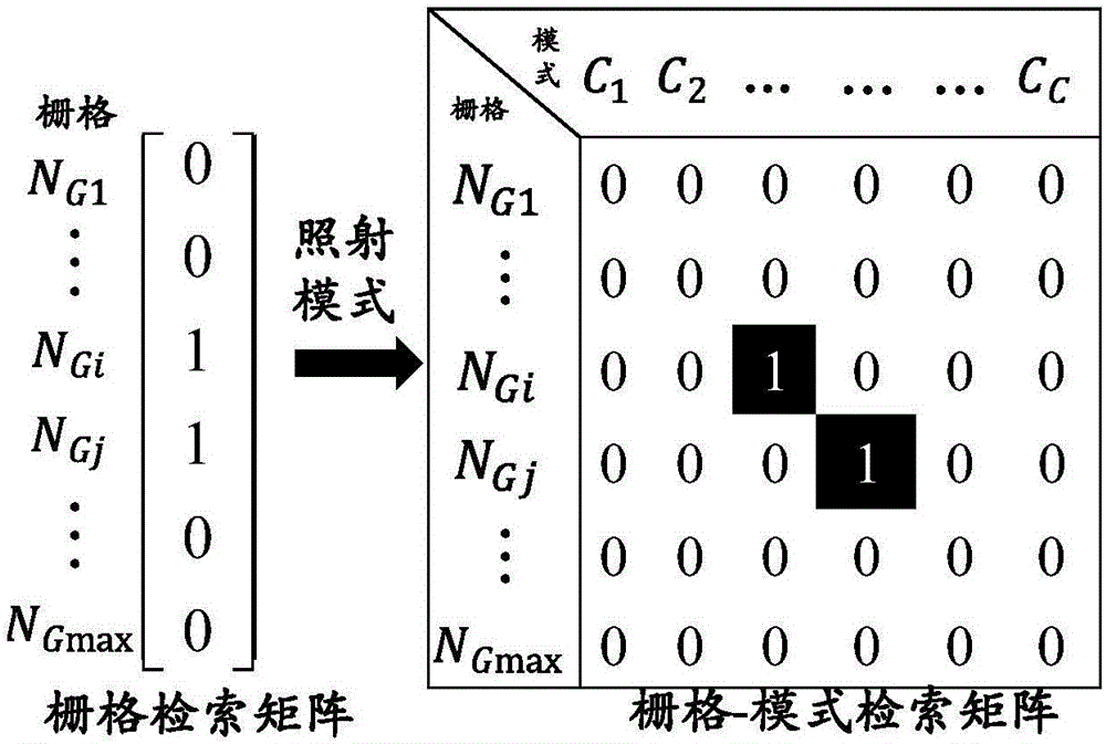
[0038] Such as figure 1 As shown, the solution of the present invention is: a multi-channel measurement information configuration method based on spatial raster data alignment, including:
[0039] S1. Carry out spatial grid division to the space monitoring area, and evenly divide the space monitoring area into longitude, latitude, and height respectively with a total G of the size of ΔLo×ΔLa×ΔH max A rectangular spatial grid, that is, the longitude of each spatial grid is ΔLo, the latitude is ΔLa, and the height is ΔH, and each spatial grid is numbered N G1 ,N G2 ,...,N Gmax .
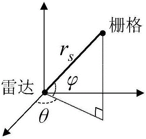
[0040] S2. Determine the azimuth θ and elevation angle of each radar corresponding to each spatial grid center point and the distance r s information, and according ...
PUM
 Abstract
Description
Claims
Application Information
 - Generate Ideas
- Intellectual Property
- Life Sciences
- Materials
- Tech Scout
- Unparalleled Data Quality
- Higher Quality Content
- 60% Fewer Hallucinations
Browse by: Latest US Patents, China's latest patents, Technical Efficacy Thesaurus, Application Domain, Technology Topic, Popular Technical Reports.
© 2025 PatSnap. All rights reserved.Legal|Privacy policy|Modern Slavery Act Transparency Statement|Sitemap|About US| Contact US: help@patsnap.com