
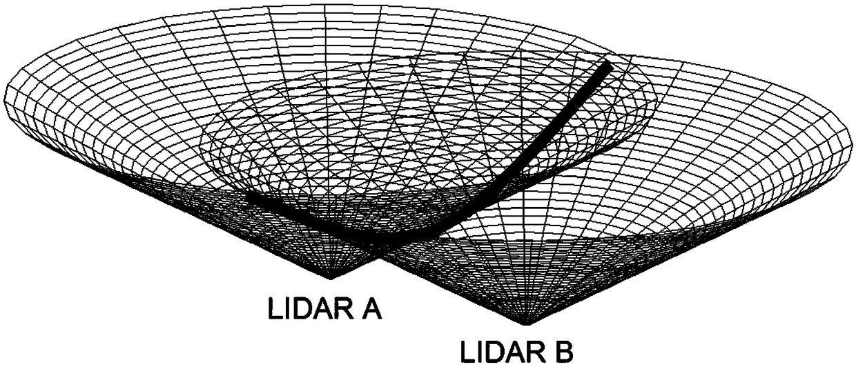
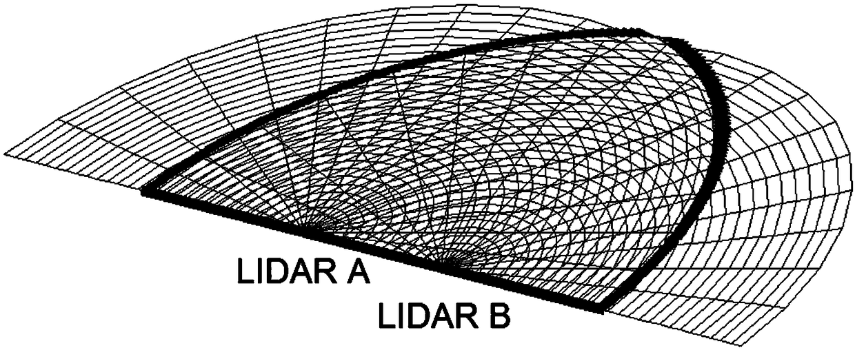
Oblique Plane Scanning Method Based on Two Wind LiDARs

A wind-measuring lidar and lidar technology, which is used in measurement devices, fluid velocity measurement, and re-radiation of electromagnetic waves, can solve problems such as the mismatch of scanning data spaces, and achieve simple principles, improved measurement accuracy, and easy operation. Effect

Inactive Publication Date: 2018-12-25
OCEAN UNIV OF CHINA
View PDF7 Cites 0 Cited by
  • Summary
  • Abstract
  • Description
  • Claims
  • Application Information

AI Technical Summary

Problems solved by technology

[0004] The purpose of the present invention is to provide a method for scanning inclined planes based on two wind-measuring laser radars, to overcome the deficiencies in the prior art, especially to eliminate the problem of spatial mismatch of the scanning data of the two laser radars

Method used


Image

  • Oblique Plane Scanning Method Based on Two Wind LiDARs
  • Oblique Plane Scanning Method Based on Two Wind LiDARs

Examples


Embodiment Construction

[0029] The inclined plane scanning method based on two wind-measuring lidars is characterized in that comprising the following steps:

[0030] 1. First level the datum planes of the two lidars, and use the coordinates of one of the lidars as the origin A(0,0,0) to establish a three-dimensional rectangular coordinate system, where the east direction is the positive direction of the x-axis and the north direction is the positive direction of the y-axis, and vertically upward is the positive direction of the z-axis;

[0031] 2. Calculate the relative coordinates of the second laser radar and the target point according to the position A(0,0,0) of the first laser radar: B(x1,y1,z1), C(x2,y2,z2);

[0032] 3. Calculate the unit normal vector p(u,v,w) of the plane where the three points A, B, and C of the space are located;

[0033] 4. Calculate the attitude variables of the two laser radars according to the unit normal vector p (u, v, w) and Euler's formula. The attitude variables i...


PUM


Abstract

The invention relates to an inclination plane scanning method based on two wind-measurement laser radars, which comprises the steps of calculating the coordinates of wind-measurement laser radars A, B and a target point C, and thus acquiring a unit normal vector p(u, v, w) of a plane in which the three points A, B, C are located; calculating attitude variables of the two wind-measurement laser radars according to the vector p and a Euler formula, wherein the attitude variables comprise a rolling angle, an azimuth angle and a pitch angle; thus adjusting the attitude of the two laser radars according to the three acquired attitude variables with the sequence being the rolling angle, the azimuth angle and the pitch angle; synchronizing the system time of the two wind-measurement laser radars, and setting a pitch angle, a scanning range and a scanning speed of a scanning rotating mirror; and enabling the two laser radars to operate simultaneously and perform wind speed measurement. The inclination plane scanning method a problem of data space mismatch of a traditional scanning method under the premise of not changing a hardware structure of a wind-measurement laser radar system, is simple to operate and easy to implement, truly gives play to advantages of the two wind-measurement laser radars in measurement for the wind speed and the wind direction, and thus improves the measurement accuracy.

Description

technical field [0001] The invention belongs to the technical field of laser radars, in particular to an inclined plane scanning method based on two wind measuring laser radars. Background technique [0002] When Doppler lidar measures atmospheric wind speed and direction, it characterizes the overall movement of particles (atmospheric molecules or aerosols) in the atmosphere according to the principle of Doppler frequency shift, that is, Doppler frequency shift. Doppler lidar measures the radial wind speed V LOS , that is, the projected component in the direction of the laser. When calculating the actual atmospheric wind speed and wind direction, it is necessary to assume that the atmospheric wind field is locally uniform or linearly changed for inversion. If dual-Doppler lidar is used, the wind speed and direction can be obtained by measuring the radial wind speed components in different directions at the same location without assumptions. However, when performing two la...

Claims


Application Information

Patent Timeline
Patent Type & Authority Patents(China)
IPC IPC(8): G01P5/26G01P13/00G01S17/95
CPCG01P5/26G01P13/0006G01S17/95Y02A90/10
Inventor 刘秉义冯长中吴松华
Owner OCEAN UNIV OF CHINA
Learn More