Method and apparatus for obtaining POIs along way, database, navigation terminal and car
A database, along the way technology, applied in the field of geographic information, can solve problems such as single route planning, inconvenience for users to travel, and inability to display information around the route according to user preferences, so as to improve efficiency and safety.
- Summary
- Abstract
- Description
- Claims
- Application Information
AI Technical Summary
Problems solved by technology
Method used
Image

Examples
Embodiment 1
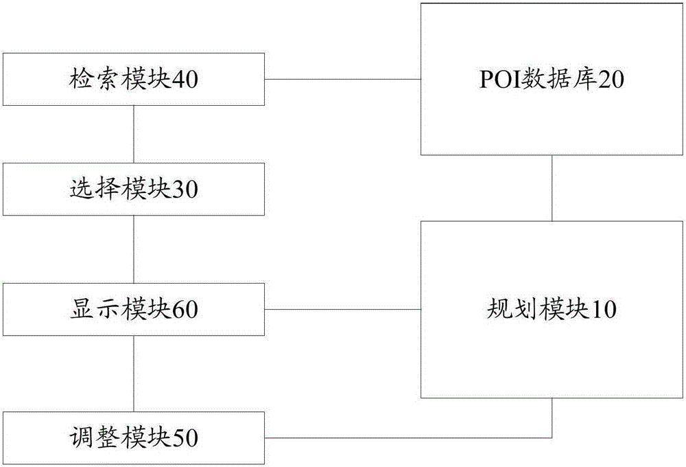
[0073] Corresponding to the above method embodiments, this embodiment proposes a device for obtaining POIs along the planned route, such as image 3 As shown, the device includes the following structural components:
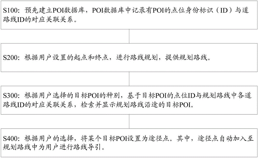
[0074] 1) The POI database 20 is used to record the data information of POIs and the corresponding relationship between point IDs of POIs and road line IDs.
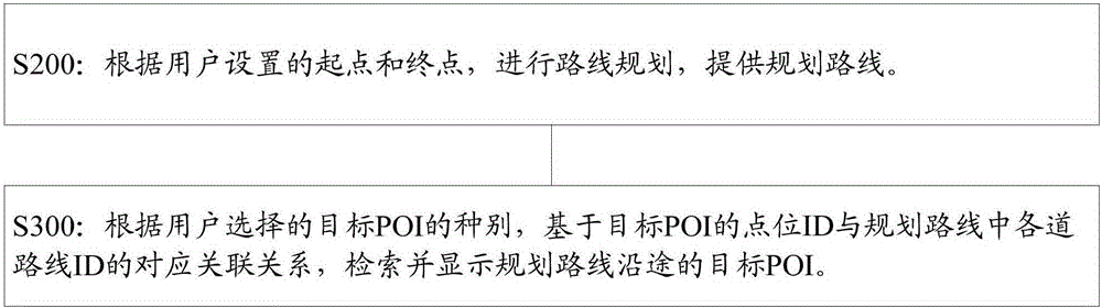
[0075] 2) The planning module 10 is configured to perform route planning and provide a planned route according to the starting point and end point set by the user.
[0076] 3) A selection module 30, used for the user to select a target POI of interest.
[0077] 4) The retrieval module 40 is used to retrieve the target POIs along the planned route based on the type of the target POI selected by the user and based on the corresponding relationship between the point ID of the target POI and each road route ID in the planned route.
[0078] 5) A display module 60, connected to the planning module 10 and the s...
Embodiment 2
[0085] In order to implement the above method, this embodiment proposes a POI database, the POI database includes: a processing module, a configuration module, an association module, a storage module and an update module, wherein:
[0086] The processing module is used to compile and process the collected POI raw data, the configuration module is used to classify and name the processed POI data, and configure point IDs for them, and the association module is used to link POI point IDs and Corresponding relationship is established between the road line ID associated with it, the storage module is used to store POI data and the point ID of POI and the road line ID and the corresponding relationship is established, and the update module is used to regularly update the POI database. The data of the POI, and the corresponding relationship between the point ID of the POI and the associated road line ID.
Embodiment 3
[0088] An embodiment of the present invention also provides a navigation terminal, which is provided with any one of the above-mentioned devices for acquiring POIs along a planned route.
[0089] Since any of the above-mentioned intelligent navigation terminals has the above-mentioned technical effects, the intelligent navigation terminal equipped with the device for obtaining POIs along the planned route should also have corresponding technical effects, and its specific implementation process is similar to the above-mentioned embodiments, hereby I won't go into details.
PUM
 Abstract
Description
Claims
Application Information
 - R&D
- Intellectual Property
- Life Sciences
- Materials
- Tech Scout
- Unparalleled Data Quality
- Higher Quality Content
- 60% Fewer Hallucinations
Browse by: Latest US Patents, China's latest patents, Technical Efficacy Thesaurus, Application Domain, Technology Topic, Popular Technical Reports.
© 2025 PatSnap. All rights reserved.Legal|Privacy policy|Modern Slavery Act Transparency Statement|Sitemap|About US| Contact US: help@patsnap.com