
Method and device for slicing three-dimensional simulation map

A technology of 3D simulation and image cutting, which is applied in image data processing, geographic information database, structured data retrieval, etc. It can solve the problems that the data does not have a geographic coordinate reference system and the steps are cumbersome, and achieve a simple registration process and convenient combination , The effect of high cutting efficiency

Active Publication Date: 2017-05-03
GUANGZHOU YIDONG NETWORK TECH
View PDF3 Cites 8 Cited by
  • Summary
  • Abstract
  • Description
  • Claims
  • Application Information

AI Technical Summary

Problems solved by technology

The current 3D simulation map slice processing image cutting technology, the data obtained in this way does not have a geographic coordinate reference system, and the steps are cumbersome

Method used


Image

  • Method and device for slicing three-dimensional simulation map

Examples


Embodiment Construction

[0043] Below, in conjunction with accompanying drawing and specific embodiment, the present invention is described further:

[0044] The present invention provides a method for cutting a three-dimensional simulation map, and first explains the professional terms:

[0045] Three-dimensional simulation map: also known as 2.5-dimensional electronic map, three-dimensional electronic map or 2.5D electronic map, it is a three-dimensional and abstract description of one or more aspects of the real world or a part of it according to a certain proportion based on the three-dimensional electronic map database . The network 3D electronic map not only provides users with map retrieval functions such as map query and travel navigation through the intuitive representation of geographical real scene simulation, but also integrates a series of services such as life information, e-government, e-commerce, virtual community, and travel navigation.

[0046] Map caching: It is a technology that r...


PUM


Abstract

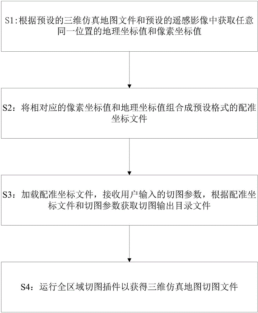
The invention discloses a method and a device for slicing a three-dimensional simulation map. The method comprises the steps of obtaining a geographical coordinate value and a pixel coordinate value of any same position according to a preset three-dimensional simulation map file and a preset remote-sensing image; combining corresponding pixel coordinate values and geographical coordinate values into a registration coordinate file with a preset format; loading the registration coordinate file, receiving slicing parameters input by a user, and obtaining a sliced map and outputting a catalogue file according to the registration coordinate file and the slicing parameters; and running a whole area slicing plug-in to obtain a three-dimensional simulation map sliced file. The method and the device disclosed by the invention can be convenient for the three-dimensional simulation map to combine with a geographical coordinate system, and a registration process is simple; and meanwhile, the three-dimensional simulation map is enabled to generate a map cache; and thus, the slicing efficiency is high.

Description

technical field [0001] The invention relates to the technical field of map updating, in particular to a method and device for cutting a three-dimensional simulation map. Background technique [0002] With the continuous strengthening of the construction of "smart cities" and digital geospatial frameworks, the demand for 3D simulation maps has also continued to increase, and 3D simulation maps have also been widely used. Cutting and processing 3D simulation maps to realize 3D simulation maps The map cache enables the 3D simulation map to be published on the Internet, which enables the 3D simulation map to be further developed and more widely used. [0003] At present, there is a geographic coordinate reference system in the production process of the 3D simulation map. In order to facilitate the use of the 3D simulation map and the combination with other maps, it is necessary to assign a geographic reference coordinate system to the 3D simulation map. This process requires spa...

Claims


Application Information

Patent Timeline
Patent Type & Authority Applications(China)
IPC IPC(8): G06F17/30G06T17/05
CPCG06F16/29G06F16/9537G06T17/05
Inventor 刘伟吴志群刘影张志刚罗超王帅磊易纯
Owner GUANGZHOU YIDONG NETWORK TECH
Learn More