Flight quality monitoring method based on temporal GIS

A flight quality and temporal technology, applied in data processing applications, instruments, calculations, etc., can solve the problems of lack of systematic mining and application of flight quality monitoring information, lack of connection of flight data, and lack of statistical display of historical data.

Active Publication Date: 2017-05-10
CHINA ACAD OF CIVIL AVIATION SCI & TECH +1
View PDF4 Cites 13 Cited by
  • Summary
  • Abstract
  • Description
  • Claims
  • Application Information

AI Technical Summary

Problems solved by technology

These analyzes are limited to some superficial features, and the statistical data are independent of each other, lacking in-depth and systematic mining and application of flight quality monitoring information
On the other hand, most of the existing analysis methods for flight data are static, without effectively linking flight data of different time periods, lacking dynamic statistical display of historical data, and estimation and early warning of possible future events

Method used


Image

  • Flight quality monitoring method based on temporal GIS
  • Flight quality monitoring method based on temporal GIS
  • Flight quality monitoring method based on temporal GIS

Examples


Embodiment Construction

[0018] The present invention will be described in detail below in conjunction with the accompanying drawings and embodiments.

[0019] The method for the flight quality monitoring based on temporal GIS of the present invention, comprises the following steps:

[0020] The first step is to make statistics on the temporal and spatial distribution of flight overrun events, including the following steps:

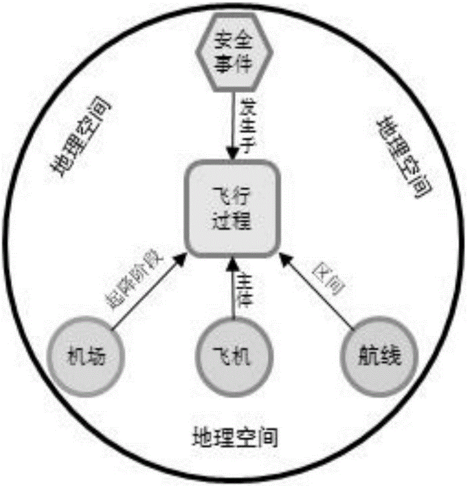
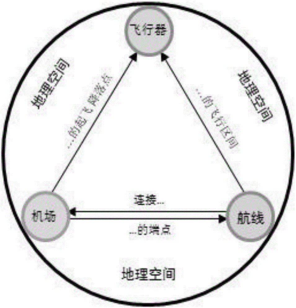
[0021] 1.1. Calculate the basic statistical items for all system elements (airports, airlines, aircraft). The basic statistical items will be used as the basic attributes of the system elements, which can be queried at any time in the system, and will be used as basic data to participate in other higher-level, more macroscopic statistical analysis. The basic statistical items include a combination of statistical objects, statistical time periods, event categories and statistical indicators. The statistical objects are airports, airlines and aircraft, the statistical time period...


PUM


Abstract

The invention discloses a flight quality monitoring method based on temporal GIS. The method comprises steps of flight overrun event spatio-temporal distribution statistics, flight overrun event multi-spatio-temporal factor regression analysis, aviation network system analysis, security risk assessment, and temporal GIS-based flight quality monitoring system model building and visualization. The problem that events are analyzed based on events only and systematic cognition is lacked in the traditional flight quality monitoring can be solved, a more scientific basis can be provided for decision making, the problem that the current analysis factor is simplex and an effective analysis model and an effective analysis method are lacked for massive data can be solved, and building and visualization of an overrun event spatio-temporal analysis model are realized.

Description

technical field [0001] The invention relates to a method for monitoring flight quality, in particular to a method for monitoring flight quality data based on temporal geographic information system (GIS). Background technique [0002] Flight quality monitoring is a system for collecting and analyzing daily flight data, which is used to improve the control quality of flight crews. It is internationally recognized as one of the important means to ensure flight safety, and has been generally recognized by the world's civil aviation industry. The value of flight quality monitoring lies in identifying safety hazards such as substandard operations, defective procedures, aircraft performance attenuation, and imperfect air traffic control systems as soon as possible by monitoring flight parameters exceeding the limits, so as to formulate improvement measures. and implementation to provide data and information support. [0003] However, at present, the management and analysis of flig...

Claims


Application Information

Patent Timeline
Patent Type & Authority Applications(China)
IPC IPC(8): G06Q10/06
CPCG06Q10/0635G06Q10/06393
Inventor 孙华波刘岳峰孙鹰舒平张凯
Owner CHINA ACAD OF CIVIL AVIATION SCI & TECH
Why Eureka
Try Eureka