Greenhouse identification method and device
An identification method and greenhouse technology, applied in the field of remote sensing applications, can solve the problems of slow processing speed, low spatial resolution, and complicated calculation, and achieve the effects of reliable identification results, high robustness, and simple and convenient identification process.
- Summary
- Abstract
- Description
- Claims
- Application Information
AI Technical Summary
Problems solved by technology
Method used
Image
Examples
Embodiment 1
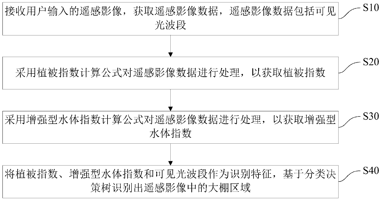
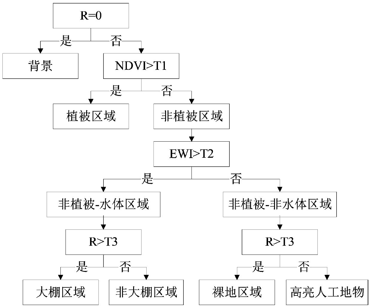
[0048] figure 1 The greenhouse identification method in the embodiment of the present invention is shown. Among them, the greenhouse knowledge method is based on the intelligent terminal. Such as figure 1 As shown, the greenhouse knowledge method includes the following steps:
[0049] S10: Receive the remote sensing image input by the user, and acquire the remote sensing image data, the remote sensing image data includes visible light band.
[0050] Among them, remote sensing images are preferably medium and low resolution remote sensing images, among which, medium and low resolution remote sensing images include NOAA / AVHRR, MODIS, SPOT VEGETATION and other low spatial resolution remote sensing images with a spatial resolution within 1000m, as well as Landsat, SPOT Medium spatial resolution remote sensing image data such as ATSER and ATSER with a spatial resolution within 100m. Due to the low and medium resolution remote sensing images have the advantages of wide image cov...
Embodiment 3
[0082] Figure 5 The greenhouse identification device in the embodiment of the present invention is shown. The greenhouse knowledge device includes, but is not limited to, an intelligent terminal. Such as Figure 5 As shown, the greenhouse knowledge device includes a remote sensing image data acquisition module 10 , a vegetation index acquisition module 20 , a water body index acquisition module 30 and a greenhouse identification module 40 .
[0083] The remote sensing image data acquiring module 10 is configured to receive the remote sensing image input by the user and acquire the remote sensing image data, the remote sensing image data includes the visible light band.
[0084] Among them, remote sensing images are preferably medium and low resolution remote sensing images, among which, medium and low resolution remote sensing images include NOAA / AVHRR, MODIS, SPOT VEGETATION and other low spatial resolution remote sensing images with a spatial resolution within 1000m, as w...
PUM
 Abstract
Description
Claims
Application Information
 - R&D
- Intellectual Property
- Life Sciences
- Materials
- Tech Scout
- Unparalleled Data Quality
- Higher Quality Content
- 60% Fewer Hallucinations
Browse by: Latest US Patents, China's latest patents, Technical Efficacy Thesaurus, Application Domain, Technology Topic, Popular Technical Reports.
© 2025 PatSnap. All rights reserved.Legal|Privacy policy|Modern Slavery Act Transparency Statement|Sitemap|About US| Contact US: help@patsnap.com


