Real-time remote sensing monitoring base site selection method for city motor vehicle tail gas
A technology for remote sensing monitoring and motor vehicles, applied in forecasting, instrumentation, data processing applications, etc., can solve problems such as huge costs, and achieve the effect of easy implementation and simple principle
- Summary
- Abstract
- Description
- Claims
- Application Information
AI Technical Summary
Problems solved by technology
Method used
Image
Examples
Embodiment Construction
[0023] The method for selecting the base site for real-time remote sensing monitoring of motor vehicle exhaust in the urban road network proposed by the present invention will be further described below in conjunction with the accompanying drawings and embodiments.
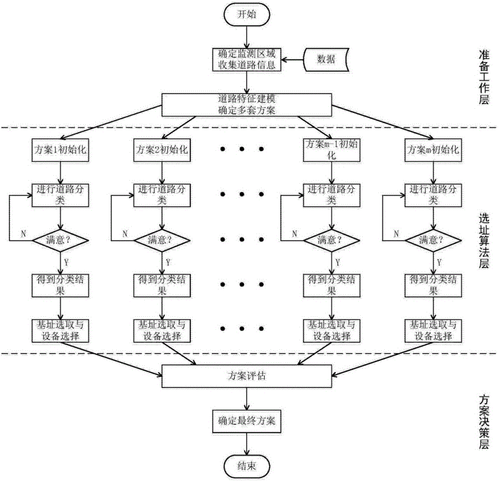
[0024] Such as figure 1 As shown, the method proposed by the present invention consists of three layers: the preparation layer, the site selection algorithm layer and the scheme decision layer.
[0025] 1. Preparation layer
[0026] First, determine the area covered by the system, that is, the monitoring range, and then investigate and collect road-related information. Definition The road network is a combination of intersections and roads, expressed mathematically as {V,E}, where V={V,V,,...,V N} represents the set of intersections, E={e 1 ,e 2 ,...,e q} is the collection of roads.
[0027] The roads in the urban road network have many characteristics, such as the width, the number of lanes, whether it is ...
PUM
 Abstract
Description
Claims
Application Information
 - R&D
- Intellectual Property
- Life Sciences
- Materials
- Tech Scout
- Unparalleled Data Quality
- Higher Quality Content
- 60% Fewer Hallucinations
Browse by: Latest US Patents, China's latest patents, Technical Efficacy Thesaurus, Application Domain, Technology Topic, Popular Technical Reports.
© 2025 PatSnap. All rights reserved.Legal|Privacy policy|Modern Slavery Act Transparency Statement|Sitemap|About US| Contact US: help@patsnap.com


