Method and system for indirectly influencing tightness by spherical terrain niches in determination of plumb line deviation
A technology of vertical deviation and topography, applied in the field of geodetic surveying and surveying and mapping engineering, which can solve problems such as poor accuracy
- Summary
- Abstract
- Description
- Claims
- Application Information
AI Technical Summary
Problems solved by technology
Method used
Image
Examples
Embodiment Construction
[0075] The specific technical solutions of the present invention will be described below according to the drawings and embodiments.
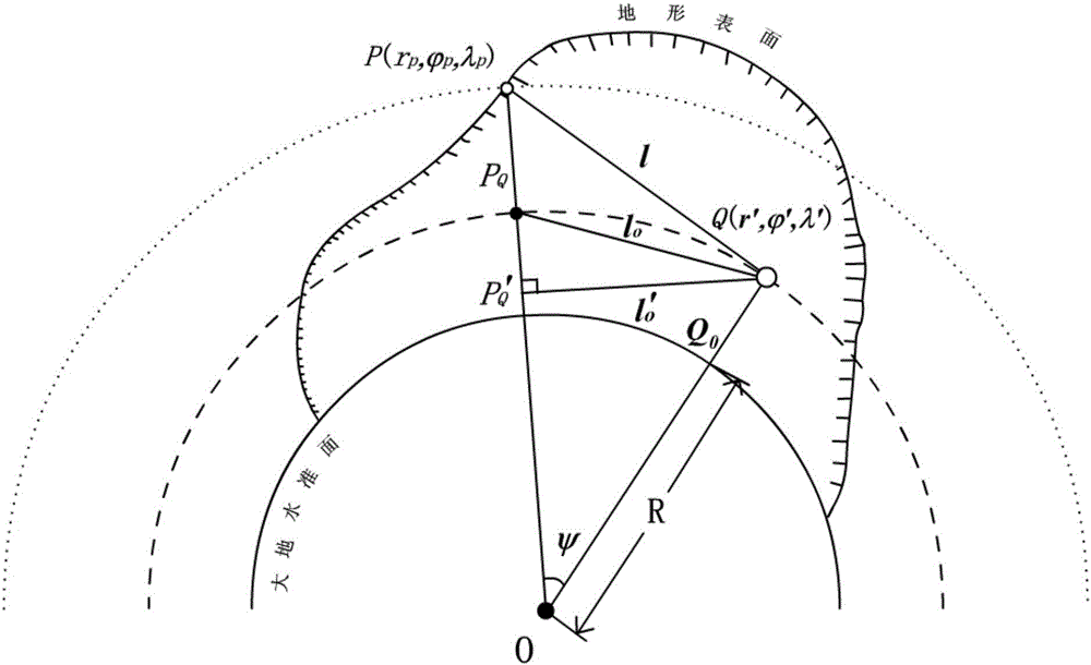
[0076] The embodiment of the present invention provides a rigorous method for determining the indirect influence of the spherical topographic position on the vertical line deviation, provides a rigorous correction scheme, and calculates the ground vertical line deviation (ξ, η), (in this embodiment, the actual gravity data sampling is 2′×2′ The follow-up calculation schemes all aim to calculate the deviation value of the vertical line of the 2′×2′ grid nodes, and the processing methods for other sampling precision are the same.) include the following steps:
[0077] Step 1, calculate any point on the ground The model value of the vertical deviation (ξ M , η M ).
[0078] In order to weaken the high-order term error of the existing gravity field model, further, the present invention proposes to use higher-resolution multi-point grid values ...
PUM
 Abstract
Description
Claims
Application Information
 - R&D
- Intellectual Property
- Life Sciences
- Materials
- Tech Scout
- Unparalleled Data Quality
- Higher Quality Content
- 60% Fewer Hallucinations
Browse by: Latest US Patents, China's latest patents, Technical Efficacy Thesaurus, Application Domain, Technology Topic, Popular Technical Reports.
© 2025 PatSnap. All rights reserved.Legal|Privacy policy|Modern Slavery Act Transparency Statement|Sitemap|About US| Contact US: help@patsnap.com


