Method for simulating hydrologic process of mountain slope scale in gneiss soil rocky mountain region
A technology for soil and rocky mountainous areas and process simulation, which is applied in special data processing applications, instruments, electrical and digital data processing, etc., and can solve problems such as low accuracy and model simulation distortion.
- Summary
- Abstract
- Description
- Claims
- Application Information
AI Technical Summary
Problems solved by technology
Method used
Image
Examples
Embodiment 1
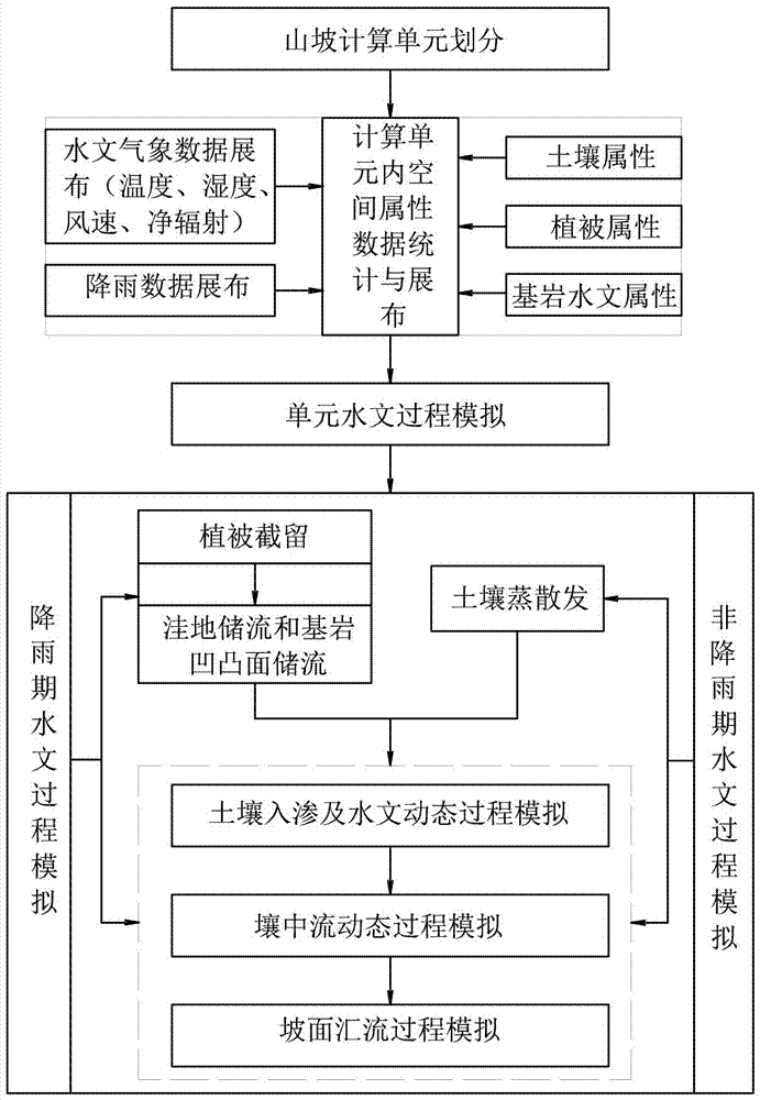
[0114] This embodiment is a method for simulating hydrological processes at the hillside scale in gneiss rocky mountainous areas. The process is as follows figure 1 shown. The calculation process of the method described in this embodiment is as follows:
[0115] Hillside calculation unit division: The hillside is divided into several basic calculation units by using the isocurrent timeline method.
[0116] Vertical section division in the calculation unit: According to the characteristics of hillside vegetation, soil and rock, it is divided into 4 layers in the basic calculation unit (contour zone): vegetation canopy interception layer, surface storage layer (litter storage layer and depression Reservoir), soil layer, bedrock layer. The soil layer is further divided into homogeneous soil layer, soil-rock binary mixed medium layer, weathered gravel layer and bedrock layer. The state variables in the calculation unit include: vegetation canopy interception, depression storag...
PUM
 Abstract
Description
Claims
Application Information
 - R&D
- Intellectual Property
- Life Sciences
- Materials
- Tech Scout
- Unparalleled Data Quality
- Higher Quality Content
- 60% Fewer Hallucinations
Browse by: Latest US Patents, China's latest patents, Technical Efficacy Thesaurus, Application Domain, Technology Topic, Popular Technical Reports.
© 2025 PatSnap. All rights reserved.Legal|Privacy policy|Modern Slavery Act Transparency Statement|Sitemap|About US| Contact US: help@patsnap.com

