Geological 3D modeling method and system for simulating spatial development trend of geological phenomenon

A technology of 3D modeling and phenomenon space, applied in 3D modeling, image data processing, instruments, etc., to achieve the effect of dynamic correlation, improving accuracy and efficiency, and realizing dynamic update

Inactive Publication Date: 2017-06-23
POWERCHINA BEIJING ENG
View PDF2 Cites 0 Cited by
  • Summary
  • Abstract
  • Description
  • Claims
  • Application Information

AI Technical Summary

Problems solved by technology

[0005] The purpose of the present invention is to provide a geological three-dimensional modeling method and system for simulating the spatial development trend of geological phenomena, so as to solve the aforementioned problems in the prior art

Method used


Image

  • Geological 3D modeling method and system for simulating spatial development trend of geological phenomenon
  • Geological 3D modeling method and system for simulating spatial development trend of geological phenomenon
  • Geological 3D modeling method and system for simulating spatial development trend of geological phenomenon

Examples


Embodiment Construction

[0055] In order to make the object, technical solution and advantages of the present invention clearer, the present invention will be further described in detail below in conjunction with the accompanying drawings. It should be understood that the specific embodiments described here are only used to explain the present invention, and are not intended to limit the present invention.

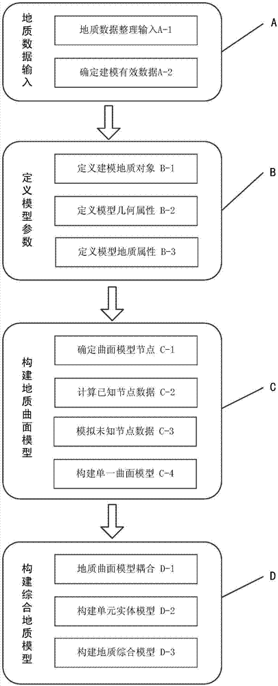
[0056] as attached figure 1 The geological three-dimensional modeling method for simulating the spatial development trend of geological phenomena of the present invention comprises the following steps:

[0057] Geological data input A, input engineering survey result data and determine valid data for engineering geological 3D modeling;

[0058] Define model parameter B, define parameters such as modeling geological objects, model geometric attributes, and model geological attributes;

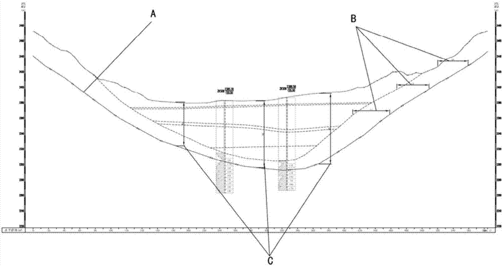
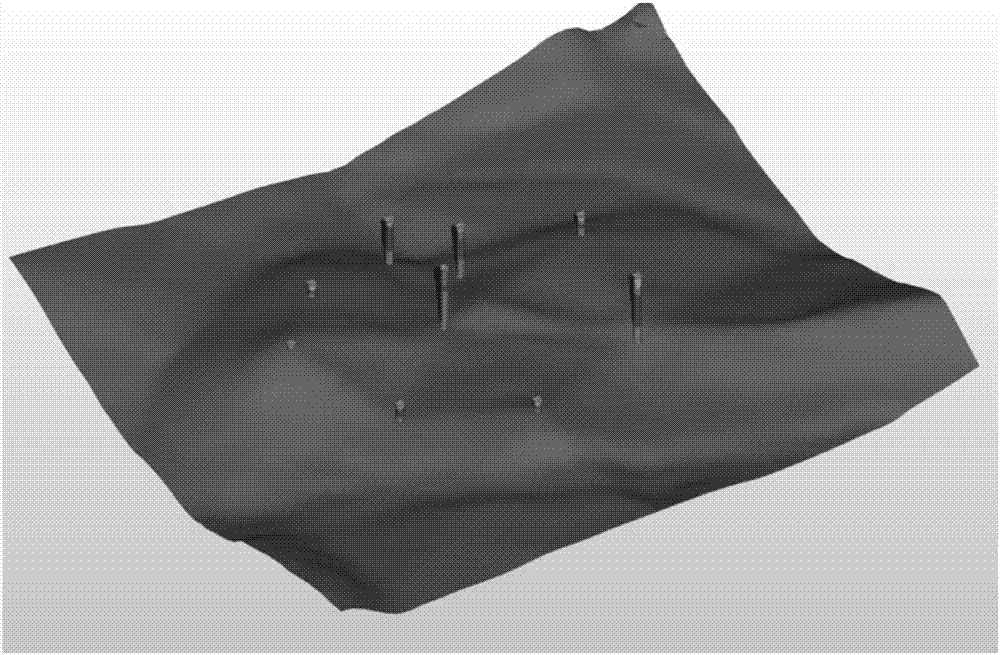
[0059] Construct a geological surface model C, and establish a surface model of a single geological object acco...


PUM


Abstract

The invention discloses a geological 3D modeling method and system for simulating the spatial development trend of a geological phenomenon. The method comprises the steps of (S1) geological data input including the input of engineering investigation result data and the determination of the effective data of engineering geological 3D modeling, (S2) model parameter definition including the definition of modeling geological object, model geological property and model geological attribute parameters, (S3) geological curved surface model construction including the establishment of a curve mode of a single geological object according to the geological data and the mode parameters, and (S4) comprehensive geological model construction including the construction of a geological comprehensive model through the coupling of the curved surface model of each geological object and related geometric operation. According to the method and the system, the accuracy and efficiency of engineering geology three-dimensional modeling are improved, at the same time, the dynamic association between the engineering geological three-dimensional model and the survey data can be realized, and the dynamic updating of the geological three-dimensional model can be realized.

Description

technical field [0001] The invention relates to the field of engineering geology, in particular to a geological three-dimensional modeling method and system for simulating the spatial development trend of geological phenomena; it is mainly used in the fields of hydropower geology, water conservancy geology, petroleum geology, marine geology, coal geology, geological exploration and the like. Background technique [0002] The traditional analysis and interpretation of engineering geological data is generally limited to two-dimensional and static expressions. This method is not intuitive enough to describe the spatial changes of geological objects, and often cannot fully reveal the laws of spatial changes, making it difficult for people to understand directly, completely and accurately. And feel the geological conditions underground, so it is increasingly unable to meet the needs of engineering designers for spatial analysis. [0003] Utilize computer graphics and visualizatio...

Claims


Application Information

Patent Timeline
Patent Type & Authority Applications(China)
IPC IPC(8): G06T17/05
CPCG06T17/05
Inventor 李进敏张国宝陈丹朱夏甫陈新球徐立彦王腾飞肖海波赵开开
Owner POWERCHINA BEIJING ENG
Why Eureka
Try Eureka