
UWB-technology-based indoor pedestrian navigation method

A technology of pedestrian navigation and technology, applied in the field of pedestrian navigation, can solve the problems of pedestrian step length, high accuracy of step count, and limited navigation accuracy, etc., to achieve the effects of suppressing divergence over time, optimizing configuration, and ensuring accuracy

Inactive Publication Date: 2017-06-30
NANJING UNIV OF AERONAUTICS & ASTRONAUTICS
View PDF6 Cites 58 Cited by
  • Summary
  • Abstract
  • Description
  • Claims
  • Application Information

AI Technical Summary

Problems solved by technology

However, it needs to be pointed out that PDR / SLU has high requirements for the accuracy of pedestrian steps and steps, which limits the final navigation accuracy.

Method used

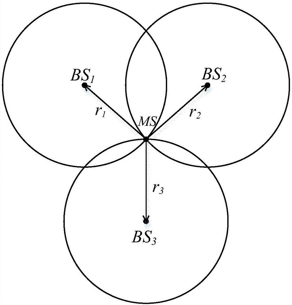
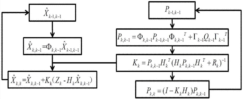

Image

  • UWB-technology-based indoor pedestrian navigation method
  • UWB-technology-based indoor pedestrian navigation method
  • UWB-technology-based indoor pedestrian navigation method

Examples


Embodiment Construction

[0049] The technical solutions of the present invention will be described in detail below in conjunction with the accompanying drawings.

[0050] The present invention provides an indoor pedestrian navigation method based on UWB technology, which is mainly applied to indoor navigation and positioning of pedestrians. In specific implementation, the core idea of ​​the present invention can also be used for pedestrian position monitoring and tracking in a weak satellite signal environment.

[0051] Such as figure 1 As shown, the method includes the following steps:

[0052] Step 1: Install the inertial sensor and UWB chip on the foot of the pedestrian, optimize the configuration of the UWB base station, initialize the inertial navigation system, and obtain the initial position information and destination information.

[0053] Optimize the configuration of UWB base station equipment when it is installed, that is, only configure a certain number of UWB base station equipment at k...


PUM


Abstract

The invention discloses a UWB-technology-based indoor pedestrian navigation method. An inertial navigation system based on zero-velocity correction is used to carry out navigation, thereby suppressing divergency of an inertial navigation positioning error with time. A UWB base station is configured at a key node in the area in an optimized manner; and Kalman filtering is carried out by using UWB positioning data and zero-velocity-correction-based inertial navigation positioning data, thereby realizing correction of an inertial navigation positioning result effectively. The UWB-technology-based indoor pedestrian navigation method is suitable for position monitoring of the special crowd, for real-time positioning of the staff in a special industry like the fire-fighting and security industries, and for navigation positioning of common pedestrians in an area with no satellite signal coverage.

Description

technical field [0001] The invention belongs to the technical field of pedestrian navigation, in particular to an indoor pedestrian navigation method based on UWB technology. Background technique [0002] The pedestrian navigation system based on satellite positioning has been widely used in the field of positioning. Since satellite signals are easily blocked by buildings, resulting in problems such as multi-path, non-line-of-sight, and time-varying, it is difficult for satellite navigation receivers to achieve high-precision indoor positioning. application. At the end of the 20th century, the Draper Laboratory of the United States proposed to install inertial measurement devices on the feet of the human body to realize the human body positioning function. The zero-speed correction technology was used to better solve the problem of rapid error divergence of low-cost inertial navigation systems. [0003] Because the indoor heading angle is difficult to obtain accurately, the...

Claims


Application Information

Patent Timeline
Patent Type & Authority Applications(China)
IPC IPC(8): G01S5/02
CPCG01S5/0263G01S5/0294
Inventor 王敬贤曾庆化孟骞曾世杰熊智刘建业
Owner NANJING UNIV OF AERONAUTICS & ASTRONAUTICS
Learn More