Three-dimensional electromagnetic imaging device applied to road disaster and collapse detection and use method thereof

A three-dimensional electromagnetic and imaging device technology, which is applied in the direction of measuring devices, utilizing re-radiation, re-radiation of sound waves, etc., can solve the problems of limited penetration and resolution of low-resistance coverage, inability to explore holes or soft strata, and low work efficiency , to achieve the effect of penetrating and resolving low-resistance coverage, eliminating electromagnetic coupling effects, and improving the effect

Inactive Publication Date: 2017-08-18
BEIJING ORANGELAMP NAVIGATION TECH DEV +1
View PDF5 Cites 7 Cited by
  • Summary
  • Abstract
  • Description
  • Claims
  • Application Information

AI Technical Summary

Problems solved by technology

[0006] In the current existing technologies, the detection methods for road disasters and subsidence are relatively simple. The main problems are that the work is too hard and the work is dangerous. It usually requires the manual investigation of field geologists and frequent dangers. The existing The working method is to drill directly on the road surface, and then judge whether there is a cavity or a soft soil layer under the road surface according to the drilling data, and the work efficiency is low. However, the relatively good technologies usually used in the current prior art, such as spectral electromagnetic method and The direct current method has very limited ability to penetrate and distinguish low-resistance coverage, and often produces high-resistance shielding phenomena, which cannot effectively detect holes or soft strata on the road

Method used


Image

  • Three-dimensional electromagnetic imaging device applied to road disaster and collapse detection and use method thereof
  • Three-dimensional electromagnetic imaging device applied to road disaster and collapse detection and use method thereof
  • Three-dimensional electromagnetic imaging device applied to road disaster and collapse detection and use method thereof

Examples


Embodiment Construction

[0031] The technical solution of this patent will be further described in detail below in conjunction with specific embodiments.

[0032] The K1033+300~K1136+700 section of XX Expressway has many high-fill road sections. According to the maintenance unit, since the opening to traffic in 2012, settlement and deformation have occurred in many places in this section of the subgrade, and remedial measures have been taken many times, but the deformation has not improved significantly so far.

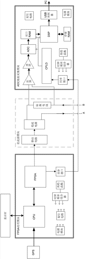
[0033] see Figure 1-4 , in order to find out whether there are cavities within the range affected by the settlement of this section of roadbed, the applicant used the technology provided in Embodiment 1 of the present invention to conduct a geophysical survey of this section of roadbed.

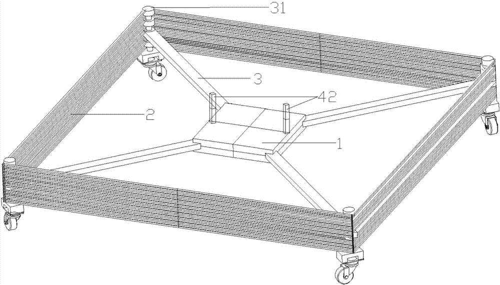
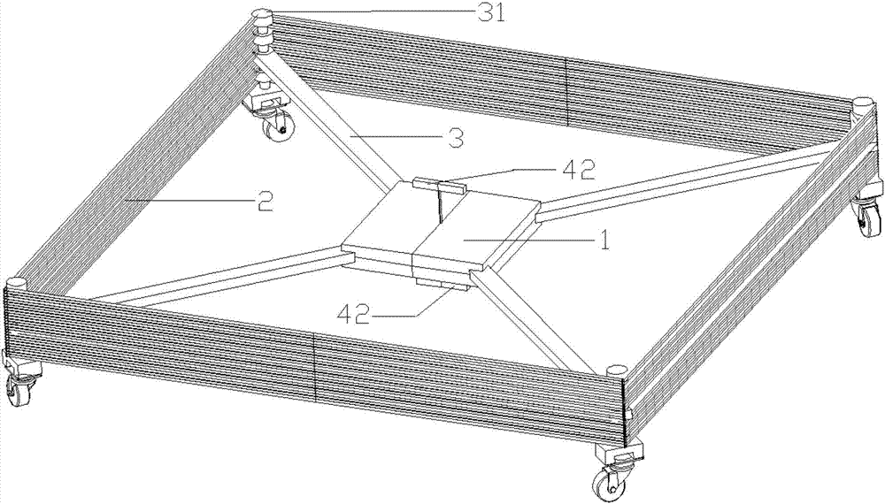
[0034] Such as figure 1 , as shown in 2, the acquisition device is in the shape of a rectangle as a whole, with a center plate 1 arranged in the center, the center plate is rectangular and placed horizont...


PUM


Abstract

The invention discloses a three-dimensional electromagnetic imaging device applied to road disaster and collapse detection and a use method thereof. The device is formed by a transmitting part, a receiving part, an acquisition device and a processing system. The GPS timing synchronization is carried out between the transmitting part and the receiving part. The processing system is installed in electronic equipment. The acquisition device is a rectangular body and is provided with a center plate. The center plate is provided with sensors and is provided with four extending brackets outward. The ends of the extending brackets are provided with auxiliary brackets which are wound by multiple turns of transmitting coils. The electronic equipment can be used in a field to carry out real-time imaging, simple real-time processing and feedback of construction quality information, the ability of penetrating and distinguishing low resistance coverage is low, a high resistance shielding phenomenon does not exist, a hole or soft stratum in a road can be effectively explored, the interference of atmospherics and an artificial electromagnetic field from the outside is reduced, the electromagnetic coupling effect between the transmitting coils and receiving coils can be effectively eliminated, the equipment is small, the weight is small, and the device is suitable for being used in cities and high speed roads.

Description

technical field [0001] The invention relates to the technical field of geological and mineral exploration equipment, in particular to a three-dimensional electromagnetic imaging device and a using method for road disaster and subsidence detection. Background technique [0002] The concept of informatization in geological and mineral exploration work in my country was put forward in the mid-1980s, and was promoted by the Ministry of Geology and Mineral Resources as a national project. Since the “Digital Earth” (Core, 1998) was proposed abroad, the informatization project of geological and mineral exploration in my country has been accelerated due to its inclusion in the “Digital China” (Xu Guanhua et al., 1999) and “Digital Land” (Zhang Hongtao, 2001) projects. carried out, but so far has not been clearly defined. [0003] The informatization of geological and mineral exploration work is not a simple application of geological information technology, but involves a more profou...

Claims


Application Information

Patent Timeline
Patent Type & Authority Applications(China)
IPC IPC(8): G01V3/10
CPCG01V3/10
Inventor 王瑞兴高隆钦郝立凯黄申硕陆占国
Owner BEIJING ORANGELAMP NAVIGATION TECH DEV
Why Eureka
Try Eureka