
China land noctilucence remote sensing classification accuracy evaluation method using two-stage sampling model

A technology of two-level sampling and classification accuracy, which is applied in the field of remote sensing image quality inspection, can solve the problems of incompleteness, few verification sets, and incomplete evaluation parameters, and achieve the effect of guaranteeing reliability and accurate accuracy evaluation

Inactive Publication Date: 2017-09-26
SHANGHAI OCEAN UNIV
View PDF6 Cites 5 Cited by
  • Summary
  • Abstract
  • Description
  • Claims
  • Application Information

AI Technical Summary

Problems solved by technology

[0004] In the past, there were some problems in the accuracy evaluation of the extraction results of luminous remote sensing lighting areas: (1) The selection of the verification set was too small, the distribution method was unreasonable, and it was not representative compared with the overall extraction area; (2) The selected verification evaluation indicators were too few and not enough. Comprehensive, cannot really reflect the extraction results; (3) The evaluation method is not systematic, and it cannot explain the spatial distribution of the extraction results just by comparing with the national statistical values
[0007] To sum up, there is an urgent need for a method for evaluating the classification accuracy of luminous remote sensing using a two-stage sampling model, to complete the system of luminous remote sensing data, and effectively realize the accuracy evaluation of large-area luminous remote sensing classification results, and to extract the results of luminous remote sensing towns. Quality inspection can solve the problem of too few verification sets and incomplete evaluation parameters in the past, and achieve a comprehensive and accurate verification result
However, there is no report on this method

Method used


Image

  • China land noctilucence remote sensing classification accuracy evaluation method using two-stage sampling model
  • China land noctilucence remote sensing classification accuracy evaluation method using two-stage sampling model
  • China land noctilucence remote sensing classification accuracy evaluation method using two-stage sampling model

Examples


Embodiment 1

[0035] Compared with ordinary visible light remote sensing data, night light remote sensing data can only be used as an indirect remote sensing data when extracting cities and towns. Aiming at the phenomenon that in the past, the application of luminous remote sensing is more important than verification, this study extracts the luminous area in luminous remote sensing, and conducts a complete accuracy verification research on the extraction results, and finally proposes a complete set of extraction and research models.

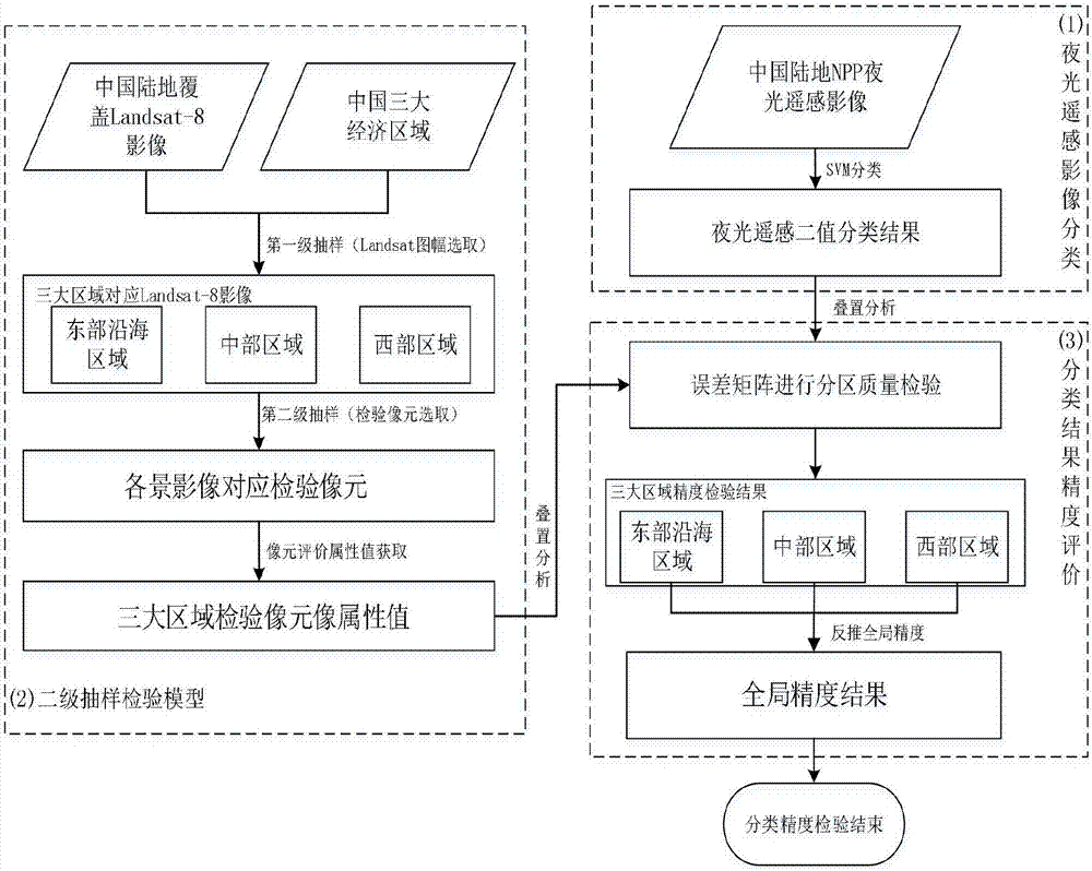
[0036] The flow chart of the research method is as follows: figure 1 , mainly consists of 3 parts:

[0037] (1) Classification of luminous remote sensing images.

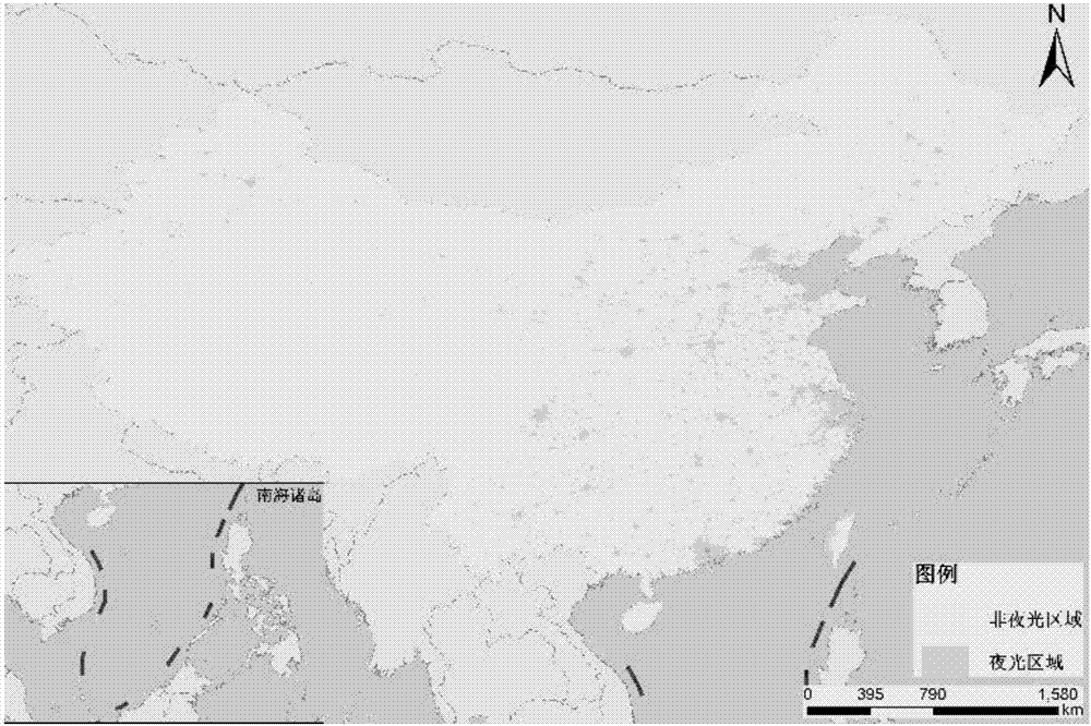
[0038] Using the support vector machine classifier to classify China's land NPP / VIIRS luminous remote sensing images, two classification results of luminous areas and non-luminous areas are obtained whose accuracy is to be verified;

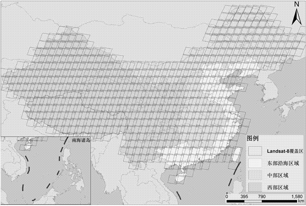
[0039] (2) Establish a secondary sampling model.

[0040] ①Com...


PUM


Abstract

The invention relates to a China land noctilucence remote sensing classification accuracy evaluation method using a two-stage sampling model. The method comprises the following steps: S1, extracting the built-up areas of China land from NPP / VIIRS series data, and getting an unverified extraction result; S2, building a two-stage sampling model, sampling evaluation areas, and getting credible inspection data sets; and S3, verifying preliminary extraction of noctilucence data area by area through an error matrix verification method, and finally, getting accuracy evaluation of the classification results of all noctilucence data. Through the noctilucence remote sensing classification accuracy evaluation method using a two-stage sampling model, systematic and effective accuracy evaluation of the classification results of large-area noctilucence remote sensing data is completed, and the quality of the noctilucence remote sensing city and town extraction result is inspected. The problem that there are too few verification sets and incomplete evaluation parameters in previous technologies is solved. A comprehensive and accurate verification result is obtained.

Description

technical field [0001] The invention relates to the technical field of remote sensing image quality inspection, in particular to a method for evaluating classification accuracy of China's land luminous remote sensing classification using a two-level sampling model. Background technique [0002] Night light remote sensing data can detect low-intensity lights from urban lights and even small-scale residential areas, and distinguish them from dark rural backgrounds, indirectly reflecting the distribution of cities and towns, and providing new insights into large-scale urban detection research. train of thought. However, due to factors such as the spillover effect of night light, extracting cities and towns based on night light may lead to problems such as the urban area extraction result being larger than the actual value. Therefore, the quality of the extraction results must be verified before application. [0003] Traditional verification methods, for example, in the study o...

Claims


Application Information

Patent Timeline
IPC IPC(8): G06K9/62G06K9/00
CPCG06V20/176G06F18/2193G06F18/2411
Inventor 黄冬梅王振华徐首珏苏诚孙婧琦梁素玲
Owner SHANGHAI OCEAN UNIV
Learn More