Road boundary detecting and tracking method

A boundary detection and road technology, applied in the field of intelligent vehicle environment perception, can solve problems such as difficulty in ensuring the stability and reliability of detection results, false detection of road boundaries, long processing time and cannot meet real-time performance, etc., to adapt to changes in road curvature , good road curvature change, high reliability effect

Active Publication Date: 2017-06-13
CHANGAN UNIV
View PDF2 Cites 82 Cited by
  • Summary
  • Abstract
  • Description
  • Claims
  • Application Information

AI Technical Summary

Problems solved by technology

[0006] Although the 3D lidar acquires data fast, with dense point clouds and rich scene objects, the data it acquires has massive characteristics, which puts higher requirements on the algorithm for processing vehicle-mounted 3D radar data
Moosmann. proposed a method to map 3D radar data to a 2D obstacle map, then extract features through image processing, and use Markov random field to further extract road edges. This method can be used for path planning well, but Because the processing time is too long to meet the real-time requirements, and when there are pedestrians, vehicles and other obstacles in the lane, it will cause false detection of road boundaries. In addition, it is difficult to guarantee the stability and reliability of the detection results only by detection

Method used


Image

  • Road boundary detecting and tracking method
  • Road boundary detecting and tracking method
  • Road boundary detecting and tracking method

Examples


Embodiment Construction

[0064] The present invention will be described in detail below in conjunction with the accompanying drawings and embodiments. This embodiment is carried out on the premise of the technical solution of the present invention, and detailed implementation and specific operation process are given, but the protection scope of the present invention is not limited to the following embodiments.

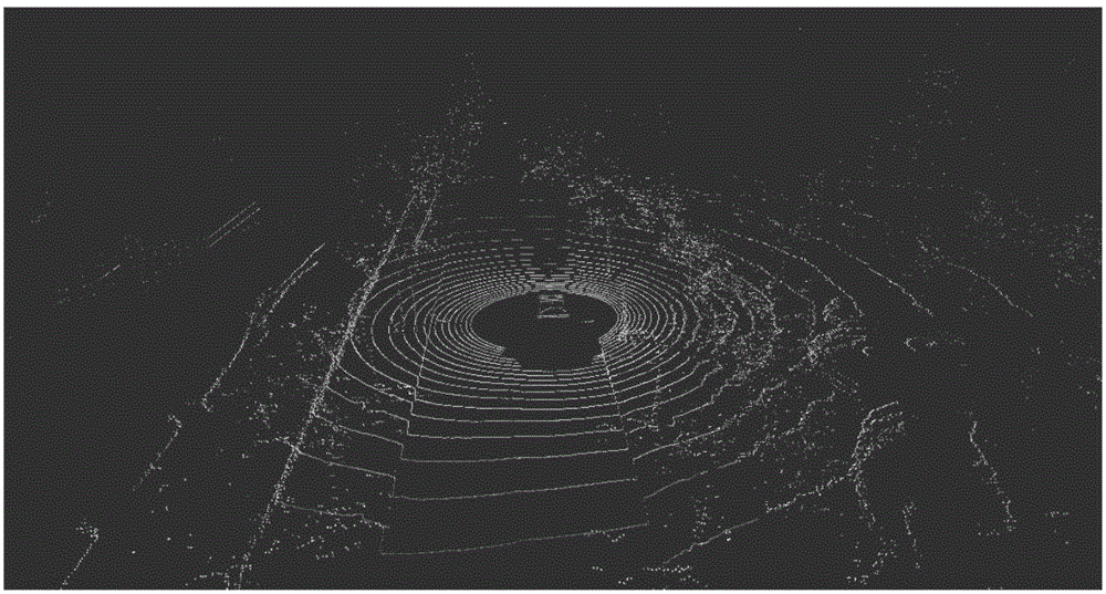
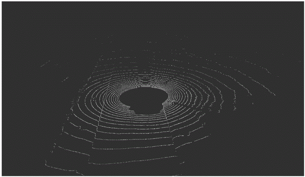
[0065] A road boundary detection and tracking method, which uses 3D laser radar to detect road boundaries, but this method is not only applicable to a certain type of laser radar sensor, but in order to specifically describe the working mode and data of sensors such as 3D laser radar format, we take the three-dimensional laser radar VelodyneHDL-32E installed on our unmanned platform as an example to analyze this method. °, the vertical angle resolution is 1.33°, and it rotates horizontally at a frequency of 10Hz per second, which can generate about 700,000 points per second, which can provide ...


PUM


Abstract

The invention discloses a road boundary detecting and tracking method. The road boundary detecting and tracking method comprises acquiringpolar coordinate data of radar scanning points of the surroundings of an unmanned vehicle through radar scanning, and converting the polar coordinate data into rectangular coordinates; mapping radar points into a polar coordinate grid, and according to the height of extending vertexes in the grid, extracting ground points; extracting road boundary points through the radial distance of the scanning points from a road boundary under the same scanning line as well as the height mutation properties of the neighboring scanning points and by combining with a road extending direction; performing filtering through the random sampling consensus algorithm, fitting the filtered road boundary points through the least square method; performing tracking through a Kalman filter. The road boundary detecting and tracking method can effectively extract road boundaries in an actual scenario when obstacles exist on roads, and by means of the Kalman filter, enhances the boundary detecting accuracy and reliability. The road boundary detecting and tracking method involves no complex computation, thereby being high in practicality and applicable to wide application to unmanned navigation modules.

Description

technical field [0001] The invention relates to the technical field of intelligent vehicle environment perception, in particular to a road boundary detection and tracking method. Background technique [0002] Since the birth of unmanned vehicles, autonomous navigation technology has attracted the attention of many scholars and research institutions, but it is still a very difficult topic. Among them, road boundary detection and tracking are very important research contents in this field. one of the core technologies. In complex urban environments, road boundaries can limit the passable area of ​​vehicles, which provides a wealth of information for autonomous navigation and path planning of unmanned vehicles; in urban areas where GPS signal reception is limited due to obstructions such as buildings and trees , the road boundary can also be used as a very good feature for vehicle position estimation; in addition, in the target detection system, the road boundary can limit the...

Claims


Application Information

Patent Timeline
Patent Type & Authority Applications(China)
IPC IPC(8): G01S17/88
CPCG01S17/88
Inventor 赵祥模孙朋朋徐志刚李骁驰闵海根吴霞
Owner CHANGAN UNIV
Why Eureka
Try Eureka